Cayo Venado
Welcome to Cayo Venado, a Tropical island in the Caribbean Sea, part of the majestic Atlantic Ocean. This guide offers a comprehensive overview of what makes Cayo Venado unique – from its geography and climate to its population, infrastructure, and beyond. Dive into the details:
- Geography and Size: Explore the island’s size and location.
- Climate and Weather: Weather patterns and temperature.
- Topography and Nature: Uncover the natural wonders of the island.
- Infrastructure and Travelling: Insights on reaching, staying, and making the most of your visit.
- News and Headlines: Latest News.
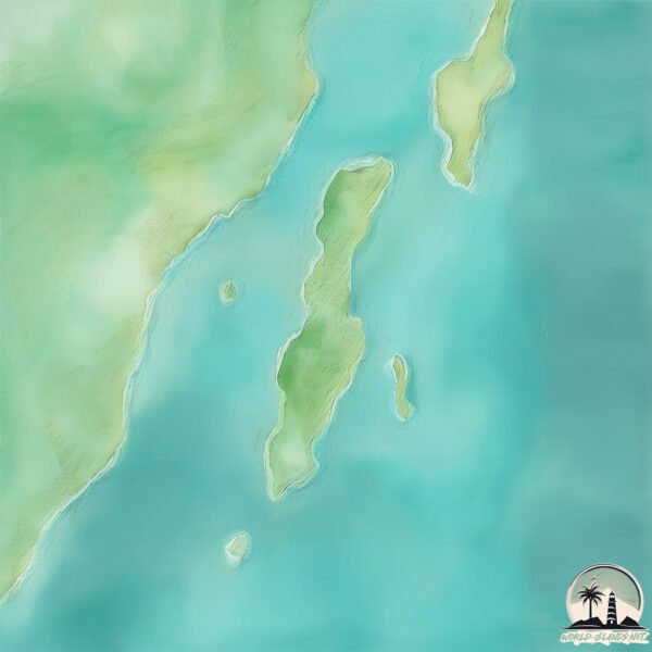
Geography and size of Cayo Venado
Size: 2.917 km²
Coastline: 12.3 km
Ocean: Atlantic Ocean
Sea: Caribbean Sea
Continent: North America
Cayo Venado is a Small Island spanning 2.9 km² with a coastline of 12.3 km.
Archipel: –
Tectonic Plate: Africa – One of the world’s largest tectonic plates, covering the African continent and parts of the surrounding oceans, known for its stability with some active rift zones.
The geographic heart of the island is pinpointed at these coordinates:
Latitude: 18.78058953 / Longitude: -88.10556581
Climate and weather of Cayo Venado
Climate Zone: Tropical
Climate Details: Tropical Monsoon Climate
Temperature: Hot
Climate Characteristics: Characterized by heavy rainfall, high humidity, and uniformly high temperatures, but with a distinct short dry season. It features a seasonal reversal of prevailing wind directions.
Topography and nature of Cayo Venado
Timezone: UTC-06:00
Timezone places: America/Chicago
Max. Elevation: 3 m
Mean Elevation: -5 m
Vegetation: Mangrove Forest
Tree Coverage: 67%
The mean elevation is -5 m. The highest elevation on the island reaches approximately 3 meters above sea level. The island is characterized by Plains: Flat, low-lying lands characterized by a maximum elevation of up to 200 meters. On islands, plains are typically coastal lowlands or central flat areas.
Dominating Vegetation: Mangrove Forest
Found in coastal areas and river deltas, these unique wetland ecosystems are adapted to saline conditions and are crucial for coastal protection and biodiversity. Cayo Venado has a tree cover of 67 %.
Vegetation: 2 vegetation zones – Low Diversity Island
Islands with two distinct vegetation zones offer slightly more ecological variety. These zones could be due to differences in elevation, moisture, or other environmental factors. While still limited in biodiversity, these islands may offer a contrast between the two zones, such as a coastline with mangroves and an inland area with grassland.
Infrastructure and Travelling to Cayo Venado
Does the island have a public airport? no.
There is no public and scheduled airport on Cayo Venado. The nearest airport is Aeropuerto Internacional de Chetumal, located 37 km away.
Does the island have a major port? no.
There are no major ports on Cayo Venado. The closest major port is BELIZE CITY, approximately 140 km away.
The mean population of Cayo Venado is 0 per km². Cayo Venado is Uninhabited. The island belongs to Mexico.
Continuing your journey, Drowned Cays is the next notable island, situated merely km away.
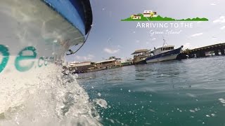
Discover Cayo Venado in the Chetumal Bay (Mexico) with our Jetskis PWC.


Mexico is classified as Emerging region: MIKT: Mexico, Indonesia, South Korea, and Turkey – Economies recognized for their development potential and emerging market status. The level of income is Upper middle income.
News – Latest Updates and Headlines from Cayo Venado
Stay informed with the most recent news and important headlines from Cayo Venado. Here’s a roundup of the latest developments.
Please note: The data used here has been primarily extracted from satellite readings. Deviations from exact values may occur, particularly regarding the height of elevations and population density. Land area and coastline measurements refer to average values at mean high tide.