Cayos Cochinos
Welcome to Cayos Cochinos, a Tropical island in the Caribbean Sea, part of the majestic Atlantic Ocean. This guide offers a comprehensive overview of what makes Cayos Cochinos unique – from its geography and climate to its population, infrastructure, and beyond. Dive into the details:
- Geography and Size: Explore the island’s size and location.
- Climate and Weather: Weather patterns and temperature.
- Topography and Nature: Uncover the natural wonders of the island.
- Infrastructure and Travelling: Insights on reaching, staying, and making the most of your visit.
- News and Headlines: Latest News.
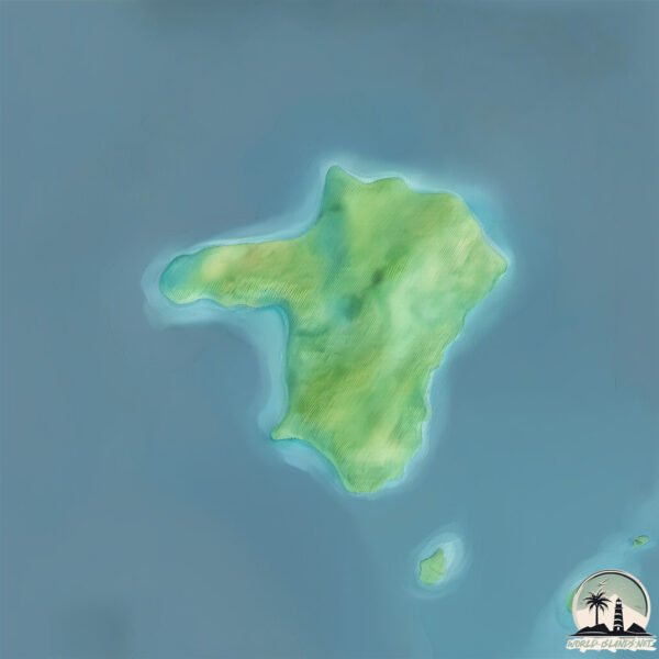
Geography and size of Cayos Cochinos
Size: 1.776 km²
Coastline: 6.8 km
Ocean: Atlantic Ocean
Sea: Caribbean Sea
Continent: North America
Cayos Cochinos is a Small Island spanning 1.8 km² with a coastline of 6.8 km.
Archipel: –
Tectonic Plate: Caribbean – Covering the Caribbean Sea and surrounding regions, this plate is bordered by the North American Plate and the South American Plate. Known for seismic activity, including earthquakes and volcanic eruptions, and features like the Puerto Rico Trench.
The geographic heart of the island is pinpointed at these coordinates:
Latitude: 15.97375454 / Longitude: -86.47597451
Climate and weather of Cayos Cochinos
Climate Zone: Tropical
Climate Details: Tropical Monsoon Climate
Temperature: Hot
Climate Characteristics: Characterized by heavy rainfall, high humidity, and uniformly high temperatures, but with a distinct short dry season. It features a seasonal reversal of prevailing wind directions.
Topography and nature of Cayos Cochinos
Timezone: UTC-06:00
Timezone places: America/Chicago
Max. Elevation: 26 m
Mean Elevation: 25 m
Vegetation: Deciduous Broadleaf Forest
Tree Coverage: 88%
The mean elevation is 25 m. The highest elevation on the island reaches approximately 26 meters above sea level. The island is characterized by Plains: Flat, low-lying lands characterized by a maximum elevation of up to 200 meters. On islands, plains are typically coastal lowlands or central flat areas.
Dominating Vegetation: Deciduous Broadleaf Forest
Composed of broadleaf trees that shed their leaves seasonally. These forests are commonly found in temperate zones and experience distinct seasonal changes. Cayos Cochinos has a tree cover of 88 %.
Vegetation: 4 vegetation zones – Diverse Island
Four distinct vegetation zones mark these islands as ecologically diverse. They might feature varied landscapes such as forests, beaches, grasslands, and rocky areas. Such diversity reflects the island’s complex ecological interactions and varied habitats, which can support a rich array of wildlife and plant species.
Infrastructure and Travelling to Cayos Cochinos
Does the island have a public airport? no.
There is no public and scheduled airport on Cayos Cochinos. The nearest airport is Juan Manuel Gálvez International Airport, located 38 km away.
Does the island have a major port? no.
There are no major ports on Cayos Cochinos. The closest major port is COXEN HOLE, approximately 38 km away.
The mean population of Cayos Cochinos is 166 per km². Cayos Cochinos is Moderately Inhabited. The island belongs to Honduras.
Continuing your journey, Isla de Roatán is the next notable island, situated merely km away.
Honduras is classified as Developing region: Regions characterized by lower income levels, with economies in the process of industrialization and modernization. The level of income is Lower middle income.
News – Latest Updates and Headlines from Cayos Cochinos
Stay informed with the most recent news and important headlines from Cayos Cochinos. Here’s a roundup of the latest developments.
Please note: The data used here has been primarily extracted from satellite readings. Deviations from exact values may occur, particularly regarding the height of elevations and population density. Land area and coastline measurements refer to average values at mean high tide.