Char Munsi
Welcome to Char Munsi, a Tropical island in the Bay of Bengal, part of the majestic Indian Ocean. This guide offers a comprehensive overview of what makes Char Munsi unique – from its geography and climate to its population, infrastructure, and beyond. Dive into the details:
- Geography and Size: Explore the island’s size and location.
- Climate and Weather: Weather patterns and temperature.
- Topography and Nature: Uncover the natural wonders of the island.
- Infrastructure and Travelling: Insights on reaching, staying, and making the most of your visit.
- News and Headlines: Latest News.
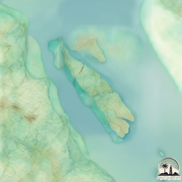
Geography and size of Char Munsi
Size: 39.7 km²
Coastline: 73.5 km
Ocean: Indian Ocean
Sea: Bay of Bengal
Continent: Asia
Char Munsi is a Medium Island spanning 40 km² with a coastline of 73 km.
Archipel: –
Tectonic Plate: India – A major tectonic plate that initially moved northward at a rapid pace before colliding with the Eurasian Plate. This collision is responsible for the uplift of the Himalayas and the Tibetan Plateau.
The geographic heart of the island is pinpointed at these coordinates:
Latitude: 22.70405891 / Longitude: 90.72693605
Climate and weather of Char Munsi
Climate Zone: Tropical
Climate Details: Tropical Monsoon Climate
Temperature: Hot
Climate Characteristics: Characterized by heavy rainfall, high humidity, and uniformly high temperatures, but with a distinct short dry season. It features a seasonal reversal of prevailing wind directions.
Topography and nature of Char Munsi
Timezone: UTC+06:00
Timezone places: Asia/Dhaka
Max. Elevation: -22 m
Mean Elevation: -27 m
Vegetation: Agricultural Mosaic
Tree Coverage: 21%
The mean elevation is -27 m. Remarkably, this unique island barely emerges above the sea level, showcasing nature’s fascinating interplay with the ocean. The island is characterized by Plains: Flat, low-lying lands characterized by a maximum elevation of up to 200 meters. On islands, plains are typically coastal lowlands or central flat areas.
Dominating Vegetation: Agricultural Mosaic
A mix of cropland and natural vegetation, often seen in rural landscapes where agricultural fields are interspersed with patches of natural habitats. Char Munsi has a tree cover of 21 %.
Vegetation: 3 vegetation zones – Moderately Diverse Island
These islands start to show a broader range of ecological niches. With three vegetation zones, they may offer a mix of ecosystems like coastal areas, inland woods, and perhaps a distinct wetland or dry area. This diversity supports a wider range of flora and fauna, making these islands more ecologically complex than those with minimal diversity.
Infrastructure and Travelling to Char Munsi
Does the island have a public airport? no.
There is no public and scheduled airport on Char Munsi. The nearest airport is Barisal Airport, located 42 km away.
Does the island have a major port? no.
There are no major ports on Char Munsi. The closest major port is CHITTAGONG, approximately 123 km away.
The mean population of Char Munsi is per km². Char Munsi is . The island belongs to Bangladesh.
Continuing your journey, Samiruddin Char is the next notable island, situated merely km away.
Roshi's TV Incident😂


Bangladesh is classified as Least developed region: Countries that exhibit the lowest indicators of socioeconomic development, with the lowest Human Development Index ratings. The level of income is Low income.
News – Latest Updates and Headlines from Char Munsi
Stay informed with the most recent news and important headlines from Char Munsi. Here’s a roundup of the latest developments.
Please note: The data used here has been primarily extracted from satellite readings. Deviations from exact values may occur, particularly regarding the height of elevations and population density. Land area and coastline measurements refer to average values at mean high tide.