Chilika
Welcome to Chilika, a Tropical island in the Bay of Bengal, part of the majestic Indian Ocean. This guide offers a comprehensive overview of what makes Chilika unique – from its geography and climate to its population, infrastructure, and beyond. Dive into the details:
- Geography and Size: Explore the island’s size and location.
- Climate and Weather: Weather patterns and temperature.
- Topography and Nature: Uncover the natural wonders of the island.
- Infrastructure and Travelling: Insights on reaching, staying, and making the most of your visit.
- News and Headlines: Latest News.
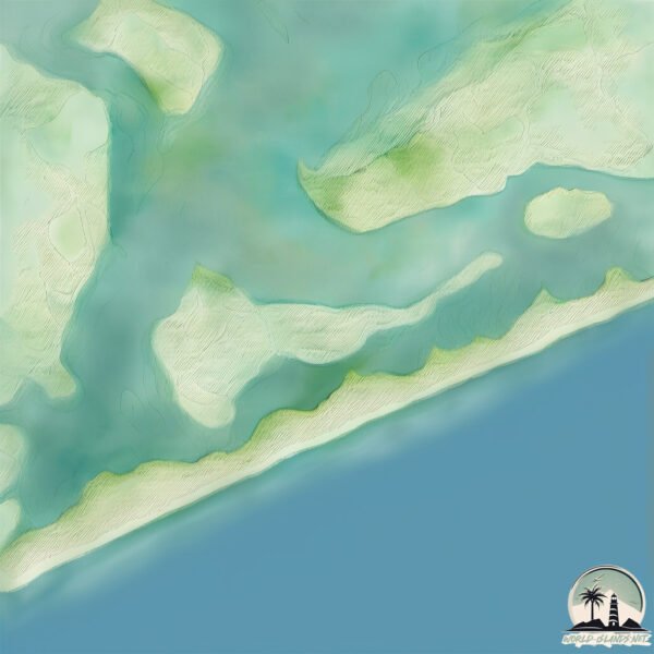
Geography and size of Chilika
Size: 3.676 km²
Coastline: 12.3 km
Ocean: Indian Ocean
Sea: Bay of Bengal
Continent: Asia
Chilika is a Small Island spanning 3.7 km² with a coastline of 12.3 km.
Archipel: –
Tectonic Plate: India – A major tectonic plate that initially moved northward at a rapid pace before colliding with the Eurasian Plate. This collision is responsible for the uplift of the Himalayas and the Tibetan Plateau.
The geographic heart of the island is pinpointed at these coordinates:
Latitude: 19.64610949 / Longitude: 85.43315731
Climate and weather of Chilika
Climate Zone: Tropical
Climate Details: Tropical Savanna, Wet
Temperature: Hot
Climate Characteristics: Defined by distinct wet and dry seasons with high temperatures year-round. Pronounced rainfall occurs during the wet season, while the dry season is marked by drought.
Topography and nature of Chilika
Timezone: UTC+05:30
Timezone places: Asia/Kolkata
Max. Elevation: 7 m
Mean Elevation: 6 m
Vegetation: Wetland
Tree Coverage: 49%
The mean elevation is 6 m. The highest elevation on the island reaches approximately 7 meters above sea level. The island is characterized by Plains: Flat, low-lying lands characterized by a maximum elevation of up to 200 meters. On islands, plains are typically coastal lowlands or central flat areas.
Dominating Vegetation: Wetland
These areas are saturated with water, either permanently or seasonally, and support aquatic plants. Wetlands are important for biodiversity and water filtration. Chilika has a tree cover of 49 %.
Vegetation: 4 vegetation zones – Diverse Island
Four distinct vegetation zones mark these islands as ecologically diverse. They might feature varied landscapes such as forests, beaches, grasslands, and rocky areas. Such diversity reflects the island’s complex ecological interactions and varied habitats, which can support a rich array of wildlife and plant species.
Infrastructure and Travelling to Chilika
Does the island have a public airport? no.
There is no public and scheduled airport on Chilika. The nearest airport is Biju Patnaik Airport, located 76 km away.
Does the island have a major port? no.
There are no major ports on Chilika. The closest major port is GOPALPUR, approximately 71 km away.
The mean population of Chilika is 193 per km². Chilika is Moderately Inhabited. The island belongs to India.
Continuing your journey, Parala is the next notable island, situated merely km away.
visit http://www.daavenhospitality.com #travel #beach #nature #resort #tourism #vacation #island #hotel


India is classified as Emerging region: BRIC: Brazil, Russia, India, and China – Economies noted for their rapid growth and increasing influence on global affairs. The level of income is Lower middle income.
News – Latest Updates and Headlines from Chilika
Stay informed with the most recent news and important headlines from Chilika. Here’s a roundup of the latest developments.
Please note: The data used here has been primarily extracted from satellite readings. Deviations from exact values may occur, particularly regarding the height of elevations and population density. Land area and coastline measurements refer to average values at mean high tide.