Chimana Sur
Welcome to Chimana Sur, a Tropical island in the Caribbean Sea, part of the majestic Atlantic Ocean. This guide offers a comprehensive overview of what makes Chimana Sur unique – from its geography and climate to its population, infrastructure, and beyond. Dive into the details:
- Geography and Size: Explore the island’s size and location.
- Climate and Weather: Weather patterns and temperature.
- Topography and Nature: Uncover the natural wonders of the island.
- Infrastructure and Travelling: Insights on reaching, staying, and making the most of your visit.
- News and Headlines: Latest News.
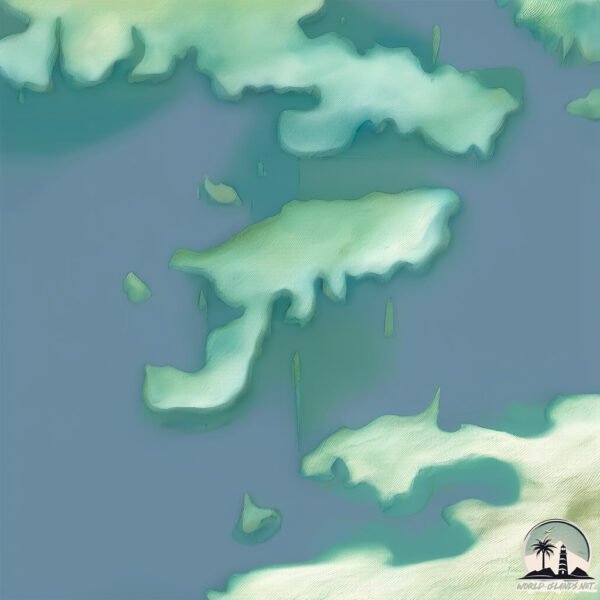
Geography and size of Chimana Sur
Size: 2.305 km²
Coastline: 11 km
Ocean: Atlantic Ocean
Sea: Caribbean Sea
Continent: South America
Chimana Sur is a Small Island spanning 2.3 km² with a coastline of 11 km.
Archipel: –
Tectonic Plate: South America – A major plate covering the South American continent and part of the Atlantic Ocean, known for the Andes mountain range and significant seismic and volcanic activity.
The geographic heart of the island is pinpointed at these coordinates:
Latitude: 10.26843968 / Longitude: -64.62869992
Climate and weather of Chimana Sur
Climate Zone: Tropical
Climate Details: Tropical Savanna, Wet
Temperature: Hot
Climate Characteristics: Defined by distinct wet and dry seasons with high temperatures year-round. Pronounced rainfall occurs during the wet season, while the dry season is marked by drought.
Topography and nature of Chimana Sur
Timezone: UTC-04:30
Timezone places: America/Caracas
Max. Elevation: 58 m
Mean Elevation: 50 m
Vegetation: Herbaceous Cover
Tree Coverage: 3%
The mean elevation is 50 m. The highest elevation on the island reaches approximately 58 meters above sea level. The island is characterized by Plains: Flat, low-lying lands characterized by a maximum elevation of up to 200 meters. On islands, plains are typically coastal lowlands or central flat areas.
Dominating Vegetation: Herbaceous Cover
Comprising mainly of grasses, herbs, and ferns, these areas are common in prairies, meadows, and savannas, and can vary widely in species composition. Chimana Sur has a tree cover of 3 %.
Vegetation: 4 vegetation zones – Diverse Island
Four distinct vegetation zones mark these islands as ecologically diverse. They might feature varied landscapes such as forests, beaches, grasslands, and rocky areas. Such diversity reflects the island’s complex ecological interactions and varied habitats, which can support a rich array of wildlife and plant species.
Infrastructure and Travelling to Chimana Sur
Does the island have a public airport? no.
There is no public and scheduled airport on Chimana Sur. The nearest airport is General José Antonio Anzoategui International Airport, located 17 km away.
Does the island have a major port? no.
There are no major ports on Chimana Sur. The closest major port is PUERTO LA CRUZ, approximately 1 km away.
The mean population of Chimana Sur is 0 per km². Chimana Sur is Uninhabited. The island belongs to Venezuela.
Continuing your journey, Cubagua is the next notable island, situated merely km away.
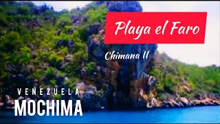
Playa el Faro en Chimana II 🐬Parque Nacional Mochima

Venezuela is classified as Emerging region: G20: Group of Twenty – Major economies comprising both developed and emerging countries, representing the world’s largest economies. The level of income is Upper middle income.
News – Latest Updates and Headlines from Chimana Sur
Stay informed with the most recent news and important headlines from Chimana Sur. Here’s a roundup of the latest developments.
Please note: The data used here has been primarily extracted from satellite readings. Deviations from exact values may occur, particularly regarding the height of elevations and population density. Land area and coastline measurements refer to average values at mean high tide.