Welcome to Comprida, a Tropical island in the South Atlantic Ocean, part of the majestic Atlantic Ocean. This guide offers a comprehensive overview of what makes Comprida unique – from its geography and climate to its population, infrastructure, and beyond. Dive into the details:
Geography and size of Comprida
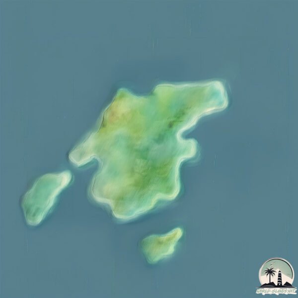
Size: 1.153 km²
Coastline: 5.4 km
Ocean: Atlantic Ocean
Sea: South Atlantic Ocean
Continent: South America
Comprida is a Small Island spanning 1.2 km² with a coastline of 5.4 km.
Archipel: –
Tectonic Plate: Pacific – The world’s largest tectonic plate, covering much of the Pacific Ocean, known for the Pacific Ring of Fire with extensive seismic and volcanic activity.
The geographic heart of the island is pinpointed at these coordinates:
Latitude: -22.86842466 / Longitude: -41.94275071
Climate and weather of Comprida
Climate Zone: Tropical
Climate Details: Tropical Savanna, Wet
Temperature: Hot
Climate Characteristics: Defined by distinct wet and dry seasons with high temperatures year-round. Pronounced rainfall occurs during the wet season, while the dry season is marked by drought.
Topography and nature of Comprida
Timezone: UTC-03:00
Timezone places: America/Sao_Paulo
Max. Elevation: 49 m
Mean Elevation: 31 m
Vegetation: Evergreen Broadleaf Forest
Tree Coverage: 100%
The mean elevation is 31 m. The highest elevation on the island reaches approximately 49 meters above sea level. The island is characterized by Plains: Flat, low-lying lands characterized by a maximum elevation of up to 200 meters. On islands, plains are typically coastal lowlands or central flat areas.
Dominating Vegetation: Evergreen Broadleaf Forest
Characterized by dense, lush canopies of broadleaf trees that retain their leaves year-round. These forests are typically found in tropical and subtropical regions and are known for their high biodiversity. Comprida has a tree cover of 100 %.
Vegetation: 4 vegetation zones – Diverse Island
Four distinct vegetation zones mark these islands as ecologically diverse. They might feature varied landscapes such as forests, beaches, grasslands, and rocky areas. Such diversity reflects the island’s complex ecological interactions and varied habitats, which can support a rich array of wildlife and plant species.
Infrastructure and Travelling to Comprida
Does the island have a public airport? no.
There is no public and scheduled airport on Comprida. The nearest airport is Cabo Frio Airport, located 15 km away.
Does the island have a major port? no.
There are no major ports on Comprida. The closest major port is PORTO DO FORNO, approximately 13 km away.
The mean population of Comprida is 75 per km². Comprida is Gently Populated. The island belongs to Brazil.
Continuing your journey, Governador Island is the next notable island, situated merely km away.
3SD/SA024 COMPRIDA ISLAND - 07 to 09 March 2014
3SD/SA024 by 3SD123 Fábio.3SD/SA024 COMPRIDA ISLAND - 07 to 09 March 2014
3SD/SA024 by 3SD123 Fábio.
3SD/SA024 by 3SD123 Fábio.
ILHA COMPRIDA in 4K HDR FPV | PARATY COASTS IN MOTION Preview #brazildrone #drone #djibrasil
FPV drone over Paraty's coast in Brazil – shot on DJI Avata 2. ...
FPV drone over Paraty's coast in Brazil – shot on DJI Avata 2. #FPVDrone #DJIAvata2 #BrazilDrone #AerialCinematography ...
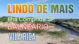
ILHA COMPRIDA - SP . BALNEÁRIO , VILA RICA . TRANQUILIDADE #ilhacomprida
ILHA COMPRIDA - SP . BALNEÁRIO , VILA RICA . TRANQUILIDADE ...
ILHA COMPRIDA - SP . BALNEÁRIO , VILA RICA . TRANQUILIDADE #ilhacomprida Seja membro deste canal e ganhe ...
ILHA COMPRIDA SP - O LITORAL que está DESAPARECENDO aos poucos
Seja bem-vindo ao nosso Canal! ILHA COMPRIDA (SP): O LITORAL QUE ESTÁ ...
Seja bem-vindo ao nosso Canal! ILHA COMPRIDA (SP): O LITORAL QUE ESTÁ DESAPARECENDO AOS POUCOS Com o ...
Qual tamanho usamos nessa ILHA DE COZINHA?
Se o seu sonho sempre foi ter uma ilha em casa mas não tem uma real ...
Se o seu sonho sempre foi ter uma ilha em casa mas não tem uma real noção do espaço, esse vídeo é a sua solução! Aqui conto ...
Long Island Brazil | Mavic Pro | Ilha Comprida
Short video of Ilha Comprida, Brazil. Music: garageband Drone: Mavic Pro.
Short video of Ilha Comprida, Brazil. Music: garageband Drone: Mavic Pro.
VLOG DE VIAGEM NA ILHA COMPRIDA
Islam Makhachev vs Ilia Topuria | Who do you pick✅‼️ #ufc #mma
3SD/SA024 COMPRIDA ISLAND BY 3SD085 ROGERIO
3SD/SA024 - COMPRIDA ISLAND By 3SD102 - Paulo 3SD085 - Rogerio 3SD123 ...
3SD/SA024 - COMPRIDA ISLAND By 3SD102 - Paulo 3SD085 - Rogerio 3SD123 - Fábio e 3SD909 - Junior 07 to 09 March ...
ILHA COMPRIDA - ESPETÁCULO DA NATUREZA
Ilha Comprida um espetáculo lindo de se ver previsão de sol para hoje ...
Ilha Comprida um espetáculo lindo de se ver previsão de sol para hoje Seja membro deste canal e ganhe benefícios: ...
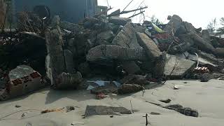
ILHA COMPRIDA ESTÁ SENDO ENGOLIDA PELO MAR, OLHA ISSO!
Piloto Profissional de Drone Ilha Comprida, localizada no litoral sul ...
Piloto Profissional de Drone Ilha Comprida, localizada no litoral sul de São Paulo, esta sendo engolida pela mar, um fenômeno ...
ILHA COMPRIDA SP#NATUREZA
Ilha comprida!#praia #follow #youtube #love #fyp #tiktok #island #beautiful
🚧 Pintura Mecanizada com airless 🚧 #Shorts #arquitetura #Pintorprofissional #pintor #airless
Pintura com airless, aplicação de tinta acrílica sobre grafiato com ...
Pintura com airless, aplicação de tinta acrílica sobre grafiato com sistema airless. . . . . . . . . . . #maiconpinturasairless ...
Ilha Comprida, Camping Beira Mar, Ruas Araçá, rua Linguado
Ilha Comprida, camping Beira mar, ruas Araçá, rua Linguado.
Ilha Comprida, camping Beira mar, ruas Araçá, rua Linguado.
HOTEL MARÉ ALTA ILHA COMPRIDA / QUEBRANDO A ROTINA
A busca por metais preciosos com aparelho de detectorismo continua no ...
A busca por metais preciosos com aparelho de detectorismo continua no hotel maré alta o famoso hotel fantasma de ilha ...
Ilha Comprida eas alarm(island own By Brazil🇧🇷)
Ilha Comprida is a island and municipality of São Paulo state,Brazil .
Ilha Comprida is a island and municipality of São Paulo state,Brazil .
ILHA COMPRIDA "CHUVA ME PEGOU DE SURPRESA" / QUEBRANDO A ROTINA
Compartilhando um momento especial pra alguns e um transtorno para ...
Compartilhando um momento especial pra alguns e um transtorno para outros , as chuvas fortes e repentinas do litoral.
ILHA COMPRIDA 05/07/2020 PONTA DA PRAIA 1
ILHA COMPRIDA 05/07/2020 PONTA DA PRAIA 1.
ILHA COMPRIDA 05/07/2020 PONTA DA PRAIA 1.
ILHA COMPRIDA SUSPENDE OS SHOWS ILHA VERÃO
ILHA COMPRIDA SUSPENDE OS SHOWS DO ILHA VERÃO .por motivo do almento ...
ILHA COMPRIDA SUSPENDE OS SHOWS DO ILHA VERÃO .por motivo do almento de pessoas com covid o Prefeito de Ilha ...
Zunesha irl? #onepiece #zunesha
Ilha Comprida, 08/02/2021 Rua: Henrique Romano , Balneário Araçá
Ilha Comprida ,08/02/2021 Balneário Araçá Rua Henrique Romano ...
Ilha Comprida ,08/02/2021 Balneário Araçá Rua Henrique Romano @PauloEscultor #pauloescultor #canalpauloescultor ...
Ilha comprida !#praia #follow #like #love #youtube #island #beautiful #fyp #happy #travel
TENTAMOS ATRAVESSAR DE KOMBI A ILHA COMPRIDA (SP)
Chegamos ao estado de São Paulo e já buscamos um desafio: atravessar a ...
Chegamos ao estado de São Paulo e já buscamos um desafio: atravessar a Ilha Comprida com a nossa KombiHome Depois de ...
Potensic atom ilha Comprida SP Brasil, #beach #island #potensic #longisland
Seja membro deste canal e ganhe benefícios: ...
Brazil is classified as Emerging region: BRIC: Brazil, Russia, India, and China – Economies noted for their rapid growth and increasing influence on global affairs. The level of income is Upper middle income.
News – Latest Updates and Headlines from Comprida
Stay informed with the most recent news and important headlines from Comprida. Here’s a roundup of the latest developments.
Loading...
Please note: The data used here has been primarily extracted from satellite readings. Deviations from exact values may occur, particularly regarding the height of elevations and population density. Land area and coastline measurements refer to average values at mean high tide.