Corfu
Welcome to Corfu, a Temperate island in the Ionian Sea, part of the majestic Atlantic Ocean. This guide offers a comprehensive overview of what makes Corfu unique – from its geography and climate to its population, infrastructure, and beyond. Dive into the details:
- Geography and Size: Explore the island’s size and location.
- Climate and Weather: Weather patterns and temperature.
- Topography and Nature: Uncover the natural wonders of the island.
- Infrastructure and Travelling: Insights on reaching, staying, and making the most of your visit.
- News and Headlines: Latest News.
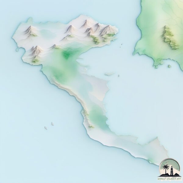
Geography and size of Corfu
Size: 593.6 km²
Coastline: 230.7 km
Ocean: Atlantic Ocean
Sea: Ionian Sea
Continent: Europe
Corfu is a Large Island spanning 594 km² with a coastline of 231 km.
Archipel: Ionian Islands – A group of islands in the Ionian Sea, west of mainland Greece, known for their rich history, beautiful landscapes, and cultural heritage.
Tectonic Plate: Eurasia – One of the world’s largest tectonic plates, the Eurasian Plate covers a significant portion of Europe and Asia. It’s characterized by diverse geological features, including the Ural Mountains, the European Plain, and the Himalayas formed from its collision with the Indian Plate.
The geographic heart of the island is pinpointed at these coordinates:
Latitude: 39.63386669 / Longitude: 19.84770653
Climate and weather of Corfu
Climate Zone: Temperate
Climate Details: Hot-Summer Mediterranean Climate
Temperature: Hot Summer
Climate Characteristics: Characterized by hot, dry summers and mild, wet winters, typical of coastal areas with abundant sunshine.
Topography and nature of Corfu
Timezone: UTC+02:00
Timezone places: Europe/Mariehamn
Max. Elevation: 784 m
Mean Elevation: 134 m
Vegetation: Evergreen Needleleaf Forest
Tree Coverage: 47%
The mean elevation is 134 m. The highest elevation on the island reaches approximately 784 meters above sea level. The island is characterized by Plateau: Elevated flatlands rising sharply above the surrounding area, with a maximum elevation over 500 meters but a mean elevation less than 300 meters, forming unique highland areas on islands.
Dominating Vegetation: Evergreen Needleleaf Forest
Dominated by evergreen coniferous trees such as pines and firs, which retain their needle-like leaves throughout the year. These forests are often found in cooler climates. Corfu has a tree cover of 47 %.
Vegetation: 15 vegetation zones – Exceptionally Diverse Island
Islands with more than ten vegetation zones are among the most ecologically rich and varied in the world. These islands are akin to miniature continents, boasting an incredible array of ecosystems. The sheer range of habitats, from high peaks to deep valleys, rainforests to deserts, creates a mosaic of life that is unparalleled. They are crucial for conservation and ecological studies.
Infrastructure and Travelling to Corfu
Does the island have a public airport? yes.
Corfu has a public and scheduled airport. The following airports are located on this island: Ioannis Kapodistrias International Airport.
Does the island have a major port? no.
There are no major ports on Corfu. The closest major port is KERKIRA, approximately 1 km away.
The mean population of Corfu is 164 per km². Corfu is Moderately Inhabited. The island belongs to Greece.
The name of the island resonates across different cultures and languages. Here is how it is known around the world: Arabic: كورفو; German: Korfu; Spanish: Corfú; French: Corfou; Portuguese: Corfu; Russian: Керкира; Chinese: 克基拉島
Continuing your journey, Paxós is the next notable island, situated merely km away.
INSIDE Corfu, Greece: The Most BEAUTIFUL Greek Island? (Travel Guide)


Greece is classified as Developed region: nonG7: Developed economies outside of the Group of Seven, characterized by high income and advanced economic structures. The level of income is High income: OECD.
News – Latest Updates and Headlines from Corfu
Stay informed with the most recent news and important headlines from Corfu. Here’s a roundup of the latest developments.
Please note: The data used here has been primarily extracted from satellite readings. Deviations from exact values may occur, particularly regarding the height of elevations and population density. Land area and coastline measurements refer to average values at mean high tide.