Welcome to Cormorant, a Temperate island in the The Coastal Waters of Southeast Alaska and British Columbia, part of the majestic Pacific Ocean. This guide offers a comprehensive overview of what makes Cormorant unique – from its geography and climate to its population, infrastructure, and beyond. Dive into the details:
Geography and size of Cormorant
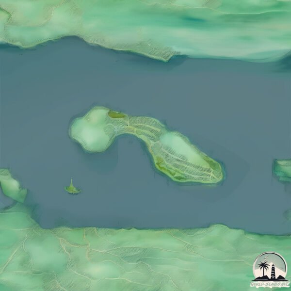
Size: 4.684 km²
Coastline: 13.2 km
Ocean: Pacific Ocean
Sea: The Coastal Waters of Southeast Alaska and British Columbia
Continent: North America
Cormorant is a Small Island spanning 4.7 km² with a coastline of 13.2 km.
Archipel: –
Tectonic Plate: North America – Covers North America and parts of the Atlantic and Arctic Oceans, characterized by diverse geological features and varying levels of seismic activity.
The geographic heart of the island is pinpointed at these coordinates:
Latitude: 50.58969139 / Longitude: -126.93121363
Climate and weather of Cormorant
Climate Zone: Temperate
Climate Details: Temperate Oceanic Climate
Temperature: Warm Summer
Climate Characteristics: Known for its moderate year-round temperatures with ample rainfall and no dry season. Warm summers are characteristic.
Topography and nature of Cormorant
Timezone: UTC-08:00
Timezone places: America/Los_Angeles
Max. Elevation: 67 m
Mean Elevation: 39 m
Vegetation: Evergreen Needleleaf Forest
Tree Coverage: 79%
The mean elevation is 39 m. The highest elevation on the island reaches approximately 67 meters above sea level. The island is characterized by Plains: Flat, low-lying lands characterized by a maximum elevation of up to 200 meters. On islands, plains are typically coastal lowlands or central flat areas.
Dominating Vegetation: Evergreen Needleleaf Forest
Dominated by evergreen coniferous trees such as pines and firs, which retain their needle-like leaves throughout the year. These forests are often found in cooler climates. Cormorant has a tree cover of 79 %.
Vegetation: 3 vegetation zones – Moderately Diverse Island
These islands start to show a broader range of ecological niches. With three vegetation zones, they may offer a mix of ecosystems like coastal areas, inland woods, and perhaps a distinct wetland or dry area. This diversity supports a wider range of flora and fauna, making these islands more ecologically complex than those with minimal diversity.
Infrastructure and Travelling to Cormorant
Does the island have a public airport? yes.
Cormorant has a public and scheduled airport. The following airports are located on this island: Alert Bay Airport.
Does the island have a major port? yes.
Cormorant is home to a major port. The following ports are situated on the island: .
The mean population of Cormorant is 316 per km². Cormorant is Moderately Inhabited. The island belongs to Canada.
Continuing your journey, Malcolm is the next notable island, situated merely km away.
ALERT BAY Day Trip Travel Guide 🐟🪶🎭 Visiting the World's Tallest Totem Pole on Cormorant Island, BC
Come join us as we continue our Vancouver Island road trip adventures by taking a day trip to Alert Bay, BC to visit the world's ...ALERT BAY Day Trip Travel Guide 🐟🪶🎭 Visiting the World's Tallest Totem Pole on Cormorant Island, BC
Come join us as we continue our Vancouver Island road trip adventures ...
Come join us as we continue our Vancouver Island road trip adventures by taking a day trip to Alert Bay, BC to visit the world's ...
Alert Bay and Cormorant Island: This Place Has Canada's Everglades!? [Episode 29]
In this episode, Sayu Rinpoche boards the ferry to Cormorant Island, ...
In this episode, Sayu Rinpoche boards the ferry to Cormorant Island, home of Alert Bay. Despite being told that there is "nothing to ...
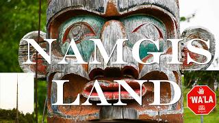
Cormorant Island, Land of Namgis. Alert Bay BC. British Columbia by motorhome ep.5
In this episode we take you to Cormorant Island, a small fragment of ...
In this episode we take you to Cormorant Island, a small fragment of the vast territory of the Namgis, the population that has lived ...
The Skull Island Mystery: Science, Perception, and a Tourism Dilemma
A mysterious skull-shaped formation on Google Maps near Cormorant ...
A mysterious skull-shaped formation on Google Maps near Cormorant Island, British Columbia, has sparked wild theories and ...
Alert Bay & Cormorant Island ’Namgis Culture & World’s Tallest Totem Pole
My name is Jon and this is my channel, Islanduncharted where I explore ...
My name is Jon and this is my channel, Islanduncharted where I explore the remote reaches and backroads of Vancouver island.
Cormorant Island, River Valley Lake, Sandhurst.
a beautiful place for birds watcher and walker.
a beautiful place for birds watcher and walker.
RIGOR MORTISS 'CORMORANT ISLAND'
RIGOR MORTISS 'CORMORANT ISLAND' Track taken from: RIGOR MORTISS ...
RIGOR MORTISS 'CORMORANT ISLAND' Track taken from: RIGOR MORTISS 'WBREWNY' CD Release date: 04.03.2019 Visit ...
Cormorant Island
Provided to YouTube by Danmark Music Group Cormorant Island · Rigor ...
Provided to YouTube by Danmark Music Group Cormorant Island · Rigor Mortiss Wbrewny ℗ Zoharum New Experimental Art ...
So Charlie & me battled choppy waters to visit cormorant island on the lake but we scared them away
A Cormorant Island in New York City
I walked about 3 miles in a Nature preserve and found a view of an ...
I walked about 3 miles in a Nature preserve and found a view of an island with lots of Cormorants, it was difficult to hold the ...
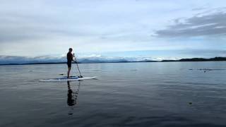
Cormorant Island, BC
Paddleboard around Cormorant Island off the Northeastern coast of ...
Paddleboard around Cormorant Island off the Northeastern coast of Vancouver Island.
Minke Whale Sighting, Cormorant Island, Alert Bay, August 4th/2025
A Minke Whale was seen foraging between Cormorant Island and Pierse ...
A Minke Whale was seen foraging between Cormorant Island and Pierse Island at a location called Peppers Point at 5:22 pm on ...
Good 2 Kno - Cormorant Island
Double Decker Turnaround - Cormorant Island
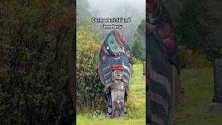
Cormorant Island Cemetery | Totem Poles in the Mist
On Cormorant Island in coastal British Columbia, the cemetery stands ...
On Cormorant Island in coastal British Columbia, the cemetery stands wrapped in fog and silence. Totem poles and cedar ...
Cormorant Island 2017 Road Trip
『北鵜島』予告編 "North Cormorant Island" Trailer
北鵜島 ドキュメンタリー / 86分 / 2024年 監督:ジョン・ウィリアムズ / 共同監督:岩崎祐 佐渡島の北端にある海辺の小さな集落、 ...
北鵜島 ドキュメンタリー / 86分 / 2024年 監督:ジョン・ウィリアムズ / 共同監督:岩崎祐 佐渡島の北端にある海辺の小さな集落、 ...
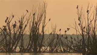
Cormorant Island
Every Winter thousands of Cormorants gather off the coast. ...
Every Winter thousands of Cormorants gather off the coast. Occasionally large numbers can be seen resting at low tide on the ...
Cormorant Island
Large numbers of Cormorants massed on the sandbank off Ramsgate ...
Large numbers of Cormorants massed on the sandbank off Ramsgate Westcliff this morning before the incoming tide forced them ...
@exploreBCruralislands - Respectful Visitation Moment - Cormorant Island
Respectful Visitation Moment - Visit Cormorant Island - ...
Respectful Visitation Moment - Visit Cormorant Island - @exploreBCruralislands Advancing Inter-Island Connectivity & Respectful ...
Eerie Silence: A Cormorant Island Like You’ve Never Heard Before
In this tranquil October scene, the sea lies completely still, ...
In this tranquil October scene, the sea lies completely still, mirroring the overcast sky. A cormorant island—a place usually filled ...
Cormorant Island ~ May 25, 2013
Cormorant Island (Duck Lake) over 200 birds nesting via YouTube Capture!
Cormorant Island (Duck Lake) over 200 birds nesting via YouTube Capture!
Canada is classified as Developed region: G7: Group of Seven – Major advanced economies, including Canada, France, Germany, Italy, Japan, the United Kingdom, and the United States. The level of income is High income: OECD.
News – Latest Updates and Headlines from Cormorant
Stay informed with the most recent news and important headlines from Cormorant. Here’s a roundup of the latest developments.
Loading...
Please note: The data used here has been primarily extracted from satellite readings. Deviations from exact values may occur, particularly regarding the height of elevations and population density. Land area and coastline measurements refer to average values at mean high tide.

![Alert Bay and Cormorant Island: This Place Has Canada's Everglades!? [Episode 29]](https://i.ytimg.com/vi/iG3RwaQufXA/mqdefault.jpg)