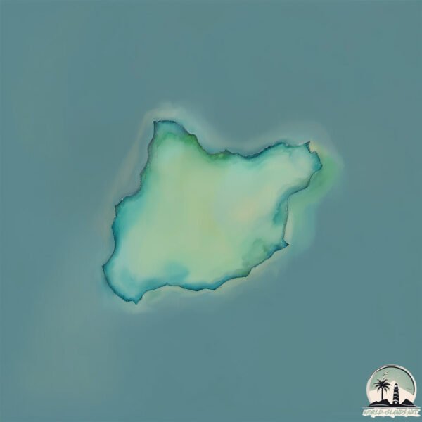
Welcome to Councillor Island, a Temperate island in the Bass Strait, part of the majestic Pacific Ocean. This guide offers a comprehensive overview of what makes Councillor Island unique – from its geography and climate to its population, infrastructure, and beyond. Dive into the details:
Geography and size of Councillor Island
Size: 0.131 km²
Coastline: 2 km
Ocean: Pacific Ocean
Sea: Bass Strait
Continent: Oceania
Councillor Island is a Tiny Island spanning 0.131 km² with a coastline of 2 km.
Archipel: –
Tectonic Plate: Australia – A major tectonic plate covering Australia, New Zealand, and parts of the Indian and Pacific Oceans, known for its relative stability and occasional seismic activity.
The geographic heart of the island is pinpointed at these coordinates:
Latitude: -39.8294832 / Longitude: 144.16118408
Climate and weather of Councillor Island
Climate Zone: Temperate
Climate Details: Warm-Summer Mediterranean Climate
Temperature: Warm Summer
Climate Characteristics: Characterized by warm, dry summers and mild, wet winters, typical of coastal areas with abundant sunshine Rain is more common in the winter months, maintaining a moderate climate.
Topography and nature of Councillor Island
Timezone: UTC+10:00
Timezone places: Australia/Sydney
Max. Elevation: 1 m
Mean Elevation: 1 m
Vegetation: Cultivated Land
Tree Coverage: 28%
The mean elevation is 1 m. The highest elevation on the island reaches approximately 1 meters above sea level. The island is characterized by Plains: Flat, low-lying lands characterized by a maximum elevation of up to 200 meters. On islands, plains are typically coastal lowlands or central flat areas.
Dominating Vegetation: Cultivated Land
Areas dedicated to agricultural activities, growing crops like grains, vegetables, and fruits. These lands are usually human-modified landscapes. Councillor Island has a tree cover of 28 %.
Vegetation: 1 vegetation zones – Minimal Diversity Island
These islands exhibit the most basic level of ecological diversity, often characterized by a single dominant vegetation type. This could be due to extreme environmental conditions, limited land area, or significant human impact. They represent unique ecosystems where specific species have adapted to thrive in these singular environments.
Infrastructure and Travelling to Councillor Island
Does the island have a public airport? no.
There is no public and scheduled airport on Councillor Island. The nearest airport is King Island Airport, located 32 km away.
Does the island have a major port? no.
There are no major ports on Councillor Island. The closest major port is STANLEY, approximately 162 km away.
The mean population of Councillor Island is 1 per km². Councillor Island is Uninhabited. The island belongs to Australia.
Continuing your journey, Hunter is the next notable island, situated merely km away.
Cllr Emma Macdonald speaks about being a councillor for Shetland Islands Council
Cllr Emma Macdonald speaks about being a councillor for Shetland Islands Council.Cllr Emma Macdonald speaks about being a councillor for Shetland Islands Council
Cllr Emma Macdonald speaks about being a councillor for Shetland ...
Cllr Emma Macdonald speaks about being a councillor for Shetland Islands Council.
Councillor pushes for bridge to Toronto island
The city plans to spend millions of dollars over the next decade to ...
The city plans to spend millions of dollars over the next decade to improve access to Toronto island, and one councillor wants that ...
Why become a Shetland Community Councillor?
Community Council elections take place every four years and the ...
Community Council elections take place every four years and the opportunity to become a community councillor for your local ...
IRU/VICTORIA-ISLAND LOCAL COUNCIL INAUGURATES COUNCILLORS
In line with due process and to ensure the smooth commencement of ...
In line with due process and to ensure the smooth commencement of democratic governance, the newly sworn-in leadership of ...
So You Want To Be A Councillor - with Stephen Hagan
Interested in local issues and in making a difference? Ever thought ...
Interested in local issues and in making a difference? Ever thought about being a Councillor? Head along to one of three ...
President meets with Councillors and Institutional representatives of Neykurendhoo Island
President meets with Councillors and Institutional representatives of ...
President meets with Councillors and Institutional representatives of Neykurendhoo Island.
Welcome to Country motion rejected by Flinders Island Council | ABC NEWS
A motion by a Flinders Island councillor requesting his council cease ...
A motion by a Flinders Island councillor requesting his council cease Welcome to Country and Acknowledgement of Country at ...
Councillor Dave Stewart gives reassurance over COVID-19 plans - Island Echo
So you want to be a councillor
An insight into the work of a councillor with Orkney Islands Council ...
An insight into the work of a councillor with Orkney Islands Council from Councillor Roderick McLeod - with advice for those ...
Pointe-Claire Councillor Brent Cowan discusses council position amid resignations and tensions.
Pointe-Claire City Councillor, Brent Cowan, sits down with the Editor ...
Pointe-Claire City Councillor, Brent Cowan, sits down with the Editor of the West Island News to discuss the trials and tribulations ...
Councillor Karl Love - Extra Focus on Housing
Councillor Angela Buswell highlights how Te Uruhi will provide a focal point in Maclean Park
Councillor Angela Buswell describes the importance of strengthening ...
Councillor Angela Buswell describes the importance of strengthening our link between the mainland and our iconic taonga, Kāpiti ...
Councillor Pancake Toss 2019
King Island Councillor Sarina Laidler has decided to stand as a candidate for the Liberal Party
"Facing the Challenges of Victoria Island 1: Councillor Solutions (Part 2)"
In this video, we dive deep into the ongoing challenges faced by the ...
In this video, we dive deep into the ongoing challenges faced by the Victoria Island 1 constituency and the solutions that a ...
Vice President meets with Councillors of Nilandhoo Island of Faafu Atoll
Vice President meets with Councillors of Nilandhoo Island of Faafu Atoll.
Vice President meets with Councillors of Nilandhoo Island of Faafu Atoll.
Vice President Meets with Councillors of Kandoodhoo Island of Thaa Atoll
Vice President Meets with Councillors of Kandoodhoo Island of Thaa Atoll.
Vice President Meets with Councillors of Kandoodhoo Island of Thaa Atoll.
LBC listener steps in to fact-check Reform councillor
Listener Ellis, who is from Gibraltar steps in to settle a sovereignty ...
Listener Ellis, who is from Gibraltar steps in to settle a sovereignty debate about the peninsula. #tomswarbrick #gibraltar ...
High Councillor
Provided to YouTube by Solar Tide Records High Councillor · The ...
Provided to YouTube by Solar Tide Records High Councillor · The Sanctum Islands · Maria Johnston The Sad Islands ℗ 2025 ...
Chaos at Vancouver Island council meeting
A village council meeting on Vancouver Island erupted into chaos last ...
A village council meeting on Vancouver Island erupted into chaos last night, with people screaming at each other and one ...
Vice President meets with the Councillors of G Dh Rathafandhoo Island
Vice President meets with the Councillors of G Dh Rathafandhoo Island.
Vice President meets with the Councillors of G Dh Rathafandhoo Island.
Pointe-Claire Councillor Tara Stainforth, says anti-Semitic slurs have no place in council
According to Pointe-Claire Councillor Tara Stainforth, anti-Semitic ...
According to Pointe-Claire Councillor Tara Stainforth, anti-Semitic slurs were uttered at this week's caucus meeting in the City of ...
President meets Councillors, senior officials and members of Fulhadhoo Island's institu
President meets Councillors, senior officials and high ranking members ...
President meets Councillors, senior officials and high ranking members of Fulhadhoo Island's institutions.
South Hams Councillor Lee Bonham was at the 2025 Island Assembly on Burgh Island
Corpus Christi City Council approves island mobility plan to improve traffic safety
Ahead of spring break, city leaders voted to incorporate a mobility ...
Ahead of spring break, city leaders voted to incorporate a mobility plan to improve safety for pedestrians, cyclists and drivers on ...
Australia is classified as Developed region: nonG7: Developed economies outside of the Group of Seven, characterized by high income and advanced economic structures. The level of income is High income: OECD.
News – Latest Updates and Headlines from Councillor Island
Stay informed with the most recent news and important headlines from Councillor Island. Here’s a roundup of the latest developments.
Loading...
Please note: The data used here has been primarily extracted from satellite readings. Deviations from exact values may occur, particularly regarding the height of elevations and population density. Land area and coastline measurements refer to average values at mean high tide.