Cù Lao Ong Con
Welcome to Cù Lao Ong Con, a Tropical island in the South China Sea, part of the majestic Pacific Ocean. This guide offers a comprehensive overview of what makes Cù Lao Ong Con unique – from its geography and climate to its population, infrastructure, and beyond. Dive into the details:
- Geography and Size: Explore the island’s size and location.
- Climate and Weather: Weather patterns and temperature.
- Topography and Nature: Uncover the natural wonders of the island.
- Infrastructure and Travelling: Insights on reaching, staying, and making the most of your visit.
- News and Headlines: Latest News.
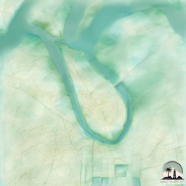
Geography and size of Cù Lao Ong Con
Size: 4.765 km²
Coastline: 10.9 km
Ocean: Pacific Ocean
Sea: South China Sea
Continent: Asia
Cù Lao Ong Con is a Small Island spanning 4.8 km² with a coastline of 10.9 km.
Archipel: –
Tectonic Plate: Sunda – Extends across Southeast Asia, encompassing parts of the Sunda Shelf, known for its interaction with the Australian Plate, contributing to volcanic activity in Indonesia.
The geographic heart of the island is pinpointed at these coordinates:
Latitude: 10.74139162 / Longitude: 106.83187333
Climate and weather of Cù Lao Ong Con
Climate Zone: Tropical
Climate Details: Tropical Savanna, Wet
Temperature: Hot
Climate Characteristics: Defined by distinct wet and dry seasons with high temperatures year-round. Pronounced rainfall occurs during the wet season, while the dry season is marked by drought.
Topography and nature of Cù Lao Ong Con
Timezone: UTC+07:00
Timezone places: Asia/Jakarta
Max. Elevation: 2 m
Mean Elevation: 2 m
Vegetation: Rice Paddy
Tree Coverage: 21%
The mean elevation is 2 m. The highest elevation on the island reaches approximately 2 meters above sea level. The island is characterized by Plains: Flat, low-lying lands characterized by a maximum elevation of up to 200 meters. On islands, plains are typically coastal lowlands or central flat areas.
Dominating Vegetation: Rice Paddy
Specifically designed for rice cultivation, these fields are flooded with water during the growing season. Paddy fields are a common sight in many parts of Asia. Cù Lao Ong Con has a tree cover of 21 %.
Vegetation: 4 vegetation zones – Diverse Island
Four distinct vegetation zones mark these islands as ecologically diverse. They might feature varied landscapes such as forests, beaches, grasslands, and rocky areas. Such diversity reflects the island’s complex ecological interactions and varied habitats, which can support a rich array of wildlife and plant species.
Infrastructure and Travelling to Cù Lao Ong Con
Does the island have a public airport? no.
There is no public and scheduled airport on Cù Lao Ong Con. The nearest airport is Tan Son Nhat International Airport, located 20 km away.
Does the island have a major port? no.
There are no major ports on Cù Lao Ong Con. The closest major port is CAT LAI, approximately 4 km away.
The mean population of Cù Lao Ong Con is 584 per km². Cù Lao Ong Con is Densely Populated. The island belongs to Vietnam.
Continuing your journey, Cù Lao Ong Go is the next notable island, situated merely km away.
Vietnam is classified as Emerging region: G20: Group of Twenty – Major economies comprising both developed and emerging countries, representing the world’s largest economies. The level of income is Lower middle income.
News – Latest Updates and Headlines from Cù Lao Ong Con
Stay informed with the most recent news and important headlines from Cù Lao Ong Con. Here’s a roundup of the latest developments.
Please note: The data used here has been primarily extracted from satellite readings. Deviations from exact values may occur, particularly regarding the height of elevations and population density. Land area and coastline measurements refer to average values at mean high tide.