Dakhara
Welcome to Dakhara, a Dry island in the Red Sea, part of the majestic Indian Ocean. This guide offers a comprehensive overview of what makes Dakhara unique – from its geography and climate to its population, infrastructure, and beyond. Dive into the details:
- Geography and Size: Explore the island’s size and location.
- Climate and Weather: Weather patterns and temperature.
- Topography and Nature: Uncover the natural wonders of the island.
- Infrastructure and Travelling: Insights on reaching, staying, and making the most of your visit.
- News and Headlines: Latest News.
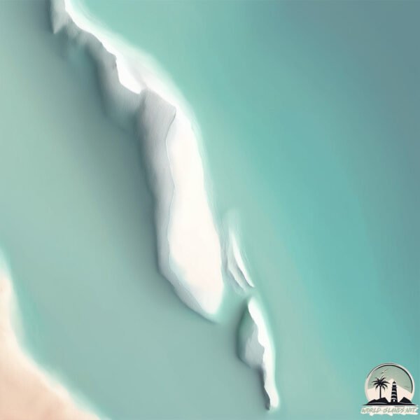
Geography and size of Dakhara
Size: 0.289 km²
Coastline: 3.7 km
Ocean: Indian Ocean
Sea: Red Sea
Continent: Africa
Dakhara is a Tiny Island spanning 0.289 km² with a coastline of 3.7 km.
Archipel: –
Tectonic Plate: Arabia – A major tectonic plate covering the Arabian Peninsula and parts of the Middle East. The plate is primarily continental and known for its collision with the Eurasian Plate, leading to the uplift of the Zagros Mountains.
The geographic heart of the island is pinpointed at these coordinates:
Latitude: 13.19089547 / Longitude: 42.57524623
Climate and weather of Dakhara
Climate Zone: Dry
Climate Details: Hot Deserts Climate
Temperature: Hot
Climate Characteristics: Dominated by extremely hot temperatures, this climate is marked by minimal rainfall and barren landscapes. Nights often experience drastic temperature drops.
Topography and nature of Dakhara
Timezone: UTC+03:00
Timezone places: Asia/Riyadh
Max. Elevation: -2 m
Mean Elevation: -3 m
Vegetation: Sparse Vegetation
Tree Coverage: 45%
The mean elevation is -3 m. Remarkably, this unique island barely emerges above the sea level, showcasing nature’s fascinating interplay with the ocean. The island is characterized by Plains: Flat, low-lying lands characterized by a maximum elevation of up to 200 meters. On islands, plains are typically coastal lowlands or central flat areas.
Dominating Vegetation: Sparse Vegetation
These regions have limited plant growth, typically due to extreme conditions like aridity or poor soils. Vegetation is scattered and consists of hardy plant species. Dakhara has a tree cover of 45 %.
Vegetation: 1 vegetation zones – Minimal Diversity Island
These islands exhibit the most basic level of ecological diversity, often characterized by a single dominant vegetation type. This could be due to extreme environmental conditions, limited land area, or significant human impact. They represent unique ecosystems where specific species have adapted to thrive in these singular environments.
Infrastructure and Travelling to Dakhara
Does the island have a public airport? no.
There is no public and scheduled airport on Dakhara. The nearest airport is Assab International Airport, located 15 km away.
Does the island have a major port? no.
There are no major ports on Dakhara. The closest major port is ASSAB, approximately 28 km away.
The mean population of Dakhara is 5 per km². Dakhara is Gently Populated. The island belongs to Eritrea.
Continuing your journey, Halib is the next notable island, situated merely km away.
Catch Fish At lake For Survival. Primitive FIRE STARTING TECHNIQUES.


Eritrea is classified as Least developed region: Countries that exhibit the lowest indicators of socioeconomic development, with the lowest Human Development Index ratings. The level of income is Low income.
News – Latest Updates and Headlines from Dakhara
Stay informed with the most recent news and important headlines from Dakhara. Here’s a roundup of the latest developments.
Please note: The data used here has been primarily extracted from satellite readings. Deviations from exact values may occur, particularly regarding the height of elevations and population density. Land area and coastline measurements refer to average values at mean high tide.