Dangsado
Welcome to Dangsado, a Temperate island in the Yellow Sea, part of the majestic Pacific Ocean. This guide offers a comprehensive overview of what makes Dangsado unique – from its geography and climate to its population, infrastructure, and beyond. Dive into the details:
- Geography and Size: Explore the island’s size and location.
- Climate and Weather: Weather patterns and temperature.
- Topography and Nature: Uncover the natural wonders of the island.
- Infrastructure and Travelling: Insights on reaching, staying, and making the most of your visit.
- News and Headlines: Latest News.
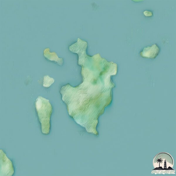
Geography and size of Dangsado
Size: 2.481 km²
Coastline: 10.3 km
Ocean: Pacific Ocean
Sea: Yellow Sea
Continent: Asia
Dangsado is a Small Island spanning 2.5 km² with a coastline of 10.3 km.
Archipel: –
Tectonic Plate: Amur – A minor tectonic plate in the region of the Amur River at the border of Russia and China, involved in complex interactions with the Pacific and Eurasian plates.
The geographic heart of the island is pinpointed at these coordinates:
Latitude: 34.88831731 / Longitude: 126.18151648
Climate and weather of Dangsado
Climate Zone: Temperate
Climate Details: Humid Subtropical Climate
Temperature: Hot Summer
Climate Characteristics: With continuous rainfall and hot summers, this climate is common in some coastal regions, supporting diverse vegetation.
Topography and nature of Dangsado
Timezone: UTC+09:00
Timezone places: Asia/Tokyo
Max. Elevation: 12 m
Mean Elevation: 8 m
Vegetation: Evergreen Needleleaf Forest
Tree Coverage: 28%
The mean elevation is 8 m. The highest elevation on the island reaches approximately 12 meters above sea level. The island is characterized by Plains: Flat, low-lying lands characterized by a maximum elevation of up to 200 meters. On islands, plains are typically coastal lowlands or central flat areas.
Dominating Vegetation: Evergreen Needleleaf Forest
Dominated by evergreen coniferous trees such as pines and firs, which retain their needle-like leaves throughout the year. These forests are often found in cooler climates. Dangsado has a tree cover of 28 %.
Vegetation: 4 vegetation zones – Diverse Island
Four distinct vegetation zones mark these islands as ecologically diverse. They might feature varied landscapes such as forests, beaches, grasslands, and rocky areas. Such diversity reflects the island’s complex ecological interactions and varied habitats, which can support a rich array of wildlife and plant species.
Infrastructure and Travelling to Dangsado
Does the island have a public airport? no.
There is no public and scheduled airport on Dangsado. The nearest airport is Muan International Airport, located 24 km away.
Does the island have a major port? no.
There are no major ports on Dangsado. The closest major port is MOKPO, approximately 24 km away.
The mean population of Dangsado is 36 per km². Dangsado is Gently Populated. The island belongs to South Korea.
Continuing your journey, Kunkiijamu To is the next notable island, situated merely km away.
The hidden treasure of Mystery Island in S.Korea-YeoSeoDo's stone wall [MOKPO JOJOSHI]
![The hidden treasure of Mystery Island in S.Korea-YeoSeoDo's stone wall [MOKPO JOJOSHI]](https://i.ytimg.com/vi/J9cKmr7PXcM/mqdefault.jpg)

![섬 속의 작은 섬, 당사도 [Korea Island]](https://i.ytimg.com/vi/rXDfi4EOcVY/mqdefault.jpg)
South Korea is classified as Emerging region: MIKT: Mexico, Indonesia, South Korea, and Turkey – Economies recognized for their development potential and emerging market status. The level of income is High income: OECD.
News – Latest Updates and Headlines from Dangsado
Stay informed with the most recent news and important headlines from Dangsado. Here’s a roundup of the latest developments.
Please note: The data used here has been primarily extracted from satellite readings. Deviations from exact values may occur, particularly regarding the height of elevations and population density. Land area and coastline measurements refer to average values at mean high tide.