Welcome to Deer Island, a Continental island in the Gulf of St. Lawrence, part of the majestic Arctic Ocean. This guide offers a comprehensive overview of what makes Deer Island unique – from its geography and climate to its population, infrastructure, and beyond. Dive into the details:
Geography and size of Deer Island
Size: 1.236 km²
Coastline: 6.7 km
Ocean: Arctic Ocean
Sea: Gulf of St. Lawrence
Continent: North America
Deer Island is a Small Island spanning 1.2 km² with a coastline of 6.7 km.
Archipel: Canadian Arctic Archipelago – A vast and remote region in northern Canada, consisting of a series of large and small islands known for their extreme Arctic environment and unique wildlife.
Tectonic Plate: North America – Covers North America and parts of the Atlantic and Arctic Oceans, characterized by diverse geological features and varying levels of seismic activity.
The geographic heart of the island is pinpointed at these coordinates:
Latitude: 49.71237695 / Longitude: -69.48271749
Climate and weather of Deer Island
Climate Zone: Continental
Climate Details: Warm-Summer Humid Continental Climate
Temperature: Warm Summer
Climate Characteristics: Features warm summers and cold winters with consistent precipitation, common in higher latitudes.
Topography and nature of Deer Island
Timezone: UTC-05:00
Timezone places: America/New_York
Max. Elevation: -15 m
Mean Elevation: -28 m
Vegetation: Evergreen Needleleaf Forest
Tree Coverage: 77%
The mean elevation is -28 m. Remarkably, this unique island barely emerges above the sea level, showcasing nature’s fascinating interplay with the ocean. The island is characterized by Plains: Flat, low-lying lands characterized by a maximum elevation of up to 200 meters. On islands, plains are typically coastal lowlands or central flat areas.
Dominating Vegetation: Evergreen Needleleaf Forest
Dominated by evergreen coniferous trees such as pines and firs, which retain their needle-like leaves throughout the year. These forests are often found in cooler climates. Deer Island has a tree cover of 77 %.
Vegetation: 10 vegetation zones – Very Highly Diverse Island
Islands in this range are ecological powerhouses, showcasing a wide array of vegetation zones. Each zone, from lush rainforests to arid scrublands, coastal mangroves to mountainous regions, contributes to a complex and interdependent ecosystem. These islands are often hotspots of biodiversity, supporting numerous species and intricate ecological processes.
Infrastructure and Travelling to Deer Island
Does the island have a public airport? no.
There is no public and scheduled airport on Deer Island. The nearest airport is St. Lewis (Fox Harbour) Airport, located 23 km away.
Does the island have a major port? no.
There are no major ports on Deer Island. The closest major port is EASTPORT, approximately 3 km away.
The mean population of Deer Island is 11 per km². Deer Island is Gently Populated. The island belongs to Canada.
Continuing your journey, Centre Island is the next notable island, situated merely km away.
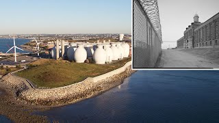
The Strange History of the Deer Island Treatment Plant
The Massachusetts wastewater treatment plant that collects crucial COVID data was built on land that has a darker history that you ...The Strange History of the Deer Island Treatment Plant
The Massachusetts wastewater treatment plant that collects crucial ...
The Massachusetts wastewater treatment plant that collects crucial COVID data was built on land that has a darker history that you ...
The Deer Island Concentration Camp… #history
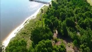
Deer Island Caught On Drone Footage
News 5 Meteorologist Thomas Geboy gained access to drone footage that ...
News 5 Meteorologist Thomas Geboy gained access to drone footage that offers a glance of the island, located off the coast of ...
Remains Of Young Girl Found On Deer Island
Police are investigating the identity of the young girl and the cause ...
Police are investigating the identity of the young girl and the cause of death. WBZ-TV's Julie Loncich reports.
Deer Island Elites’ Secret Retreat
Deer Island New York isn't just another island in the Thousand Islands ...
Deer Island New York isn't just another island in the Thousand Islands — it's owned entirely by the Russell Trust Association, the ...
Deer Island Drone Video
Deer Island Drone Video.
Deer Island Drone Video.
DEER ISLAND 1985.wmv
DEER ISLAND IN THE NEWS 1985 Check out the 2 part escape video, Click ...
DEER ISLAND IN THE NEWS 1985 Check out the 2 part escape video, Click "MORE FROM:..."
A Peaceful Escape to Deer Island | Hidden Maritime Paradise in Canada | Scenic Atlantic Journey
Experience the quiet beauty of Deer Island, New Brunswick, in this ...
Experience the quiet beauty of Deer Island, New Brunswick, in this comprehensive travel guide. From the iconic Deer Island Ferry ...
Weird Skull and Bones Ritual on Deer Island
Drove by in boat and spooked Bonesmen doing some weird ritual.
Drove by in boat and spooked Bonesmen doing some weird ritual.
NEW Dayz Deer isle 6.0 - Questline to End Game
Created on server MiddleGroundZ Deer Isle Discord: ...
Why New York's Plum Island is Totally Forbidden
Plum Island, located off the northeastern coast of Long Island, New ...
Plum Island, located off the northeastern coast of Long Island, New York, has a rich history spanning centuries. Originally known ...
This Small Island is OVERRUN by Deer...
Martha's Vineyard is a small island just 7 miles off the coast of ...
Martha's Vineyard is a small island just 7 miles off the coast of Massachusetts. Known for its beautiful Summer homes and New ...
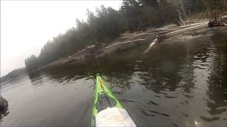
DEER ISLAND CIRCUMNAVIGATION BY KAYAK
OutdoorsNB's Jeremy Cline and White Water Paddler Shayne Lee ...
OutdoorsNB's Jeremy Cline and White Water Paddler Shayne Lee Circumnavigate Deer Island New Brunswick in 4 hours of ...
New 5.9 Deer Isle Questline Tutorial (1.26 DayZ update)
Created on server MiddleGroundZ Deer Isle Vanilla+ Discord: ...
This Island Has 10x More Deer Than People | JRE #2358
Joe Rogan talks about Lanai, a small Hawaiian island with no predators ...
Joe Rogan talks about Lanai, a small Hawaiian island with no predators and a deer population 10x larger than its human ...
Completing The Hardest Quest In DayZ - A Deer Isle Adventure (Full Movie)
Join me and my friends on Deer Isle, one of DayZ's most atmospheric ...
Join me and my friends on Deer Isle, one of DayZ's most atmospheric and unforgiving maps. In this adventure we explore the ...
Deer Island
Provided to YouTube by Nice Guys Deer Island · Yot Club Deer Island ℗ ...
Provided to YouTube by Nice Guys Deer Island · Yot Club Deer Island ℗ Nice Guys Released on: 2021-12-17 Producer: Ryan ...
Greater Boston Video: Deer Island Tragedy Chronicled In 'Trapped Under The Sea'
Visitors flock to Deer Island today to enjoy unparalleled views of ...
Visitors flock to Deer Island today to enjoy unparalleled views of Boston Harbor, now one of the cleanest urban harbors in the ...
Deer Island workers relieved Baby Doe mystery is finally solved
People have been leaving flowers and teddy bears at a memorial on Deer ...
People have been leaving flowers and teddy bears at a memorial on Deer Island where Bella Bond's body was found nearly three ...
Worlds FIRST Streamer To Complete The Hardest Quest In DayZ! Deer Isle 6.0
Join me on one of the most intense lives I ever had in DayZ. Watch as ...
Join me on one of the most intense lives I ever had in DayZ. Watch as one come up changes the whole direction of the run and ...
Remains of young girl found on Deer Island
The remains of a young girl were found on Deer Island. Subscribe to ...
The remains of a young girl were found on Deer Island. Subscribe to WCVB on YouTube now for more:
http://bit.ly/1e8lAMZ Get ...
Deer Island (Thousand Islands) Top # 10 Facts
Deer Island (Thousand Islands) Top # 10 Facts.
Deer Island (Thousand Islands) Top # 10 Facts.
The BEST QUESTLINE EVER In DayZ! A Deerisle Adventure in 2025!
Trying to complete DayZ's most engaging quest which seems to guarantee ...
Trying to complete DayZ's most engaging quest which seems to guarantee encounters! TRMZ is now partnered with PC Specialist ...
Towns of Deer Isle, and Stonington, Maine 2023
Peaceful beautiful towns of Deer Isle, and Stonington, Maine. A must ...
Peaceful beautiful towns of Deer Isle, and Stonington, Maine. A must see in Downeast Maine. 0-3:19 mark Deer Isle - Sedgwick ...
Deer Isle 6.0 Update Soon - New Areas, Secrets & Surprises!
Server MiddleGroundZ Deer Isle | 1PP | Vanilla+ Discord: ...
Canada is classified as Developed region: G7: Group of Seven – Major advanced economies, including Canada, France, Germany, Italy, Japan, the United Kingdom, and the United States. The level of income is High income: OECD.
News – Latest Updates and Headlines from Deer Island
Stay informed with the most recent news and important headlines from Deer Island. Here’s a roundup of the latest developments.
Loading...
Please note: The data used here has been primarily extracted from satellite readings. Deviations from exact values may occur, particularly regarding the height of elevations and population density. Land area and coastline measurements refer to average values at mean high tide.