Welcome to Desecheo, a Tropical island in the Caribbean Sea, part of the majestic Atlantic Ocean. This guide offers a comprehensive overview of what makes Desecheo unique – from its geography and climate to its population, infrastructure, and beyond. Dive into the details:
Geography and size of Desecheo
Size: 1.19 km²
Coastline: 4.4 km
Ocean: Atlantic Ocean
Sea: Caribbean Sea
Continent: North America
Desecheo is a Small Island spanning 1.2 km² with a coastline of 4.4 km.
Archipel: Greater Antilles – A major island group in the Caribbean, including Cuba, Jamaica, Hispaniola, and Puerto Rico, known for their rich history and diverse cultures.
Tectonic Plate: Caribbean – Covering the Caribbean Sea and surrounding regions, this plate is bordered by the North American Plate and the South American Plate. Known for seismic activity, including earthquakes and volcanic eruptions, and features like the Puerto Rico Trench.
The geographic heart of the island is pinpointed at these coordinates:
Latitude: 18.38373108 / Longitude: -67.48067546
Climate and weather of Desecheo
Climate Zone: Tropical
Climate Details: Tropical Savanna, Wet
Temperature: Hot
Climate Characteristics: Defined by distinct wet and dry seasons with high temperatures year-round. Pronounced rainfall occurs during the wet season, while the dry season is marked by drought.
Topography and nature of Desecheo
Timezone: UTC-04:00
Timezone places: America/La_Paz
Max. Elevation: 43 m
Mean Elevation: 21 m
Vegetation: Deciduous Needleleaf Forest
Tree Coverage: 74%
The mean elevation is 21 m. The highest elevation on the island reaches approximately 43 meters above sea level. The island is characterized by Plains: Flat, low-lying lands characterized by a maximum elevation of up to 200 meters. On islands, plains are typically coastal lowlands or central flat areas.
Dominating Vegetation: Deciduous Needleleaf Forest
Consists of needleleaf trees that shed their needles annually. This type of forest is less common and can be found in certain cold, northern regions. Desecheo has a tree cover of 74 %.
Vegetation: 3 vegetation zones – Moderately Diverse Island
These islands start to show a broader range of ecological niches. With three vegetation zones, they may offer a mix of ecosystems like coastal areas, inland woods, and perhaps a distinct wetland or dry area. This diversity supports a wider range of flora and fauna, making these islands more ecologically complex than those with minimal diversity.
Infrastructure and Travelling to Desecheo
Does the island have a public airport? no.
There is no public and scheduled airport on Desecheo. The nearest airport is Eugenio Maria De Hostos Airport, located 39 km away.
Does the island have a major port? no.
There are no major ports on Desecheo. The closest major port is AGUADILLA, approximately 36 km away.
The mean population of Desecheo is 2 per km². Desecheo is Gently Populated. The island belongs to United States of America.
Continuing your journey, Mona is the next notable island, situated merely km away.
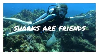
Best diving in Puerto Rico//Diving Desecheo Island
Desecheo island is right off the coast of Rincon, Puerto Rico. It used to be target practice for the military, and is currently a ...Best diving in Puerto Rico//Diving Desecheo Island
Desecheo island is right off the coast of Rincon, Puerto Rico. It used ...
Desecheo island is right off the coast of Rincon, Puerto Rico. It used to be target practice for the military, and is currently a ...
🏝 DESECHEO ISLAND ( La isla ⛰ PROHIBIDA) Mayagüez
Por que no se debe visitar la isla Información aquí: ...
Scuba Diving Most Dangerous Island in Caribbean in 4K - Desecheo Island Off Rincón, Puerto Rico
After Old San Juan, we went scuba diving with Taino Divers at Desecheo ...
After Old San Juan, we went scuba diving with Taino Divers at Desecheo Island - an old military island and nature preserve near ...
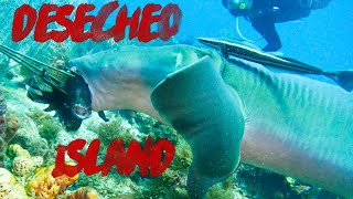
Diving Desecheo, The Uninhabited Island - Puerto Rico
Scuba diving along Isla Desecheo, an uninhabited island about 15 miles ...
Scuba diving along Isla Desecheo, an uninhabited island about 15 miles from Rincón. The boat ride can be a little rough, but well ...
Bird decoys and mirrors on Desecheo Island
Bird decoys and mirrors put up on Desecheo Island off the coast of the ...
Bird decoys and mirrors put up on Desecheo Island off the coast of the main island of Puerto Rico. Credit: Jose Luis Herrera/Island ...
I saw this Giant Lobster at Desecheo Island off the west coast of Puerto Rico #giantlobster #lobster
I saw this Giant Lobster at Desecheo Island off the west coast of ...
I saw this Giant Lobster at Desecheo Island off the west coast of Puerto Rico. It's a marine preserve so nothing can be taken here, ...
Scuba Diving in Desecheo Island, Puerto Rico
Desecheo Island Diving (GoPro Hero 6 & Dji Mavic Pro)
Diving at Desecheo Island- Aquatica Underwater Adventures
This is what it looks like to come on a dive with us to the remote ...
This is what it looks like to come on a dive with us to the remote island of Desecheo! This island is extremely unique as it is illegal ...
Sound systems to attract seabirds to Desecheo Island, Puerto Rico.
Using sound systems to play bird calls in order to attract and restore ...
Using sound systems to play bird calls in order to attract and restore seabird colonies on Desecheo Island, Puerto Rico.
Desecheo Island Puerto Rico Scuba Diving Nov2025
Desecheo Island Puerto Rico Scuba Diving Nov2025.
Desecheo Island Puerto Rico Scuba Diving Nov2025.
Operation: Desecheo, Puerto Rico - Seabird Colony
An ambitious operation by Island Conservation, U.S. Fish and Wildlife ...
An ambitious operation by Island Conservation, U.S. Fish and Wildlife Service, and partners to rid Desecheo National Wildlife ...
Scuba Diving in Desecheo Puerto Rico
Check out this island that I went diving on off of the coast of Puerto ...
Check out this island that I went diving on off of the coast of Puerto Rico that is known for humpback whales, sharks, even ...
Desecheo Island bird colony recruiting
Researchers show the experimental setup for attracting seabirds to a ...
Researchers show the experimental setup for attracting seabirds to a former colony off the west coast of Puerto Rico. Credit: Jose ...
Desecheo Island Hoisting ~
MH-65D Dolphin from US Coast Guard Air Station Borinquen, Puerto Rico ...
MH-65D Dolphin from US Coast Guard Air Station Borinquen, Puerto Rico ~Hoisting University of Puerto Rico scientist for work on ...
desecheo island drone footage Puerto Rico
this is just a test dont watch this or do im not your dad. Or am I?
this is just a test dont watch this or do im not your dad. Or am I?
Desecheo Island
Video Software we use:
https://amzn.to/2KpdCQF Ad-free videos. You can support us by purchasing something through our ...
Scuba Diving Desecheo Island (Rincón, Puerto Rico)
Enjoying an amazing time underwater scuba diving with sharks, rays, ...
Enjoying an amazing time underwater scuba diving with sharks, rays, variety of colorful fish, fan coral and exploring many swim ...
Desecheo island dive
its just two dope boys on a dive excursion. headed out to see the ...
its just two dope boys on a dive excursion. headed out to see the natural wonders of the Mona passage off the west coast of ...
Desecheo Island, Puerto Rico
Scuba Diving in Puerto Rico -Desecheo Island
Scuba Diving in Desecheo in Rincon Puerto Rico was by far one of our ...
Scuba Diving in Desecheo in Rincon Puerto Rico was by far one of our best experiences yet. We went to Ricon to Taino Diver ...
Desecheo Island
Desecheo Island, Puerto Rico - dive site: Candyland.
Desecheo Island, Puerto Rico - dive site: Candyland.
Scuba Diving Desecheo in Puerto Rico | PR Dive Underwater Adventures
One of the best dive spots in Puerto Rico is Desecheo Island, of the ...
One of the best dive spots in Puerto Rico is Desecheo Island, of the West Coast of the Island. Here's a bit of @SplashedChris first ...
Coral Reefs In Puerto Rico: Desecheo Island 2016-2022 Historical Archive Marine Ecology Ricky Shub
In this video we visit the coral reefs of Desecheo Island, Puerto Rico ...
In this video we visit the coral reefs of Desecheo Island, Puerto Rico between the years 2016 and 2022. This footage is part of our ...
United States of America is classified as Developed region: G7: Group of Seven – Major advanced economies, including Canada, France, Germany, Italy, Japan, the United Kingdom, and the United States. The level of income is High income: OECD.
News – Latest Updates and Headlines from Desecheo
Stay informed with the most recent news and important headlines from Desecheo. Here’s a roundup of the latest developments.
Loading...
Please note: The data used here has been primarily extracted from satellite readings. Deviations from exact values may occur, particularly regarding the height of elevations and population density. Land area and coastline measurements refer to average values at mean high tide.