Welcome to Doi Moi, a Tropical island in the South China Sea, part of the majestic Pacific Ocean. This guide offers a comprehensive overview of what makes Doi Moi unique – from its geography and climate to its population, infrastructure, and beyond. Dive into the details:
Geography and size of Doi Moi
Size: 0.214 km²
Coastline: 2 km
Ocean: Pacific Ocean
Sea: South China Sea
Continent: Asia
Doi Moi is a Tiny Island spanning 0.214 km² with a coastline of 2 km.
Archipel: –
Tectonic Plate: Sunda – Extends across Southeast Asia, encompassing parts of the Sunda Shelf, known for its interaction with the Australian Plate, contributing to volcanic activity in Indonesia.
The geographic heart of the island is pinpointed at these coordinates:
Latitude: 12.65441538 / Longitude: 109.4675419
Climate and weather of Doi Moi
Climate Zone: Tropical
Climate Details: Tropical Savanna, Wet
Temperature: Hot
Climate Characteristics: Defined by distinct wet and dry seasons with high temperatures year-round. Pronounced rainfall occurs during the wet season, while the dry season is marked by drought.
Topography and nature of Doi Moi
Timezone: UTC+07:00
Timezone places: Asia/Jakarta
Max. Elevation: 3 m
Mean Elevation: 3 m
Vegetation: Evergreen Broadleaf Forest
Tree Coverage: 78%
The mean elevation is 3 m. The highest elevation on the island reaches approximately 3 meters above sea level. The island is characterized by Plains: Flat, low-lying lands characterized by a maximum elevation of up to 200 meters. On islands, plains are typically coastal lowlands or central flat areas.
Dominating Vegetation: Evergreen Broadleaf Forest
Characterized by dense, lush canopies of broadleaf trees that retain their leaves year-round. These forests are typically found in tropical and subtropical regions and are known for their high biodiversity. Doi Moi has a tree cover of 78 %.
Vegetation: 2 vegetation zones – Low Diversity Island
Islands with two distinct vegetation zones offer slightly more ecological variety. These zones could be due to differences in elevation, moisture, or other environmental factors. While still limited in biodiversity, these islands may offer a contrast between the two zones, such as a coastline with mangroves and an inland area with grassland.
Infrastructure and Travelling to Doi Moi
Does the island have a public airport? no.
There is no public and scheduled airport on Doi Moi. The nearest airport is Dong Tac Airport, located 46 km away.
Does the island have a major port? no.
There are no major ports on Doi Moi. The closest major port is NHA TRANG, approximately 52 km away.
The mean population of Doi Moi is 260 per km². Doi Moi is Moderately Inhabited. The island belongs to Vietnam.
Continuing your journey, Hòn Lớn is the next notable island, situated merely km away.
Phu Quoc Turtle Island (Doi Moi) | The trace of expedition of snorkeling in North Phu Quoc Island
A trace of adventure - soak up between the sea, prepare welcoming expeditions ahead Phu Quoc Turtle Island - Top snorkeling ...Phu Quoc Turtle Island (Doi Moi) | The trace of expedition of snorkeling in North Phu Quoc Island
A trace of adventure - soak up between the sea, prepare welcoming ...
A trace of adventure - soak up between the sea, prepare welcoming expeditions ahead Phu Quoc Turtle Island - Top snorkeling ...
San ho hon Doi Moi, Phu Quoc - Turtle Rock Reef
Phu Quoc, Vietnam October 2015.
Phu Quoc, Vietnam October 2015.
Drone | Vietnam, Phu Quoc, Turtle Island
February 2019. DJI Mavic Air footage from Phu Quoc, Hon Doi Moi ...
February 2019. DJI Mavic Air footage from Phu Quoc, Hon Doi Moi (Turtle Island), Vietnam. Music: Cafe del Mar, Volumen 15 ...
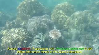
Hawksbill Turtle Island Phu Quoc, Vietnam | Phu Quoc Sea Turtle Nest (Hon Doi Moi)
Doi Moi or Hòn Đồi Mồi has long been mistakenly called Turtle Island ...
Doi Moi or Hòn Đồi Mồi has long been mistakenly called Turtle Island for a long time due to misunderstanding and mistranslation ...
Doi moi island-Phú Quốc 4/2/2107
Phu Quoc Island- Doi moi island
VÍCH BIỂN (ĐỒI MỒI)SIÊU TO.
Phu Quoc 2025 🇻🇳 Still Vietnam's Paradise Island?
Phu Quoc: Still a Paradise or Overdeveloped? Once a quiet fishing ...
Phu Quoc: Still a Paradise or Overdeveloped? Once a quiet fishing island, Phu Quoc has transformed into one of Vietnam's ...
DJI FPV high velocity wind resistant fly to the Doi Moi island - Phu Quoc - Vietnam
DJI FPV high velocity wind resistant test. Yeah, it's really strong ...
DJI FPV high velocity wind resistant test. Yeah, it's really strong and very good at high velocity wind resistant, look at the video, it is ...
Phú Quốc island travel- Hòn Đồi Mồi
恐怖分子駕船逃亡,最強特種兵怒追海上終極對決! #kungfu #movie #功夫 #李連杰 #jetli
观看更多精彩内容请订阅我们:https://reurl.cc/QaqMQO HLDF #武俠電影#功夫#kungfu ...
观看更多精彩内容请订阅我们:https://reurl.cc/QaqMQO HLDF #武俠電影#功夫#kungfu #少林#花木蘭#mulan #中国电视剧#功夫# ...
Hawksbill sea turtle in Phu Quoc Island, Vietnam | Turtle Island Phu Quoc
A hawksbill (one of 5 sea turtle species in Vietnam) found swimming in ...
A hawksbill (one of 5 sea turtle species in Vietnam) found swimming in the North-east Coral Reef, South Phu Quoc Island, sea ...
Spearfishing doi moi island#Spearfishing #fishing
🇹🇭10 best things to do in Chiang Mai, Thailand #chiangmai #thailandtravel #thailandtrip
Get my FREE Chiang Mai Guide at chiangmai.kelseyinlondon.com (link in ...
Get my FREE Chiang Mai Guide at chiangmai.kelseyinlondon.com (link in bio) which includes: ⭐️ Top things to do ...
Phu Quoc Đoi moi island December 21, 2022
KOH SAMUI, THAILAND | 10 Incredible Things To Do In & Around Koh Samui
Koh Samui is located in the southern Gulf of Thailand. It's the ...
Koh Samui is located in the southern Gulf of Thailand. It's the largest island of the Samui Archipelago and the second-largest in ...
Tauchen in Vietnam, Phu Quoc / Turtle Island
Tauchgang vom 12.12.2011 in Vietnam, Phu Quoc, Turtle Island.
Tauchgang vom 12.12.2011 in Vietnam, Phu Quoc, Turtle Island.
Chấm Xanh chấm cam chấm đỏ trên iPhone cách để biết
Đăng ký kênh để biết nhiều mẹo hay về iPhone.
Đăng ký kênh để biết nhiều mẹo hay về iPhone.
[Review Phim] Hòn Đảo Bị Sương Mù Cô Lập Và Bí Mật Động Trời Bị Quân Đội Che Giấu
[Review Phim] Hòn Đảo Bị Sương Mù Cô Lập Và Bí Mật Động Trời Bị Quân ...
[Review Phim] Hòn Đảo Bị Sương Mù Cô Lập Và Bí Mật Động Trời Bị Quân Đội Che Giấu Tóm Tắt Phim: : The Island 2026 ...
Is KOH SAMUI, THAILAND Still Worth Traveling to?
Want to see how's traveling to Koh Samui, Thailand now? Get a Holafly ...
Want to see how's traveling to Koh Samui, Thailand now? Get a Holafly eSim and get 5% off your purchase: ...
SCUBA-DIVING in PHU QUOC ISLAND TO EXPLORE PHU QUOC HALF-MOON REEF & U-TURN 2022
Scuba Diving Trip in Phu Quoc Island to explore coral reefs in the the ...
Scuba Diving Trip in Phu Quoc Island to explore coral reefs in the the shallow water of 8 - 16m about the Pearl Island. Challenge ...
May rut trong island - One of the most beautiful island on phu quoc
Let's come to hon may rut island ,if you are dreaming about a ...
Let's come to hon may rut island ,if you are dreaming about a mid-ocean island with pure blue water, white sand and cool coconut ...
Turtle Islet - Phu Quoc Island 02/01/2014
Phu Quoc Vietnam | Most beautiful place in Vietnam
Phu Quoc Vietnam | Most beautiful place in Vietnam Phu Quoc Phu Quoc ...
Phu Quoc Vietnam | Most beautiful place in Vietnam Phu Quoc Phu Quoc is the largest island in Vietnam, located Kien Giang ...
Vietnam is classified as Emerging region: G20: Group of Twenty – Major economies comprising both developed and emerging countries, representing the world’s largest economies. The level of income is Lower middle income.
News – Latest Updates and Headlines from Doi Moi
Stay informed with the most recent news and important headlines from Doi Moi. Here’s a roundup of the latest developments.
Loading...
Please note: The data used here has been primarily extracted from satellite readings. Deviations from exact values may occur, particularly regarding the height of elevations and population density. Land area and coastline measurements refer to average values at mean high tide.


![[Review Phim] Hòn Đảo Bị Sương Mù Cô Lập Và Bí Mật Động Trời Bị Quân Đội Che Giấu](https://i.ytimg.com/vi/hXo67vK1-gc/mqdefault.jpg)