Dominica
Welcome to Dominica, a Tropical island in the Caribbean Sea, part of the majestic Atlantic Ocean. This guide offers a comprehensive overview of what makes Dominica unique – from its geography and climate to its population, infrastructure, and beyond. Dive into the details:
- Geography and Size: Explore the island’s size and location.
- Climate and Weather: Weather patterns and temperature.
- Topography and Nature: Uncover the natural wonders of the island.
- Infrastructure and Travelling: Insights on reaching, staying, and making the most of your visit.
- News and Headlines: Latest News.
Geography and size of Dominica
Size: 755.1 km²
Coastline: 164.7 km
Ocean: Atlantic Ocean
Sea: Caribbean Sea
Continent: North America
Dominica is a Large Island spanning 755 km² with a coastline of 165 km.
Archipel: Lesser Antilles – A long arc of small islands in the Caribbean Sea, stretching from the Virgin Islands to Trinidad, known for their distinct cultures and tropical landscapes.
Tectonic Plate: Caribbean – Covering the Caribbean Sea and surrounding regions, this plate is bordered by the North American Plate and the South American Plate. Known for seismic activity, including earthquakes and volcanic eruptions, and features like the Puerto Rico Trench.
The geographic heart of the island is pinpointed at these coordinates:
Latitude: 15.43437965 / Longitude: -61.35015713
Climate and weather of Dominica
Climate Zone: Tropical
Climate Details: Tropical Rainforest Climate
Temperature: Hot
Climate Characteristics: This climate is typified by heavy rainfall throughout the year, high humidity, and consistently high temperatures, leading to lush rainforests and rich biodiversity. Seasonal temperature variations are minimal.
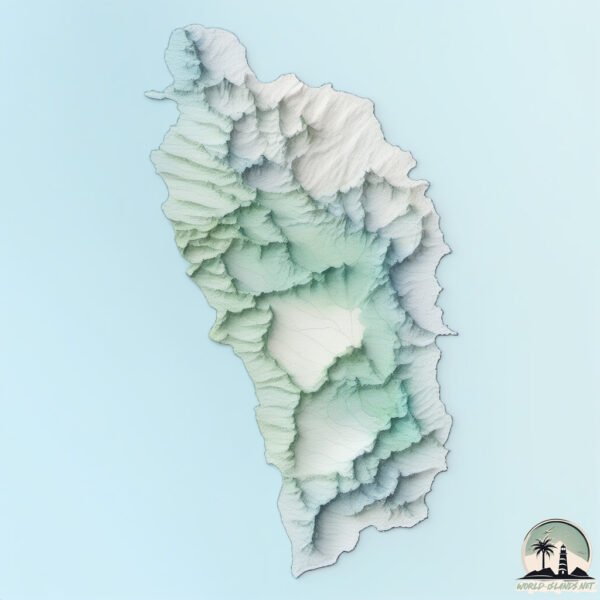
Topography and nature of Dominica
Timezone: UTC-04:00
Timezone places: America/La_Paz
Max. Elevation: 1282 m
Mean Elevation: 355 m
Vegetation: Evergreen Broadleaf Forest
Tree Coverage: 71%
The mean elevation is 355 m. The highest elevation on the island reaches approximately 1282 meters above sea level. The island is characterized by Mountains: High, steeply elevated landforms. Characterized by both a high maximum elevation (over 500 meters) and a high mean elevation, creating rugged, mountainous terrains on islands.
Dominating Vegetation: Evergreen Broadleaf Forest
Characterized by dense, lush canopies of broadleaf trees that retain their leaves year-round. These forests are typically found in tropical and subtropical regions and are known for their high biodiversity. Dominica has a tree cover of 71 %.
Vegetation: 14 vegetation zones – Exceptionally Diverse Island
Islands with more than ten vegetation zones are among the most ecologically rich and varied in the world. These islands are akin to miniature continents, boasting an incredible array of ecosystems. The sheer range of habitats, from high peaks to deep valleys, rainforests to deserts, creates a mosaic of life that is unparalleled. They are crucial for conservation and ecological studies.
Infrastructure and Travelling to Dominica
Does the island have a public airport? yes.
Dominica has a public and scheduled airport. The following airports are located on this island: Canefield Airport, Douglas-Charles Airport.
Does the island have a major port? no.
There are no major ports on Dominica. The closest major port is PORTSMOUTH, approximately 1 km away.
The mean population of Dominica is 94 per km². Dominica is Gently Populated. The island belongs to Dominica.
The name of the island resonates across different cultures and languages. Here is how it is known around the world: Arabic: دومينيكا; German: Dominica; Spanish: Dominica; French: Dominique; Portuguese: Dominica; Russian: Доминика; Chinese: 多米尼克
Continuing your journey, Marie Galante is the next notable island, situated merely km away.
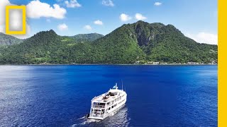
9 BEST Things to do in Dominica (& Places to VISIT) | Dominica Travel Guide


Dominica is classified as Developing region: Regions characterized by lower income levels, with economies in the process of industrialization and modernization. The level of income is Upper middle income.
News – Latest Updates and Headlines from Dominica
Stay informed with the most recent news and important headlines from Dominica. Here’s a roundup of the latest developments.
Please note: The data used here has been primarily extracted from satellite readings. Deviations from exact values may occur, particularly regarding the height of elevations and population density. Land area and coastline measurements refer to average values at mean high tide.