Dongdao
Welcome to Dongdao, a Tropical island in the South China Sea, part of the majestic Pacific Ocean. This guide offers a comprehensive overview of what makes Dongdao unique – from its geography and climate to its population, infrastructure, and beyond. Dive into the details:
- Geography and Size: Explore the island’s size and location.
- Climate and Weather: Weather patterns and temperature.
- Topography and Nature: Uncover the natural wonders of the island.
- Infrastructure and Travelling: Insights on reaching, staying, and making the most of your visit.
- News and Headlines: Latest News.
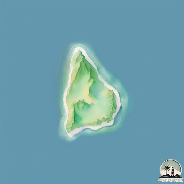
Geography and size of Dongdao
Size: 0.565 km²
Coastline: 3.4 km
Ocean: Pacific Ocean
Sea: South China Sea
Continent: Asia
Dongdao is a Tiny Island spanning 0.565 km² with a coastline of 3.4 km.
Archipel: –
Tectonic Plate: Eurasia – One of the world’s largest tectonic plates, the Eurasian Plate covers a significant portion of Europe and Asia. It’s characterized by diverse geological features, including the Ural Mountains, the European Plain, and the Himalayas formed from its collision with the Indian Plate.
The geographic heart of the island is pinpointed at these coordinates:
Latitude: 18.21684962 / Longitude: 109.41456848
Climate and weather of Dongdao
Climate Zone: Tropical
Climate Details: Tropical Monsoon Climate
Temperature: Hot
Climate Characteristics: Characterized by heavy rainfall, high humidity, and uniformly high temperatures, but with a distinct short dry season. It features a seasonal reversal of prevailing wind directions.
Topography and nature of Dongdao
Timezone: UTC+08:00
Timezone places: Australia/Perth
Max. Elevation: 5 m
Mean Elevation: 4 m
Vegetation: Deciduous Broadleaf Forest
Tree Coverage: 0%
The mean elevation is 4 m. The highest elevation on the island reaches approximately 5 meters above sea level. The island is characterized by Plains: Flat, low-lying lands characterized by a maximum elevation of up to 200 meters. On islands, plains are typically coastal lowlands or central flat areas.
Dominating Vegetation: Deciduous Broadleaf Forest
Composed of broadleaf trees that shed their leaves seasonally. These forests are commonly found in temperate zones and experience distinct seasonal changes. Dongdao has a tree cover of 0 %.
Vegetation: 2 vegetation zones – Low Diversity Island
Islands with two distinct vegetation zones offer slightly more ecological variety. These zones could be due to differences in elevation, moisture, or other environmental factors. While still limited in biodiversity, these islands may offer a contrast between the two zones, such as a coastline with mangroves and an inland area with grassland.
Infrastructure and Travelling to Dongdao
Does the island have a public airport? no.
There is no public and scheduled airport on Dongdao. The nearest airport is Sanya Phoenix International Airport, located 9 km away.
Does the island have a major port? no.
There are no major ports on Dongdao. The closest major port is SANYA, approximately 11 km away.
The mean population of Dongdao is 7230 per km². Dongdao is Densely Populated. The island belongs to China.
Continuing your journey, Hainan is the next notable island, situated merely km away.
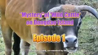
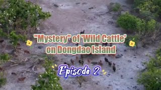
Episode 1: "Mystery"of 'Wild Cattle' on Dongdao Island

China is classified as Emerging region: BRIC: Brazil, Russia, India, and China – Economies noted for their rapid growth and increasing influence on global affairs. The level of income is Upper middle income.
News – Latest Updates and Headlines from Dongdao
Stay informed with the most recent news and important headlines from Dongdao. Here’s a roundup of the latest developments.
Please note: The data used here has been primarily extracted from satellite readings. Deviations from exact values may occur, particularly regarding the height of elevations and population density. Land area and coastline measurements refer to average values at mean high tide.