Dongmando
Welcome to Dongmando, a Continental island in the Yellow Sea, part of the majestic Pacific Ocean. This guide offers a comprehensive overview of what makes Dongmando unique – from its geography and climate to its population, infrastructure, and beyond. Dive into the details:
- Geography and Size: Explore the island’s size and location.
- Climate and Weather: Weather patterns and temperature.
- Topography and Nature: Uncover the natural wonders of the island.
- Infrastructure and Travelling: Insights on reaching, staying, and making the most of your visit.
- News and Headlines: Latest News.
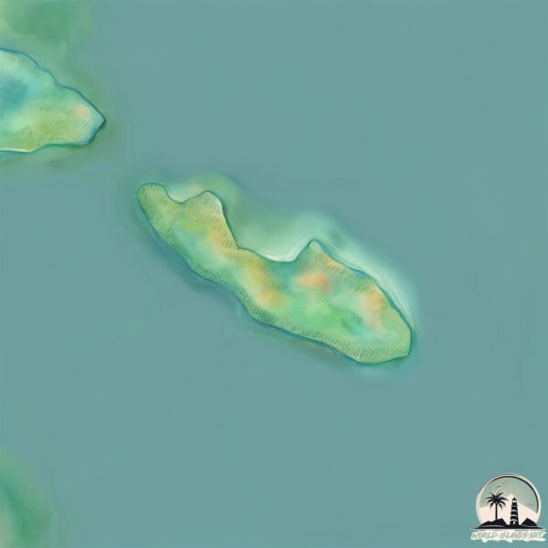
Geography and size of Dongmando
Size: 0.216 km²
Coastline: 3.3 km
Ocean: Pacific Ocean
Sea: Yellow Sea
Continent: Asia
Dongmando is a Tiny Island spanning 0.216 km² with a coastline of 3.3 km.
Archipel: –
Tectonic Plate: Amur – A minor tectonic plate in the region of the Amur River at the border of Russia and China, involved in complex interactions with the Pacific and Eurasian plates.
The geographic heart of the island is pinpointed at these coordinates:
Latitude: 37.54633674 / Longitude: 126.2721468
Climate and weather of Dongmando
Climate Zone: Continental
Climate Details: Monsoon-Influenced Hot-Summer Humid Continental Climate
Temperature: Hot Summer
Climate Characteristics: Hot summers with monsoon rains, contrasting with dry, cold winters. Typical of east Asian continental edges.
Topography and nature of Dongmando
Timezone: UTC+09:00
Timezone places: Asia/Tokyo
Max. Elevation: 10 m
Mean Elevation: 8 m
Vegetation: Shrubland
Tree Coverage: 48%
The mean elevation is 8 m. The highest elevation on the island reaches approximately 10 meters above sea level. The island is characterized by Plains: Flat, low-lying lands characterized by a maximum elevation of up to 200 meters. On islands, plains are typically coastal lowlands or central flat areas.
Dominating Vegetation: Shrubland
Dominated by shrubs and small bushes, these areas are typical in dry, rocky, or sandy environments, as well as in regions with poor soil fertility. Dongmando has a tree cover of 48 %.
Vegetation: 1 vegetation zones – Minimal Diversity Island
These islands exhibit the most basic level of ecological diversity, often characterized by a single dominant vegetation type. This could be due to extreme environmental conditions, limited land area, or significant human impact. They represent unique ecosystems where specific species have adapted to thrive in these singular environments.
Infrastructure and Travelling to Dongmando
Does the island have a public airport? no.
There is no public and scheduled airport on Dongmando. The nearest airport is Incheon International Airport, located 21 km away.
Does the island have a major port? no.
There are no major ports on Dongmando. The closest major port is INCHON, approximately 39 km away.
The mean population of Dongmando is 75 per km². Dongmando is Gently Populated. The island belongs to South Korea.
Continuing your journey, Seongmodo is the next notable island, situated merely km away.
Everything You Need To Know About Dondoko Island In Like A Dragon Infinite Wealth


South Korea is classified as Emerging region: MIKT: Mexico, Indonesia, South Korea, and Turkey – Economies recognized for their development potential and emerging market status. The level of income is High income: OECD.
News – Latest Updates and Headlines from Dongmando
Stay informed with the most recent news and important headlines from Dongmando. Here’s a roundup of the latest developments.
Please note: The data used here has been primarily extracted from satellite readings. Deviations from exact values may occur, particularly regarding the height of elevations and population density. Land area and coastline measurements refer to average values at mean high tide.