Dongshan
Welcome to Dongshan, a Temperate island in the South China Sea, part of the majestic Pacific Ocean. This guide offers a comprehensive overview of what makes Dongshan unique – from its geography and climate to its population, infrastructure, and beyond. Dive into the details:
- Geography and Size: Explore the island’s size and location.
- Climate and Weather: Weather patterns and temperature.
- Topography and Nature: Uncover the natural wonders of the island.
- Infrastructure and Travelling: Insights on reaching, staying, and making the most of your visit.
- News and Headlines: Latest News.
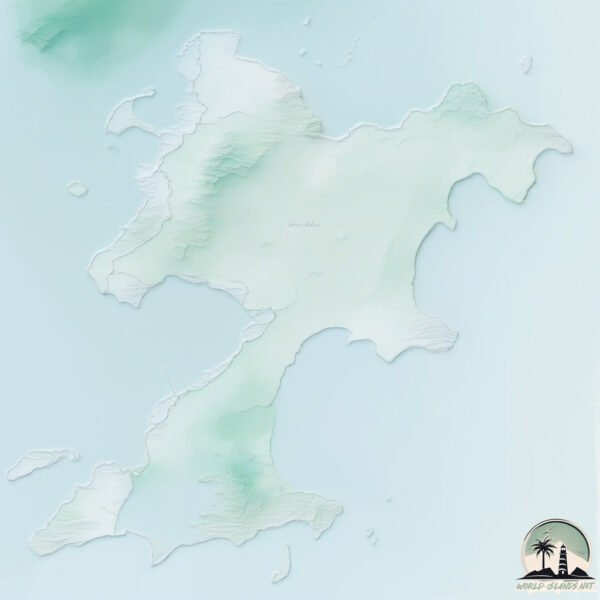
Geography and size of Dongshan
Size: 190.4 km²
Coastline: 192.9 km
Ocean: Pacific Ocean
Sea: South China Sea
Continent: Asia
Dongshan is a Large Island spanning 190 km² with a coastline of 193 km.
Archipel: –
Tectonic Plate: Okinawa – Located in the East China Sea, near the Ryukyu Islands and Taiwan, it’s involved in the subduction zone between the Philippine Sea Plate and the Eurasian Plate.
The geographic heart of the island is pinpointed at these coordinates:
Latitude: 23.68539078 / Longitude: 117.41693187
Climate and weather of Dongshan
Climate Zone: Temperate
Climate Details: Humid Subtropical Climate
Temperature: Hot Summer
Climate Characteristics: With continuous rainfall and hot summers, this climate is common in some coastal regions, supporting diverse vegetation.
Topography and nature of Dongshan
Timezone: UTC+08:00
Timezone places: Australia/Perth
Max. Elevation: 147 m
Mean Elevation: 26 m
Vegetation: Agricultural Mosaic
Tree Coverage: 35%
The mean elevation is 26 m. The highest elevation on the island reaches approximately 147 meters above sea level. The island is characterized by Plains: Flat, low-lying lands characterized by a maximum elevation of up to 200 meters. On islands, plains are typically coastal lowlands or central flat areas.
Dominating Vegetation: Agricultural Mosaic
A mix of cropland and natural vegetation, often seen in rural landscapes where agricultural fields are interspersed with patches of natural habitats. Dongshan has a tree cover of 35 %.
Vegetation: 14 vegetation zones – Exceptionally Diverse Island
Islands with more than ten vegetation zones are among the most ecologically rich and varied in the world. These islands are akin to miniature continents, boasting an incredible array of ecosystems. The sheer range of habitats, from high peaks to deep valleys, rainforests to deserts, creates a mosaic of life that is unparalleled. They are crucial for conservation and ecological studies.
Infrastructure and Travelling to Dongshan
Does the island have a public airport? no.
There is no public and scheduled airport on Dongshan. The nearest airport is Jieyang Chaoshan International Airport, located 90 km away.
Does the island have a major port? yes.
Dongshan is home to a major port. The following ports are situated on the island: .
The mean population of Dongshan is 1150 per km². Dongshan is Densely Populated. The island belongs to China.
Continuing your journey, Nan’ao Dao is the next notable island, situated merely km away.
Dongshan Island 东山岛 | Travel Film


China is classified as Emerging region: BRIC: Brazil, Russia, India, and China – Economies noted for their rapid growth and increasing influence on global affairs. The level of income is Upper middle income.
News – Latest Updates and Headlines from Dongshan
Stay informed with the most recent news and important headlines from Dongshan. Here’s a roundup of the latest developments.
Please note: The data used here has been primarily extracted from satellite readings. Deviations from exact values may occur, particularly regarding the height of elevations and population density. Land area and coastline measurements refer to average values at mean high tide.