Welcome to Dyroya, a Continental island in the Norwegian Sea, part of the majestic Arctic Ocean. This guide offers a comprehensive overview of what makes Dyroya unique – from its geography and climate to its population, infrastructure, and beyond. Dive into the details:
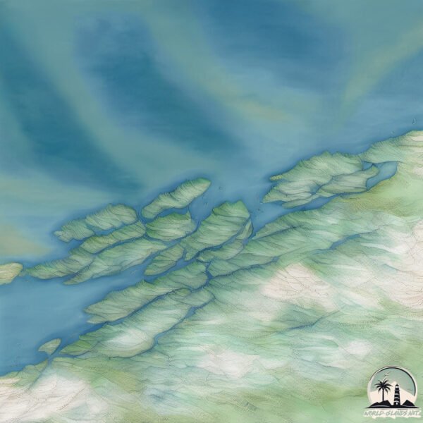
Geography and size of Dyroya
Size: 52.6 km²
Coastline: 43.7 km
Ocean: Arctic Ocean
Sea: Norwegian Sea
Continent: Europe
Dyroya is a Medium Island spanning 53 km² with a coastline of 44 km.
Archipel: Vesterålen – A district and archipelago in Norway, north of the Lofoten, known for its stunning landscapes, fishing culture, and whale watching.
Tectonic Plate: Eurasia – One of the world’s largest tectonic plates, the Eurasian Plate covers a significant portion of Europe and Asia. It’s characterized by diverse geological features, including the Ural Mountains, the European Plain, and the Himalayas formed from its collision with the Indian Plate.
The geographic heart of the island is pinpointed at these coordinates:
Latitude: 69.02016028 / Longitude: 17.14835363
Climate and weather of Dyroya
Climate Zone: Continental
Climate Details: Subarctic Climate
Temperature: Cold Summer
Climate Characteristics: Characterized by long, extremely cold winters and short, cool summers, often found in northern latitudes of North America and Eurasia.
Topography and nature of Dyroya
Timezone: UTC+01:00
Timezone places: Europe/Paris
Max. Elevation: 531 m
Mean Elevation: 215 m
Vegetation: Deciduous Needleleaf Forest
Tree Coverage: 65%
The mean elevation is 215 m. The highest elevation on the island reaches approximately 531 meters above sea level. The island is characterized by Plateau: Elevated flatlands rising sharply above the surrounding area, with a maximum elevation over 500 meters but a mean elevation less than 300 meters, forming unique highland areas on islands.
Dominating Vegetation: Deciduous Needleleaf Forest
Consists of needleleaf trees that shed their needles annually. This type of forest is less common and can be found in certain cold, northern regions. Dyroya has a tree cover of 65 %.
Vegetation: 8 vegetation zones – Very Highly Diverse Island
Islands in this range are ecological powerhouses, showcasing a wide array of vegetation zones. Each zone, from lush rainforests to arid scrublands, coastal mangroves to mountainous regions, contributes to a complex and interdependent ecosystem. These islands are often hotspots of biodiversity, supporting numerous species and intricate ecological processes.
Infrastructure and Travelling to Dyroya
Does the island have a public airport? no.
There is no public and scheduled airport on Dyroya. The nearest airport is Stokmarknes Airport, Skagen, located 32 km away.
Does the island have a major port? no.
There are no major ports on Dyroya. The closest major port is MEDBY, approximately 25 km away.
The mean population of Dyroya is 5 per km². Dyroya is Gently Populated. The island belongs to Norway.
The name of the island resonates across different cultures and languages. Here is how it is known around the world: Arabic: فيستريلان; German: Vesterålen; Spanish: Vesterålen; French: Vesterålen; Portuguese: Vesterålen; Russian: Вестеролен; Chinese: 西奧倫群島
Continuing your journey, Skogsoya is the next notable island, situated merely km away.
Norway Travel Video: Discovering the Beautiful Norwegian Nature (Senja and Dyrøya) - 4K drone shots
Join me for a trip to the nothern part of #Norway in region of Troms & Finnmark. This is my first time visiting this part of the world, ...Norway Travel Video: Discovering the Beautiful Norwegian Nature (Senja and Dyrøya) - 4K drone shots
Join me for a trip to the nothern part of #Norway in region of Troms & ...
Join me for a trip to the nothern part of #Norway in region of Troms & Finnmark. This is my first time visiting this part of the world, ...
Dyroy - Dyrøy Holiday - Norway
This is a short video from a short stay at Dyrøy Holiday in Norway.
This is a short video from a short stay at Dyrøy Holiday in Norway.
Amazing scenery | Drone video from dyrøya 4K (Ultra HD)
This is Berg, an old farm beautifully situated on the outside of ...
This is Berg, an old farm beautifully situated on the outside of Dyrøya. Drive by car to Vinje and follow the tractor road. On the trip ...
Solskinn og finvær ved Dyrøya og Dyrøybrua
Video som viser Dyrøybrua, småbåthavna som ligger ved brua og Dyrøya.
Video som viser Dyrøybrua, småbåthavna som ligger ved brua og Dyrøya.
Dyrøya
Small timelapse video from Dyrøya island in Norway. Music: Kevin ...
Small timelapse video from Dyrøya island in Norway. Music: Kevin MacLeod - "Bathed in the Light - Calming"
Wreck diving in Norway: D/S Sirius
In June 2019 we used Camp Solbergfjord near the bridge to Dyrøya ...
In June 2019 we used Camp Solbergfjord near the bridge to Dyrøya (Troms, Norway) as a base camp for some wreck diving in the ...
Ikke fisk 2015 Dyrøya osa 2
Perinteinen kalastusreissu Norjaan elokuussa 2015. Osa 2. Editointi: ...
Perinteinen kalastusreissu Norjaan elokuussa 2015. Osa 2. Editointi: Marko Kuvaus: Jarno, Janne, Timppa, Marko, Rane, Jusu ...
Ikke Fisk 2015 Dyrøya osa 3
Perinteinen kalastusreissu Norjaan elokuussa 2015. Osa 3. Editointi: ...
Perinteinen kalastusreissu Norjaan elokuussa 2015. Osa 3. Editointi: Marko Kuvaus: Jarno, Janne, Timppa, Marko, Rane, Jusu ...
Ikke Fisk 2015 Dyrøya osa 1
Perinteinen kalastusreissu Norjaan elokuussa 2015. Osa 1 Editointi: ...
Perinteinen kalastusreissu Norjaan elokuussa 2015. Osa 1 Editointi: Marko Kuvaus: Jarno, Janne, Rane, Timppa, Jusu & Marko ...
Smørsiden av Dyrøy
Ifm Demas sitt 25 års jubileum fikk alle ansatte i Br.botn en liten ...
Ifm Demas sitt 25 års jubileum fikk alle ansatte i Br.botn en liten helikoptertur 🙂
Dyrøya 2017
Movie about our fishing holidays in Norway Dyrøya island.
Movie about our fishing holidays in Norway Dyrøya island.
Norway's Secret Island in the Middle of Nowhere #norway #norwegianisland #norwegian #norwegian
Не Лофотены, но красота Заполярья. Острова Dyrøya, Andørja, Rolla, Harstad. Северная Норвегия. 17мая
Наше путешествие по 4м островам севера в Национальный день Норвегии. ...
Наше путешествие по 4м островам севера в Национальный день Норвегии. Сначала мы добрались до острова Дирой ...
Fette Dorsche im Schatten der Insel Senja - Dorschangeln und Heilbuttangeln in Norwegen
Kommt mit zu den Fjordgiganten vor Sørreisa! Unterwegs im Rückraum der ...
Kommt mit zu den Fjordgiganten vor Sørreisa! Unterwegs im Rückraum der Insel Senja. Wir machen Station im Sandbakken ...
Film fra torgdagen i Dyrøy 1.mov
En kort filmsnutt laget med iPad av deltakere på barnehagens stand, ...
En kort filmsnutt laget med iPad av deltakere på barnehagens stand, 23.06.2012.
Highlights From Norway Episode 1 #Shorts
The Most Breathtaking Views Of Norway: Highlights From Norway Episode ...
The Most Breathtaking Views Of Norway: Highlights From Norway Episode 1 #Shorts Reindeer Strolling Down the Highway The ...
Vinter i Dyrøy 1
Fra Dyrøyhamn til Brøstadbotn i vintervær med tette snøbyger.
Fra Dyrøyhamn til Brøstadbotn i vintervær med tette snøbyger.
Stormy Weather Clouds and Rainbow Time-lapse (Amazing Nature Norway) #shorts
Stormy Weather Clouds and Rainbow Time-lapse (Amazing Nature Norway) ...
Stormy Weather Clouds and Rainbow Time-lapse (Amazing Nature Norway) #shorts Discover Heikaymusic:
https://bit.ly/3dv7GYB ...
The Arctic Midnight-sun In Norway: An Amazing Time-lapse (with Ambient Piano Music) #shorts
The Arctic Midnight-sun In Norway: An Amazing Time-lapse (with Ambient ...
The Arctic Midnight-sun In Norway: An Amazing Time-lapse (with Ambient Piano Music) #shorts Discover Heikaymusic: ...
The Midnight-sun in Norway Time-lapse (Amazing Nature Norway) Ambient Piano Music #shorts
The Midnight-sun in Norway Time-lapse (Amazing Nature Norway) Ambient ...
The Midnight-sun in Norway Time-lapse (Amazing Nature Norway) Ambient Piano Music #shorts Discover Heikaymusic: ...
Starker Butt vor Vengsoy 08/2018
An diesem Tag hatte ich besonderes Glück und konnte einen tollen Fisch ...
An diesem Tag hatte ich besonderes Glück und konnte einen tollen Fisch landen. Zuvor habe ich bereits zwei Aussteiger ...
Sea fishing in Norway Kastneshamn. DINTUR - Jaeger Adventure Camp
Welcome to Jaeger Adventure Camp in Kastneshamn We are located at the ...
Welcome to Jaeger Adventure Camp in Kastneshamn We are located at the mainland side of Dyrøya in Troms, is a camp for sea ...
Vissen op heilbot met lichte materialen in Noorwegen
Een visreis naar Noorwegen en dan vissen met extreem lichte materialen ...
Een visreis naar Noorwegen en dan vissen met extreem lichte materialen op heilbot, koolvis en kabeljauw, dat is een echte sport.
Norway is classified as Developed region: nonG7: Developed economies outside of the Group of Seven, characterized by high income and advanced economic structures. The level of income is High income: OECD.
News – Latest Updates and Headlines from Dyroya
Stay informed with the most recent news and important headlines from Dyroya. Here’s a roundup of the latest developments.
Loading...
Please note: The data used here has been primarily extracted from satellite readings. Deviations from exact values may occur, particularly regarding the height of elevations and population density. Land area and coastline measurements refer to average values at mean high tide.