Eagle
Welcome to Eagle, a Temperate island in the The Northwestern Passages, part of the majestic Atlantic Ocean. This guide offers a comprehensive overview of what makes Eagle unique – from its geography and climate to its population, infrastructure, and beyond. Dive into the details:
- Geography and Size: Explore the island’s size and location.
- Climate and Weather: Weather patterns and temperature.
- Topography and Nature: Uncover the natural wonders of the island.
- Infrastructure and Travelling: Insights on reaching, staying, and making the most of your visit.
- News and Headlines: Latest News.
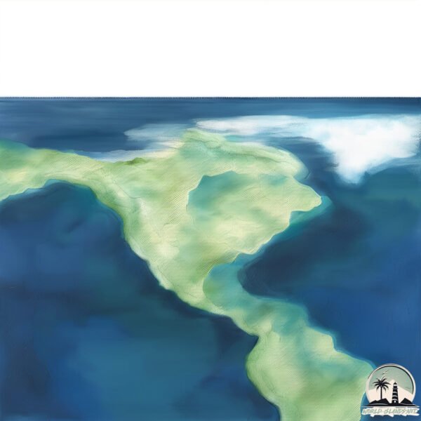
Geography and size of Eagle
Size: 1.305 km²
Coastline: 6.5 km
Ocean: Atlantic Ocean
Sea: The Northwestern Passages
Continent: North America
Eagle is a Small Island spanning 1.3 km² with a coastline of 6.5 km.
Archipel: Alexander Archipelago – A group of about 1,100 islands off the southeast coast of Alaska, USA, known for their temperate rainforests and indigenous Tlingit culture.
Tectonic Plate: North America – Covers North America and parts of the Atlantic and Arctic Oceans, characterized by diverse geological features and varying levels of seismic activity.
The geographic heart of the island is pinpointed at these coordinates:
Latitude: 53.8019108 / Longitude: -110.20272534
Climate and weather of Eagle
Climate Zone: Temperate
Climate Details: Temperate Oceanic Climate
Temperature: Warm Summer
Climate Characteristics: Known for its moderate year-round temperatures with ample rainfall and no dry season. Warm summers are characteristic.
Topography and nature of Eagle
Timezone: UTC-03:30
Timezone places: America/St_Johns
Max. Elevation: 39 m
Mean Elevation: 24 m
Vegetation: Evergreen Needleleaf Forest
Tree Coverage: 88%
The mean elevation is 24 m. The highest elevation on the island reaches approximately 39 meters above sea level. The island is characterized by Plains: Flat, low-lying lands characterized by a maximum elevation of up to 200 meters. On islands, plains are typically coastal lowlands or central flat areas.
Dominating Vegetation: Evergreen Needleleaf Forest
Dominated by evergreen coniferous trees such as pines and firs, which retain their needle-like leaves throughout the year. These forests are often found in cooler climates. Eagle has a tree cover of 88 %.
Vegetation: 6 vegetation zones – Very Highly Diverse Island
Islands in this range are ecological powerhouses, showcasing a wide array of vegetation zones. Each zone, from lush rainforests to arid scrublands, coastal mangroves to mountainous regions, contributes to a complex and interdependent ecosystem. These islands are often hotspots of biodiversity, supporting numerous species and intricate ecological processes.
Infrastructure and Travelling to Eagle
Does the island have a public airport? no.
There is no public and scheduled airport on Eagle. The nearest airport is Port Protection Seaplane Base, located 33 km away.
Does the island have a major port? no.
There are no major ports on Eagle. The closest major port is NORTH HAVEN, approximately 12 km away.
The mean population of Eagle is 0 per km². Eagle is Uninhabited. The island belongs to Canada.
The name of the island resonates across different cultures and languages. Here is how it is known around the world: Arabic: لبرادور; German: Labrador; Spanish: Labrador; French: Labrador; Portuguese: Labrador; Russian: Лабрадор; Chinese: 拉布拉多
Continuing your journey, Onslow is the next notable island, situated merely km away.
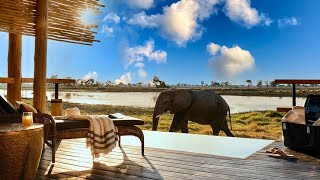
Luxury in Africa | Eagle Island Lodge, a Belmond Safari (full tour in 4K)


Canada is classified as Developed region: G7: Group of Seven – Major advanced economies, including Canada, France, Germany, Italy, Japan, the United Kingdom, and the United States. The level of income is High income: OECD.
News – Latest Updates and Headlines from Eagle
Stay informed with the most recent news and important headlines from Eagle. Here’s a roundup of the latest developments.
Please note: The data used here has been primarily extracted from satellite readings. Deviations from exact values may occur, particularly regarding the height of elevations and population density. Land area and coastline measurements refer to average values at mean high tide.