Welcome to East Bremer Islet, a Tropical island in the Arafura Sea, part of the majestic Indian Ocean. This guide offers a comprehensive overview of what makes East Bremer Islet unique – from its geography and climate to its population, infrastructure, and beyond. Dive into the details:
Geography and size of East Bremer Islet
Size: 0.107 km²
Coastline: 1.7 km
Ocean: Indian Ocean
Sea: Arafura Sea
Continent: Oceania
East Bremer Islet is a Tiny Island spanning 0.107 km² with a coastline of 1.7 km.
Archipel: –
Tectonic Plate: Australia – A major tectonic plate covering Australia, New Zealand, and parts of the Indian and Pacific Oceans, known for its relative stability and occasional seismic activity.
The geographic heart of the island is pinpointed at these coordinates:
Latitude: -12.08900944 / Longitude: 136.8675804
Climate and weather of East Bremer Islet
Climate Zone: Tropical
Climate Details: Tropical Savanna, Wet
Temperature: Hot
Climate Characteristics: Defined by distinct wet and dry seasons with high temperatures year-round. Pronounced rainfall occurs during the wet season, while the dry season is marked by drought.
Topography and nature of East Bremer Islet
Timezone: UTC+09:30
Timezone places: Australia/Adelaide
Max. Elevation: -5 m
Mean Elevation: -6 m
Vegetation: Cultivated Land
Tree Coverage: 59%
The mean elevation is -6 m. Remarkably, this unique island barely emerges above the sea level, showcasing nature’s fascinating interplay with the ocean. The island is characterized by Plains: Flat, low-lying lands characterized by a maximum elevation of up to 200 meters. On islands, plains are typically coastal lowlands or central flat areas.
Dominating Vegetation: Cultivated Land
Areas dedicated to agricultural activities, growing crops like grains, vegetables, and fruits. These lands are usually human-modified landscapes. East Bremer Islet has a tree cover of 59 %.
Vegetation: 1 vegetation zones – Minimal Diversity Island
These islands exhibit the most basic level of ecological diversity, often characterized by a single dominant vegetation type. This could be due to extreme environmental conditions, limited land area, or significant human impact. They represent unique ecosystems where specific species have adapted to thrive in these singular environments.
Infrastructure and Travelling to East Bremer Islet
Does the island have a public airport? no.
There is no public and scheduled airport on East Bremer Islet. The nearest airport is Gove Airport, located 21 km away.
Does the island have a major port? no.
There are no major ports on East Bremer Islet. The closest major port is GOVE, approximately 22 km away.
The mean population of East Bremer Islet is 0 per km². East Bremer Islet is Uninhabited. The island belongs to Australia.
Continuing your journey, Bremer is the next notable island, situated merely km away.
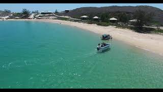
Banubanu Beach Resort, Bremer Island
EXPLORE UNTOUCHED NORTH EAST ARNHEM LAND AT BANUBANU A BRAND NEW ECO-FRIENDLY BEACH RESORT ...Banubanu Beach Resort, Bremer Island
EXPLORE UNTOUCHED NORTH EAST ARNHEM LAND AT BANUBANU A BRAND NEW ...
EXPLORE UNTOUCHED NORTH EAST ARNHEM LAND AT BANUBANU A BRAND NEW ECO-FRIENDLY BEACH RESORT ...
[Wikipedia] Higginson Island
Higginson Island is a small island in the Arafura Sea lying off the ...
Higginson Island is a small island in the Arafura Sea lying off the north-eastern coast of Arnhem Land, in the Northern Territory of ...
Bremer Island, East Arnhem Land 10.09.22
Very pretty Bremer Island in the Northern Territory, just off the ...
Very pretty Bremer Island in the Northern Territory, just off the coast of Nhulunbuy. Shame about the amount of plastic waste ...
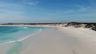
🤯 4 HIDDEN GEMS in Western Australia You NEED to Visit! 🇦🇺✨
We saved the best for last… We've lived in Western Australia for ...
We saved the best for last… We've lived in Western Australia for nearly 30 years, and we can confidently say WA is full of ...
EXPLORING EAST ARNHEM LAND
Follow me on Instagram for photos of this trip - ...
Fly Fishing in Arnhem Land, Australia
Fishing DVD visit to Bremer Island in North East Arnhem Land.
Fishing DVD visit to Bremer Island in North East Arnhem Land.
The Esperance Region - Western Australia
The Esperance region of W.A. contains some of the most spectacular ...
The Esperance region of W.A. contains some of the most spectacular coastline anywhere in the world. Join us a s we travel from ...
Banu Banu, East Arnhem Land 10.09.22
Banu Banu beach resort on Bremer Island, Northern Territory, ...
Banu Banu beach resort on Bremer Island, Northern Territory, Australia. Just off the coast of Nhulunbuy.
Stokes National Park
Stokes NP inclues Quagi Beach, Fanny Cove, Moir homestead and Shoal ...
Stokes NP inclues Quagi Beach, Fanny Cove, Moir homestead and Shoal Cape. 2wd access to Quagi but 4x4 is required to reach ...
Betty's Beach, East Bay, Tozer's Bush Camp & Bremmer Bay | Vanlife Australia Ep 36
OMG, this trip keeps getting better and better!! The coastline after ...
OMG, this trip keeps getting better and better!! The coastline after Albany WA gets even prettier with stunning wild beaches that ...
East esperance (Thomas and Cindy)
Wharton beach, duke orleans, table island.
Wharton beach, duke orleans, table island.
Bonaire Island filmed with a DJI Mavic Mini in 2.7K
This is one of my first drones videos filmed in Bonaire in the ...
This is one of my first drones videos filmed in Bonaire in the Caribbean Netherlands last January 2020 with my DJI Mavic Mini.
Ecosplash - The Blue Connection - episode 1
Nature documentary series about the coastal ecosystems of Aruba, ...
Nature documentary series about the coastal ecosystems of Aruba, Curacao and Bonaire - in papiamento - episode 1: the ...
Frenchmans Bay Overview
Stunning video of Frenchmans Bay Albany Western Australia ...
Bremer Bay - Western Australia
Bremer Bay, located 2 hours drive east of Albany, on West Australia's ...
Bremer Bay, located 2 hours drive east of Albany, on West Australia's south coast has some of the most amazing beaches ...
Swimming at Hellfire Bay in Esperance
East woody, Nhulunbuy in East Arnhem Land the NT.
Peaceful Bay - Western Australia
Peaceful Bay is well named and lies on the south coast to the east of ...
Peaceful Bay is well named and lies on the south coast to the east of Walpole. Find out more at ...
Hakea Trail Solo Hike, Fitzgerald River National Park - 2022
Hakea trail solo trek through Fitzgerald NP, 50 km total hike.
Hakea trail solo trek through Fitzgerald NP, 50 km total hike.
Duke of Orleans Bay Esperance Western Australia
Duke of Orleans Bay Esperance Western Australia is 80 kilometres east ...
Duke of Orleans Bay Esperance Western Australia is 80 kilometres east of Esperance WA.
Banksia Camp at D’entrecasteaux National Park
Fitzgerald River National Park #welcometoperth #shorts #westernaustralia #nationalpark
IG: pablo_escapades_ #welcometoperth #westaus #fitzgeraldnationalpark.
IG: pablo_escapades_ #welcometoperth #westaus #fitzgeraldnationalpark.
An Eco Retreat in Arnhem Land, Northern Territory
Fishing Hommocky Island ALL 4D Venture
Drone And Fishing Adventure shots of the coast of Yeppoon!!
Drone And Fishing Adventure shots of the coast of Yeppoon!!
Munglinup Beach, Ravensthorpe - Esperance , Western Australia, Drone/ Aerial footage
Munglinup is located between Ravensthorpe and Esperance on Western ...
Munglinup is located between Ravensthorpe and Esperance on Western Australia's Fitzgerald Coast. It is approximately a ...
Australia is classified as Developed region: nonG7: Developed economies outside of the Group of Seven, characterized by high income and advanced economic structures. The level of income is High income: OECD.
News – Latest Updates and Headlines from East Bremer Islet
Stay informed with the most recent news and important headlines from East Bremer Islet. Here’s a roundup of the latest developments.
Loading...
Please note: The data used here has been primarily extracted from satellite readings. Deviations from exact values may occur, particularly regarding the height of elevations and population density. Land area and coastline measurements refer to average values at mean high tide.
![[Wikipedia] Higginson Island](https://i.ytimg.com/vi/2pB7yUN6WAI/mqdefault.jpg)