El Castillo
Welcome to El Castillo, a Dry island in the Gulf of California, part of the majestic Pacific Ocean. This guide offers a comprehensive overview of what makes El Castillo unique – from its geography and climate to its population, infrastructure, and beyond. Dive into the details:
- Geography and Size: Explore the island’s size and location.
- Climate and Weather: Weather patterns and temperature.
- Topography and Nature: Uncover the natural wonders of the island.
- Infrastructure and Travelling: Insights on reaching, staying, and making the most of your visit.
- News and Headlines: Latest News.
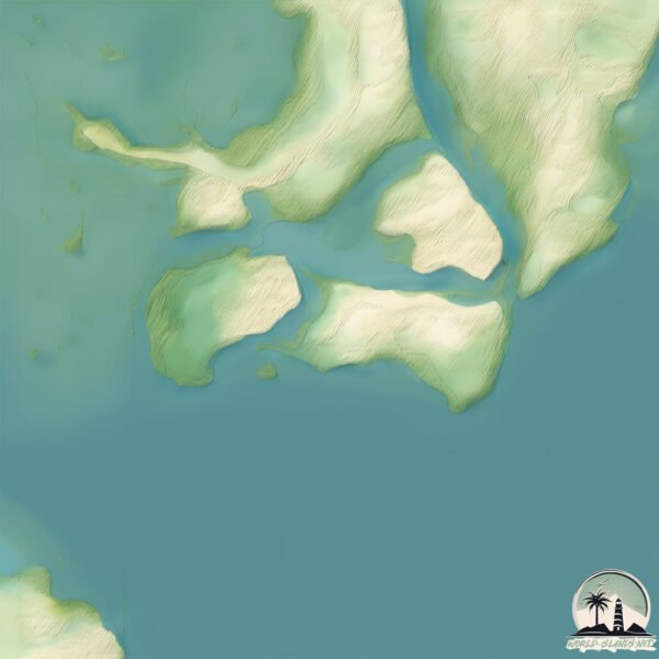
Geography and size of El Castillo
Size: 1.355 km²
Coastline: 6.2 km
Ocean: Pacific Ocean
Sea: Gulf of California
Continent: North America
El Castillo is a Small Island spanning 1.4 km² with a coastline of 6.2 km.
Archipel: –
Tectonic Plate: North America – Covers North America and parts of the Atlantic and Arctic Oceans, characterized by diverse geological features and varying levels of seismic activity.
The geographic heart of the island is pinpointed at these coordinates:
Latitude: 24.4968525 / Longitude: -107.72025619
Climate and weather of El Castillo
Climate Zone: Dry
Climate Details: Hot Semi-Arid (Steppe) Climate
Temperature: Hot
Climate Characteristics: Features hot summers and mild to warm winters. Receives more rainfall than hot deserts but less than tropical savannas, leading to a somewhat more varied landscape.
Topography and nature of El Castillo
Timezone: UTC-07:00
Timezone places: America/Denver
Max. Elevation: 3 m
Mean Elevation: 2 m
Vegetation: Mangrove Forest
Tree Coverage: 47%
The mean elevation is 2 m. The highest elevation on the island reaches approximately 3 meters above sea level. The island is characterized by Plains: Flat, low-lying lands characterized by a maximum elevation of up to 200 meters. On islands, plains are typically coastal lowlands or central flat areas.
Dominating Vegetation: Mangrove Forest
Found in coastal areas and river deltas, these unique wetland ecosystems are adapted to saline conditions and are crucial for coastal protection and biodiversity. El Castillo has a tree cover of 47 %.
Vegetation: 3 vegetation zones – Moderately Diverse Island
These islands start to show a broader range of ecological niches. With three vegetation zones, they may offer a mix of ecosystems like coastal areas, inland woods, and perhaps a distinct wetland or dry area. This diversity supports a wider range of flora and fauna, making these islands more ecologically complex than those with minimal diversity.
Infrastructure and Travelling to El Castillo
Does the island have a public airport? no.
There is no public and scheduled airport on El Castillo. The nearest airport is Bachigualato Federal International Airport, located 39 km away.
Does the island have a major port? no.
There are no major ports on El Castillo. The closest major port is TOPOLOBAMPO, approximately 192 km away.
The mean population of El Castillo is 20 per km². El Castillo is Gently Populated. The island belongs to Mexico.
Continuing your journey, Quevedo is the next notable island, situated merely km away.
Isla iraní activa infierno para marines! Alto cargo iraní anuncia MASACRE!


![SuperTux: "A Short Visit to El Castillo" (Bonus Island II) [Level Showcase]](https://i.ytimg.com/vi/Bc_wRQV2EWg/mqdefault.jpg)
Mexico is classified as Emerging region: MIKT: Mexico, Indonesia, South Korea, and Turkey – Economies recognized for their development potential and emerging market status. The level of income is Upper middle income.
News – Latest Updates and Headlines from El Castillo
Stay informed with the most recent news and important headlines from El Castillo. Here’s a roundup of the latest developments.
Please note: The data used here has been primarily extracted from satellite readings. Deviations from exact values may occur, particularly regarding the height of elevations and population density. Land area and coastline measurements refer to average values at mean high tide.