El Rancho
Welcome to El Rancho, a Dry island in the Gulf of California, part of the majestic Pacific Ocean. This guide offers a comprehensive overview of what makes El Rancho unique – from its geography and climate to its population, infrastructure, and beyond. Dive into the details:
- Geography and Size: Explore the island’s size and location.
- Climate and Weather: Weather patterns and temperature.
- Topography and Nature: Uncover the natural wonders of the island.
- Infrastructure and Travelling: Insights on reaching, staying, and making the most of your visit.
- News and Headlines: Latest News.
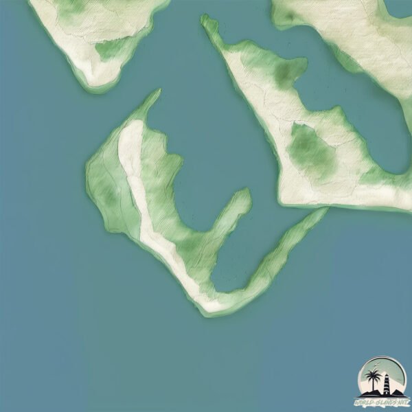
Geography and size of El Rancho
Size: 3.425 km²
Coastline: 21.6 km
Ocean: Pacific Ocean
Sea: Gulf of California
Continent: North America
El Rancho is a Small Island spanning 3.4 km² with a coastline of 21.6 km.
Archipel: –
Tectonic Plate: North America – Covers North America and parts of the Atlantic and Arctic Oceans, characterized by diverse geological features and varying levels of seismic activity.
The geographic heart of the island is pinpointed at these coordinates:
Latitude: 25.16490249 / Longitude: -108.37500895
Climate and weather of El Rancho
Climate Zone: Dry
Climate Details: Hot Semi-Arid (Steppe) Climate
Temperature: Hot
Climate Characteristics: Features hot summers and mild to warm winters. Receives more rainfall than hot deserts but less than tropical savannas, leading to a somewhat more varied landscape.
Topography and nature of El Rancho
Timezone: UTC-07:00
Timezone places: America/Denver
Max. Elevation: -5 m
Mean Elevation: -20 m
Vegetation: Shrubland
Tree Coverage: 50%
The mean elevation is -20 m. Remarkably, this unique island barely emerges above the sea level, showcasing nature’s fascinating interplay with the ocean. The island is characterized by Plains: Flat, low-lying lands characterized by a maximum elevation of up to 200 meters. On islands, plains are typically coastal lowlands or central flat areas.
Dominating Vegetation: Shrubland
Dominated by shrubs and small bushes, these areas are typical in dry, rocky, or sandy environments, as well as in regions with poor soil fertility. El Rancho has a tree cover of 50 %.
Vegetation: 1 vegetation zones – Minimal Diversity Island
These islands exhibit the most basic level of ecological diversity, often characterized by a single dominant vegetation type. This could be due to extreme environmental conditions, limited land area, or significant human impact. They represent unique ecosystems where specific species have adapted to thrive in these singular environments.
Infrastructure and Travelling to El Rancho
Does the island have a public airport? no.
There is no public and scheduled airport on El Rancho. The nearest airport is Camaguey-Campo Cuatro Milpas Airport, located 55 km away.
Does the island have a major port? no.
There are no major ports on El Rancho. The closest major port is TOPOLOBAMPO, approximately 89 km away.
The mean population of El Rancho is 0 per km². El Rancho is Uninhabited. The island belongs to Mexico.
Continuing your journey, Saliaca is the next notable island, situated merely km away.
El Rancho cocoa island


Mexico is classified as Emerging region: MIKT: Mexico, Indonesia, South Korea, and Turkey – Economies recognized for their development potential and emerging market status. The level of income is Upper middle income.
News – Latest Updates and Headlines from El Rancho
Stay informed with the most recent news and important headlines from El Rancho. Here’s a roundup of the latest developments.
Please note: The data used here has been primarily extracted from satellite readings. Deviations from exact values may occur, particularly regarding the height of elevations and population density. Land area and coastline measurements refer to average values at mean high tide.