Fillladhoo
Welcome to Fillladhoo, a Tropical island in the Laccadive Sea, part of the majestic Indian Ocean. This guide offers a comprehensive overview of what makes Fillladhoo unique – from its geography and climate to its population, infrastructure, and beyond. Dive into the details:
- Geography and Size: Explore the island’s size and location.
- Climate and Weather: Weather patterns and temperature.
- Topography and Nature: Uncover the natural wonders of the island.
- Infrastructure and Travelling: Insights on reaching, staying, and making the most of your visit.
- News and Headlines: Latest News.
Geography and size of Fillladhoo
Size: 2.699 km²
Coastline: 17 km
Ocean: Indian Ocean
Sea: Laccadive Sea
Continent: Seven seas (open ocean)
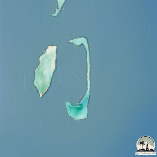
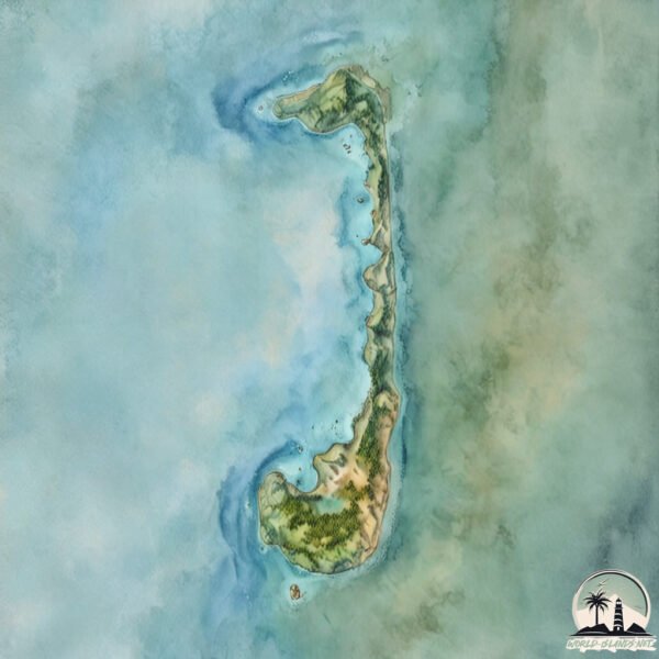
Fillladhoo is a Small Island spanning 2.7 km² with a coastline of 17 km.
Archipel: Maldive Islands – A tropical paradise in the Indian Ocean, known for their stunning coral reefs, diverse marine life, and luxury resorts.
Tectonic Plate: Sunda – Extends across Southeast Asia, encompassing parts of the Sunda Shelf, known for its interaction with the Australian Plate, contributing to volcanic activity in Indonesia.
The geographic heart of the island is pinpointed at these coordinates:
Latitude: 6.88957681 / Longitude: 73.23022939
Climate and weather of Fillladhoo
Climate Zone: Tropical
Climate Details: Tropical Monsoon Climate
Temperature: Hot
Climate Characteristics: Characterized by heavy rainfall, high humidity, and uniformly high temperatures, but with a distinct short dry season. It features a seasonal reversal of prevailing wind directions.
Topography and nature of Fillladhoo
Timezone: UTC+05:00
Timezone places: Asia/Karachi
Max. Elevation: -12 m
Mean Elevation: -17 m
Vegetation: Evergreen Needleleaf Forest
Tree Coverage: 59%
The mean elevation is -17 m. Remarkably, this unique island barely emerges above the sea level, showcasing nature’s fascinating interplay with the ocean. The island is characterized by Plains: Flat, low-lying lands characterized by a maximum elevation of up to 200 meters. On islands, plains are typically coastal lowlands or central flat areas.
Dominating Vegetation: Evergreen Needleleaf Forest
Dominated by evergreen coniferous trees such as pines and firs, which retain their needle-like leaves throughout the year. These forests are often found in cooler climates. Fillladhoo has a tree cover of 59 %.
Vegetation: 6 vegetation zones – Very Highly Diverse Island
Islands in this range are ecological powerhouses, showcasing a wide array of vegetation zones. Each zone, from lush rainforests to arid scrublands, coastal mangroves to mountainous regions, contributes to a complex and interdependent ecosystem. These islands are often hotspots of biodiversity, supporting numerous species and intricate ecological processes.
Infrastructure and Travelling to Fillladhoo
Does the island have a public airport? no.
There is no public and scheduled airport on Fillladhoo. The nearest airport is Hanimaadhoo Airport, located 15 km away.
Does the island have a major port? no.
There are no major ports on Fillladhoo. The closest major port is MALE, approximately 302 km away.
The mean population of Fillladhoo is 97 per km². Fillladhoo is Gently Populated. The island belongs to India.
Continuing your journey, Vypīn Island is the next notable island, situated merely km away.
Filicudi - The Island of Simplicity - Aeolian Islands


India is classified as Emerging region: BRIC: Brazil, Russia, India, and China – Economies noted for their rapid growth and increasing influence on global affairs. The level of income is Lower middle income.
News – Latest Updates and Headlines from Fillladhoo
Stay informed with the most recent news and important headlines from Fillladhoo. Here’s a roundup of the latest developments.
Please note: The data used here has been primarily extracted from satellite readings. Deviations from exact values may occur, particularly regarding the height of elevations and population density. Land area and coastline measurements refer to average values at mean high tide.