Fogo
Welcome to Fogo, a Dry island in the North Atlantic Ocean, part of the majestic Atlantic Ocean. This guide offers a comprehensive overview of what makes Fogo unique – from its geography and climate to its population, infrastructure, and beyond. Dive into the details:
- Geography and Size: Explore the island’s size and location.
- Climate and Weather: Weather patterns and temperature.
- Topography and Nature: Uncover the natural wonders of the island.
- Infrastructure and Travelling: Insights on reaching, staying, and making the most of your visit.
- News and Headlines: Latest News.
Geography and size of Fogo
Size: 470.4 km²
Coastline: 93.8 km
Ocean: Atlantic Ocean
Sea: North Atlantic Ocean
Continent: Africa
Fogo is a Large Island spanning 470 km² with a coastline of 94 km.
Archipel: Cape Verde – An island country in the central Atlantic Ocean, known for its Creole Portuguese-African culture, music, and volcanic landscapes.
Tectonic Plate: Africa – One of the world’s largest tectonic plates, covering the African continent and parts of the surrounding oceans, known for its stability with some active rift zones.
The geographic heart of the island is pinpointed at these coordinates:
Latitude: 14.92841089 / Longitude: -24.38437361
Climate and weather of Fogo
Climate Zone: Dry
Climate Details: Hot Deserts Climate
Temperature: Hot
Climate Characteristics: Dominated by extremely hot temperatures, this climate is marked by minimal rainfall and barren landscapes. Nights often experience drastic temperature drops.
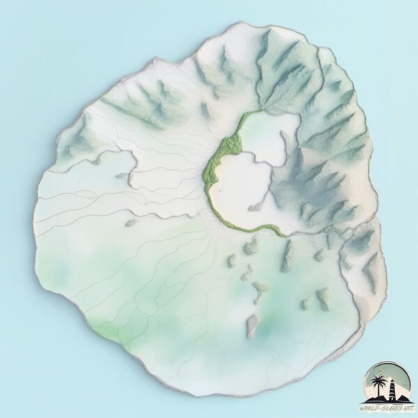
Topography and nature of Fogo
Timezone: UTC-01:00
Timezone places: Atlantic/Cape_Verde
Max. Elevation: 2829 m Pico de Fogo
Mean Elevation: 863 m
Vegetation: Herbaceous Cover
Tree Coverage: 7%
The mean elevation is 863 m. Dominating the island’s landscape, the majestic “Pico de Fogo” rises as the highest peak, soaring to impressive heights. The island is characterized by Mountains: High, steeply elevated landforms. Characterized by both a high maximum elevation (over 500 meters) and a high mean elevation, creating rugged, mountainous terrains on islands.
Dominating Vegetation: Herbaceous Cover
Comprising mainly of grasses, herbs, and ferns, these areas are common in prairies, meadows, and savannas, and can vary widely in species composition. Fogo has a tree cover of 7 %.
Vegetation: 10 vegetation zones – Very Highly Diverse Island
Islands in this range are ecological powerhouses, showcasing a wide array of vegetation zones. Each zone, from lush rainforests to arid scrublands, coastal mangroves to mountainous regions, contributes to a complex and interdependent ecosystem. These islands are often hotspots of biodiversity, supporting numerous species and intricate ecological processes.
Infrastructure and Travelling to Fogo
Does the island have a public airport? yes.
Fogo has a public and scheduled airport. The following airports are located on this island: São Filipe Airport.
Does the island have a major port? no.
There are no major ports on Fogo. The closest major port is PORTO DA PRAIA, approximately 85 km away.
The mean population of Fogo is 81 per km². Fogo is Gently Populated. The island belongs to Cabo Verde.
The name of the island resonates across different cultures and languages. Here is how it is known around the world: Arabic: فوغو; German: Fogo; Spanish: Fogo; French: Fogo; Portuguese: Ilha do Fogo; Russian: Фогу; Chinese: 福古岛
Continuing your journey, Ilha Brava is the next notable island, situated merely km away.
Fogo Island: A far away comeback story


Cabo Verde is classified as Developing region: Regions characterized by lower income levels, with economies in the process of industrialization and modernization. The level of income is Lower middle income.
News – Latest Updates and Headlines from Fogo
Stay informed with the most recent news and important headlines from Fogo. Here’s a roundup of the latest developments.
Please note: The data used here has been primarily extracted from satellite readings. Deviations from exact values may occur, particularly regarding the height of elevations and population density. Land area and coastline measurements refer to average values at mean high tide.