Fondeado
Welcome to Fondeado, a Tropical island in the Sulu Sea, part of the majestic Pacific Ocean. This guide offers a comprehensive overview of what makes Fondeado unique – from its geography and climate to its population, infrastructure, and beyond. Dive into the details:
- Geography and Size: Explore the island’s size and location.
- Climate and Weather: Weather patterns and temperature.
- Topography and Nature: Uncover the natural wonders of the island.
- Infrastructure and Travelling: Insights on reaching, staying, and making the most of your visit.
- News and Headlines: Latest News.
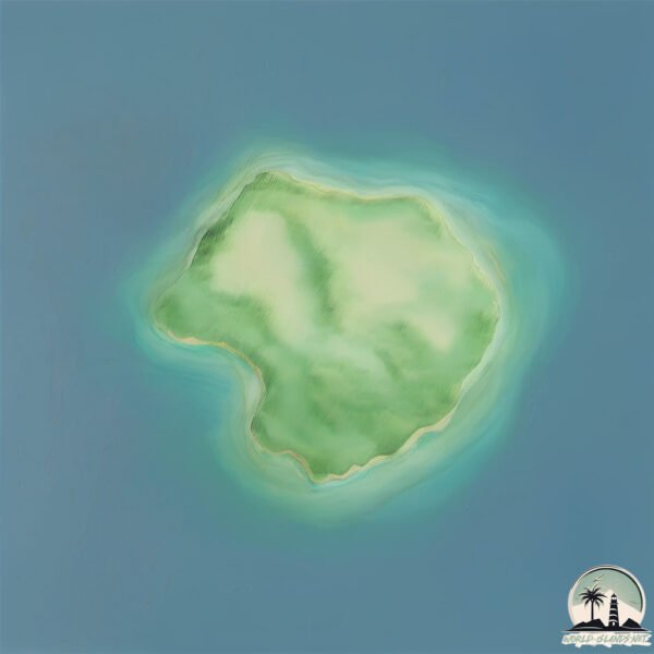
Geography and size of Fondeado
Size: 1.654 km²
Coastline: 5.2 km
Ocean: Pacific Ocean
Sea: Sulu Sea
Continent: Asia
Fondeado is a Small Island spanning 1.7 km² with a coastline of 5.2 km.
Archipel: Malay Archipelago – The world’s largest archipelago, located between mainland Southeast Asia and Australia, known for its immense biodiversity and cultural diversity.
Tectonic Plate: Sunda – Extends across Southeast Asia, encompassing parts of the Sunda Shelf, known for its interaction with the Australian Plate, contributing to volcanic activity in Indonesia.
The geographic heart of the island is pinpointed at these coordinates:
Latitude: 9.93371447 / Longitude: 118.92473453
Climate and weather of Fondeado
Climate Zone: Tropical
Climate Details: Tropical Savanna, Wet
Temperature: Hot
Climate Characteristics: Defined by distinct wet and dry seasons with high temperatures year-round. Pronounced rainfall occurs during the wet season, while the dry season is marked by drought.
Topography and nature of Fondeado
Timezone: UTC+08:00
Timezone places: Australia/Perth
Max. Elevation: 4 m
Mean Elevation: 4 m
Vegetation: Evergreen Needleleaf Forest
Tree Coverage: 100%
The mean elevation is 4 m. The highest elevation on the island reaches approximately 4 meters above sea level. The island is characterized by Plains: Flat, low-lying lands characterized by a maximum elevation of up to 200 meters. On islands, plains are typically coastal lowlands or central flat areas.
Dominating Vegetation: Evergreen Needleleaf Forest
Dominated by evergreen coniferous trees such as pines and firs, which retain their needle-like leaves throughout the year. These forests are often found in cooler climates. Fondeado has a tree cover of 100 %.
Vegetation: 3 vegetation zones – Moderately Diverse Island
These islands start to show a broader range of ecological niches. With three vegetation zones, they may offer a mix of ecosystems like coastal areas, inland woods, and perhaps a distinct wetland or dry area. This diversity supports a wider range of flora and fauna, making these islands more ecologically complex than those with minimal diversity.
Infrastructure and Travelling to Fondeado
Does the island have a public airport? no.
There is no public and scheduled airport on Fondeado. The nearest airport is Puerto Princesa International Airport / PAF Antonio Bautista Air Base, located 27 km away.
Does the island have a major port? no.
There are no major ports on Fondeado. The closest major port is PUERTO PRINCESA, approximately 30 km away.
The mean population of Fondeado is 117 per km². Fondeado is Moderately Inhabited. The island belongs to Philippines.
Continuing your journey, Palawan is the next notable island, situated merely km away.
FONDEADO ISLAND OVERVIEW


![Top 10 Best Things to Do in Palawan Island, Philippines [Palawan Island Travel Guide 2024]](https://i.ytimg.com/vi/Xah_5V6vz0w/mqdefault.jpg)
Philippines is classified as Emerging region: G20: Group of Twenty – Major economies comprising both developed and emerging countries, representing the world’s largest economies. The level of income is Lower middle income.
News – Latest Updates and Headlines from Fondeado
Stay informed with the most recent news and important headlines from Fondeado. Here’s a roundup of the latest developments.
Please note: The data used here has been primarily extracted from satellite readings. Deviations from exact values may occur, particularly regarding the height of elevations and population density. Land area and coastline measurements refer to average values at mean high tide.