Gang
Welcome to Gang, a Polar island in the Labrador Sea, part of the majestic Atlantic Ocean. This guide offers a comprehensive overview of what makes Gang unique – from its geography and climate to its population, infrastructure, and beyond. Dive into the details:
- Geography and Size: Explore the island’s size and location.
- Climate and Weather: Weather patterns and temperature.
- Topography and Nature: Uncover the natural wonders of the island.
- Infrastructure and Travelling: Insights on reaching, staying, and making the most of your visit.
- News and Headlines: Latest News.
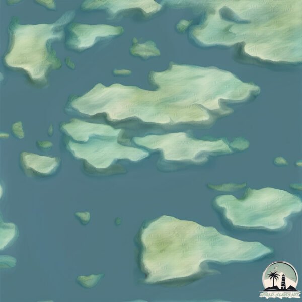
Geography and size of Gang
Size: 1.892 km²
Coastline: 8.9 km
Ocean: Atlantic Ocean
Sea: Labrador Sea
Continent: North America
Gang is a Small Island spanning 1.9 km² with a coastline of 8.9 km.
Archipel: –
Tectonic Plate: North America – Covers North America and parts of the Atlantic and Arctic Oceans, characterized by diverse geological features and varying levels of seismic activity.
The geographic heart of the island is pinpointed at these coordinates:
Latitude: 56.76572133 / Longitude: -61.22470907
Climate and weather of Gang
Climate Zone: Polar
Climate Details: Tundra
Temperature: Cold
Climate Characteristics: The tundra climate features long, extremely cold winters and short, cool summers. Vegetation is limited to mosses, lichens, and small shrubs due to the low temperatures and short growing seasons. Biodiversity is low, but some specialized species thrive.
Topography and nature of Gang
Timezone: UTC-04:00
Timezone places: America/La_Paz
Max. Elevation: 33 m
Mean Elevation: 17 m
Vegetation: Deciduous Needleleaf Forest
Tree Coverage: 47%
The mean elevation is 17 m. The highest elevation on the island reaches approximately 33 meters above sea level. The island is characterized by Plains: Flat, low-lying lands characterized by a maximum elevation of up to 200 meters. On islands, plains are typically coastal lowlands or central flat areas.
Dominating Vegetation: Deciduous Needleleaf Forest
Consists of needleleaf trees that shed their needles annually. This type of forest is less common and can be found in certain cold, northern regions. Gang has a tree cover of 47 %.
Vegetation: 3 vegetation zones – Moderately Diverse Island
These islands start to show a broader range of ecological niches. With three vegetation zones, they may offer a mix of ecosystems like coastal areas, inland woods, and perhaps a distinct wetland or dry area. This diversity supports a wider range of flora and fauna, making these islands more ecologically complex than those with minimal diversity.
Infrastructure and Travelling to Gang
Does the island have a public airport? no.
There is no public and scheduled airport on Gang. The nearest airport is Nain Airport, located 53 km away.
Does the island have a major port? no.
There are no major ports on Gang. The closest major port is GOOSE BAY, approximately 390 km away.
The mean population of Gang is 0 per km². Gang is Uninhabited. The island belongs to Canada.
Continuing your journey, Orton is the next notable island, situated merely km away.
ISLAND GANG - WATCHU FAWKA MUSIC VIDEO


![Fetty Wap - RGF Island [Audio Only]](https://i.ytimg.com/vi/bl5egtkC51Y/mqdefault.jpg)


![JayDaYoungan - 23 Island [Official Music Video]](https://i.ytimg.com/vi/WChdrGtdLUI/mqdefault.jpg)


Canada is classified as Developed region: G7: Group of Seven – Major advanced economies, including Canada, France, Germany, Italy, Japan, the United Kingdom, and the United States. The level of income is High income: OECD.
News – Latest Updates and Headlines from Gang
Stay informed with the most recent news and important headlines from Gang. Here’s a roundup of the latest developments.
Please note: The data used here has been primarily extracted from satellite readings. Deviations from exact values may occur, particularly regarding the height of elevations and population density. Land area and coastline measurements refer to average values at mean high tide.