Ganghwado
Welcome to Ganghwado, a Continental island in the Yellow Sea, part of the majestic Pacific Ocean. This guide offers a comprehensive overview of what makes Ganghwado unique – from its geography and climate to its population, infrastructure, and beyond. Dive into the details:
- Geography and Size: Explore the island’s size and location.
- Climate and Weather: Weather patterns and temperature.
- Topography and Nature: Uncover the natural wonders of the island.
- Infrastructure and Travelling: Insights on reaching, staying, and making the most of your visit.
- News and Headlines: Latest News.
Geography and size of Ganghwado
Size: 331.5 km²
Coastline: 136 km
Ocean: Pacific Ocean
Sea: Yellow Sea
Continent: Asia
Ganghwado is a Large Island spanning 331 km² with a coastline of 136 km.
Archipel: –
Tectonic Plate: Eurasia – One of the world’s largest tectonic plates, the Eurasian Plate covers a significant portion of Europe and Asia. It’s characterized by diverse geological features, including the Ural Mountains, the European Plain, and the Himalayas formed from its collision with the Indian Plate.
The geographic heart of the island is pinpointed at these coordinates:
Latitude: 37.69772952 / Longitude: 126.44731824
Climate and weather of Ganghwado
Climate Zone: Continental
Climate Details: Monsoon-Influenced Hot-Summer Humid Continental Climate
Temperature: Hot Summer
Climate Characteristics: Hot summers with monsoon rains, contrasting with dry, cold winters. Typical of east Asian continental edges.
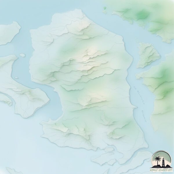
Topography and nature of Ganghwado
Timezone: UTC+09:00
Timezone places: Asia/Tokyo
Max. Elevation: 335 m
Mean Elevation: 53 m
Vegetation: Agricultural Mosaic
Tree Coverage: 45%
The mean elevation is 53 m. The highest elevation on the island reaches approximately 335 meters above sea level. The island is characterized by Hills: Gently sloping landforms with rounded tops, having a maximum elevation between 200 and 500 meters. Hills contribute to a varied landscape on islands.
Dominating Vegetation: Agricultural Mosaic
A mix of cropland and natural vegetation, often seen in rural landscapes where agricultural fields are interspersed with patches of natural habitats. Ganghwado has a tree cover of 45 %.
Vegetation: 15 vegetation zones – Exceptionally Diverse Island
Islands with more than ten vegetation zones are among the most ecologically rich and varied in the world. These islands are akin to miniature continents, boasting an incredible array of ecosystems. The sheer range of habitats, from high peaks to deep valleys, rainforests to deserts, creates a mosaic of life that is unparalleled. They are crucial for conservation and ecological studies.
Infrastructure and Travelling to Ganghwado
Does the island have a public airport? no.
There is no public and scheduled airport on Ganghwado. The nearest airport is Incheon International Airport, located 11 km away.
Does the island have a major port? no.
There are no major ports on Ganghwado. The closest major port is INCHON, approximately 16 km away.
The mean population of Ganghwado is 126 per km². Ganghwado is Moderately Inhabited. The island belongs to South Korea.
Continuing your journey, Jinaeseom is the next notable island, situated merely km away.
Ganghwa Island Korea Trip: Discover a Hidden Gem in 2 Days


South Korea is classified as Emerging region: MIKT: Mexico, Indonesia, South Korea, and Turkey – Economies recognized for their development potential and emerging market status. The level of income is High income: OECD.
News – Latest Updates and Headlines from Ganghwado
Stay informed with the most recent news and important headlines from Ganghwado. Here’s a roundup of the latest developments.
Please note: The data used here has been primarily extracted from satellite readings. Deviations from exact values may occur, particularly regarding the height of elevations and population density. Land area and coastline measurements refer to average values at mean high tide.