Welcome to Geitoya, a Temperate island in the Norwegian Sea, part of the majestic Arctic Ocean. This guide offers a comprehensive overview of what makes Geitoya unique – from its geography and climate to its population, infrastructure, and beyond. Dive into the details:
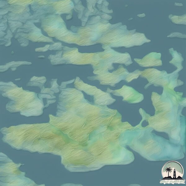
Geography and size of Geitoya
Size: 1.885 km²
Coastline: 14.9 km
Ocean: Arctic Ocean
Sea: Norwegian Sea
Continent: Europe
Geitoya is a Small Island spanning 1.9 km² with a coastline of 14.9 km.
Archipel: –
Tectonic Plate: Eurasia – One of the world’s largest tectonic plates, the Eurasian Plate covers a significant portion of Europe and Asia. It’s characterized by diverse geological features, including the Ural Mountains, the European Plain, and the Himalayas formed from its collision with the Indian Plate.
The geographic heart of the island is pinpointed at these coordinates:
Latitude: 64.47959008 / Longitude: 10.72418899
Climate and weather of Geitoya
Climate Zone: Temperate
Climate Details: Temperate Oceanic Climate
Temperature: Warm Summer
Climate Characteristics: Known for its moderate year-round temperatures with ample rainfall and no dry season. Warm summers are characteristic.
Topography and nature of Geitoya
Timezone: UTC+01:00
Timezone places: Europe/Paris
Max. Elevation: 63 m
Mean Elevation: 48 m
Vegetation: Evergreen Needleleaf Forest
Tree Coverage: 88%
The mean elevation is 48 m. The highest elevation on the island reaches approximately 63 meters above sea level. The island is characterized by Plains: Flat, low-lying lands characterized by a maximum elevation of up to 200 meters. On islands, plains are typically coastal lowlands or central flat areas.
Dominating Vegetation: Evergreen Needleleaf Forest
Dominated by evergreen coniferous trees such as pines and firs, which retain their needle-like leaves throughout the year. These forests are often found in cooler climates. Geitoya has a tree cover of 88 %.
Vegetation: 5 vegetation zones – Highly Diverse Island
With five different vegetation zones, these islands offer a rich tapestry of ecosystems. The variety could include dense forests, open meadows, wetlands, coastal zones, and more. This level of diversity supports an intricate web of life, with each zone playing a vital role in the overall ecological health and balance of the island.
Infrastructure and Travelling to Geitoya
Does the island have a public airport? no.
There is no public and scheduled airport on Geitoya. The nearest airport is Rørvik Airport, Ryum, located 59 km away.
Does the island have a major port? no.
There are no major ports on Geitoya. The closest major port is MALM, approximately 70 km away.
The mean population of Geitoya is 2 per km². Geitoya is Gently Populated. The island belongs to Norway.
Continuing your journey, Halmoya is the next notable island, situated merely km away.
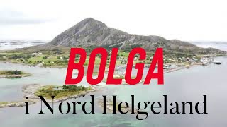
4K BOLGA 090821 GEITOYA ISLAND 🇳🇴
4K drone video taken on 09 August 2021 showing views around Geitoya Island to the southeast of Bolga. Footage of a tug boat ...4K BOLGA 090821 GEITOYA ISLAND 🇳🇴
4K drone video taken on 09 August 2021 showing views around Geitoya ...
4K drone video taken on 09 August 2021 showing views around Geitoya Island to the southeast of Bolga. Footage of a tug boat ...
Atlantic Ocean Road - Geitoya
Atlantic Ocean Road / Atlanterhavsvegen Scenic Route in Norway. ...
Geitøya: Attraction along Atlanterhavsvegen
Geitøya Short walks to hilltops and back down to the water provide ...
Geitøya Short walks to hilltops and back down to the water provide panoramic views over the archipelago. An angler's path leads ...
Geitøya på Atlanterhavsvegen 040116
Nedstigning til Geitøya på Atlanterhavsvegen, en flott januardag.
Nedstigning til Geitøya på Atlanterhavsvegen, en flott januardag.
Atlantic Ocean Road, Norway (World's most beautiful road) Drone footage
norway #scenicroute #atlanticoceanroad #shorts Atlantic ocean road or ...
norway #scenicroute #atlanticoceanroad #shorts Atlantic ocean road or Atlanterhavsvegen or Atlanterhavsveien is the world most ...
Vik i Flatanger, Norge sett med drone fra Geitøya. Velkommen til Vik Midtre, overnatting og havfiske
Oversiktsbilde fra Vik i Flatanger, Norge. Vik Midtre overnatting og ...
Oversiktsbilde fra Vik i Flatanger, Norge. Vik Midtre overnatting og havfiske vikmidtre.no.
Fly through Støtt islands in north of Norway!
Støtt is a cluster magical islands just a few hours away from the ...
Støtt is a cluster magical islands just a few hours away from the famous Lofoten islands. Cameras used: Fimi Palm Sony a7 II ...
Megleren Din presenterer Geitøyveien 46
Oppgradert fritidsbolig, flott beliggenhet på Geitøya på Mausund. ...
Oppgradert fritidsbolig, flott beliggenhet på Geitøya på Mausund. Naust og bod ligger ved sjøen. Boligen er bygd i 1950 og er ...
جاده ی آتلانتیک اقیانوس اطلس /جاده ای افسانه ای در کشور نروژ و کاوش در زیبایی های طبیعت #shorts
سلام به کانال تایم دانستنی خوش اومدین در این کانال به دانستنی های ...
سلام به کانال تایم دانستنی خوش اومدین در این کانال به دانستنی های ایران و جهان میپردازیم دانستنی ها دانستنی روز عجایب جهان عجایب ...
4K BOLGA 040721 RETT KURS 🇳🇴
4 K drone video of a kayaking course given by Åge and Lisbeth Hansen ...
4 K drone video of a kayaking course given by Åge and Lisbeth Hansen on July 4, 2021. Drone: DJI MINI 2 Pilot: Jeffrey Lee ...
4K BOLGA 030921 HAVNA & NAUSTENE 🇳🇴
4K drone video of the jetty in Bolga Harbor - slow pan from north to ...
4K drone video of the jetty in Bolga Harbor - slow pan from north to south end showing boathouses, harbor mouth and fish landing ...
4K BOLGA 090921 Home Sweet Island Home 🇳🇴
4K drone video taken on Bolga with a slow route reveal of the island ...
4K drone video taken on Bolga with a slow route reveal of the island and various boat activity in and around Bolga Harbor.
4K BOLGA 231021 Fall Day 🇳🇴
4K video of the island of Bolga on a sunny but cool fall day in 2021. ...
4K video of the island of Bolga on a sunny but cool fall day in 2021. Highlights include take-offs from one of the island's hilltops ...
4K BOLGA 010721 NORTH HELGELAND 🇳🇴
This video includes footage shot on July 1, 2021 at both ...
This video includes footage shot on July 1, 2021 at both Klippfiskbergan and Bolgenden/Storvika. Important notice to all YouTube ...
BOLGA 4K 210422 REKETRÅLER 🇳🇴
Reketråleren John Ivar seiler sakte men sikkert forbi øya Bolga i ...
Reketråleren John Ivar seiler sakte men sikkert forbi øya Bolga i Meløy, Nord Helgeland. ❤️ #Bolga #Meløy #Reketråler ...
The Atlantic Ocean Road or the Atlantic Road Norway.
The Atlantic Ocean Road or the Atlantic Road (Norwegian: ...
The Atlantic Ocean Road or the Atlantic Road (Norwegian: Atlanterhavsvegen / Atlanterhavsveien) is an 8.3-kilometer (5.2 mi) ...
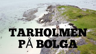
4K BOLGA 260621 TARHOLMEN 🇳🇴
Flying over one of Bolga's sandy beaches at a spot called Tarholmen. ...
Flying over one of Bolga's sandy beaches at a spot called Tarholmen. Important notice to all YouTube administrators: All of my ...
Details and ropes on deck of yacht.
Details and ropes on deck of moving yacht with white sails on ...
Details and ropes on deck of moving yacht with white sails on background of water surface during sea journey. Concept of water ...
Details, ropes in equipment of sailing yacht .
Fethiye, Turkey - September 14, 2017: Details, ropes in equipment of ...
Fethiye, Turkey - September 14, 2017: Details, ropes in equipment of sailing yacht during sea journey. Sea, mountains, summer ...
2020 Feeling Free on Bolga 🇳🇴
NOTE: This is NOT a still picture. The sun takes forever to set here ...
NOTE: This is NOT a still picture. The sun takes forever to set here on the island of Bolga as we are situated at 66 degrees N, just ...
Boende Bolga Brygga
Semester på Bolga Brygga.
Semester på Bolga Brygga.
BOLGA 1080p Winter 031121 🇳🇴
Bolga #Winter #2021 Important note to YouTube administrators: all ...
Bolga #Winter #2021 Important note to YouTube administrators: all music in this video was sourced legally using the DJI FLY ...
4K BOLGA 231021 FISH LANDING 🇳🇴
4K Bolga Pilot video of boats arriving at the fish landing on our ...
4K Bolga Pilot video of boats arriving at the fish landing on our island. Nice video and still images of the facility and Bolga Harbor.
4K BOLGA 160921 NEX Express Cat 🇳🇴
4K drone video by Bolga pilot along with some other footage focusing ...
4K drone video by Bolga pilot along with some other footage focusing on the Nordlandsekspressen (NEX) catamarans that ...
4K BOLGA 270921 North Shore 🇳🇴
4K video including both drone footage and a slideshow featuring ...
4K video including both drone footage and a slideshow featuring handheld images shot using an iPhone 12 Pro Max. On this ...
Norway is classified as Developed region: nonG7: Developed economies outside of the Group of Seven, characterized by high income and advanced economic structures. The level of income is High income: OECD.
News – Latest Updates and Headlines from Geitoya
Stay informed with the most recent news and important headlines from Geitoya. Here’s a roundup of the latest developments.
Loading...
Please note: The data used here has been primarily extracted from satellite readings. Deviations from exact values may occur, particularly regarding the height of elevations and population density. Land area and coastline measurements refer to average values at mean high tide.