Welcome to Helgoland, a Temperate island in the North Sea, part of the majestic Atlantic Ocean. This guide offers a comprehensive overview of what makes Helgoland unique – from its geography and climate to its population, infrastructure, and beyond. Dive into the details:
Geography and size of Helgoland
Size: 1.106 km²
Coastline: 7.8 km
Ocean: Atlantic Ocean
Sea: North Sea
Continent: Europe
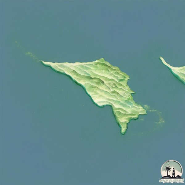
Helgoland is a Small Island spanning 1.1 km² with a coastline of 7.8 km.
Archipel: –
Tectonic Plate: Eurasia – One of the world’s largest tectonic plates, the Eurasian Plate covers a significant portion of Europe and Asia. It’s characterized by diverse geological features, including the Ural Mountains, the European Plain, and the Himalayas formed from its collision with the Indian Plate.
The geographic heart of the island is pinpointed at these coordinates:
Latitude: 54.18247955 / Longitude: 7.88402995
Climate and weather of Helgoland
Climate Zone: Temperate
Climate Details: Temperate Oceanic Climate
Temperature: Warm Summer
Climate Characteristics: Known for its moderate year-round temperatures with ample rainfall and no dry season. Warm summers are characteristic.
Topography and nature of Helgoland
Timezone: UTC+01:00
Timezone places: Europe/Paris
Max. Elevation: 12 m
Mean Elevation: 9 m
Vegetation: Evergreen Needleleaf Forest
Tree Coverage: 2%
The mean elevation is 9 m. The highest elevation on the island reaches approximately 12 meters above sea level. The island is characterized by Plains: Flat, low-lying lands characterized by a maximum elevation of up to 200 meters. On islands, plains are typically coastal lowlands or central flat areas.
Dominating Vegetation: Evergreen Needleleaf Forest
Dominated by evergreen coniferous trees such as pines and firs, which retain their needle-like leaves throughout the year. These forests are often found in cooler climates. Helgoland has a tree cover of 2 %.
Vegetation: 3 vegetation zones – Moderately Diverse Island
These islands start to show a broader range of ecological niches. With three vegetation zones, they may offer a mix of ecosystems like coastal areas, inland woods, and perhaps a distinct wetland or dry area. This diversity supports a wider range of flora and fauna, making these islands more ecologically complex than those with minimal diversity.
Infrastructure and Travelling to Helgoland
Does the island have a public airport? no.
There is no public and scheduled airport on Helgoland. The nearest airport is Helgoland-Düne Airport, located 3 km away.
Does the island have a major port? no.
There are no major ports on Helgoland. The closest major port is WILHELMSHAVEN, approximately 77 km away.
The mean population of Helgoland is 576 per km². Helgoland is Densely Populated. The island belongs to Germany.
Continuing your journey, Insel Spiekeroog is the next notable island, situated merely km away.
Heligoland: Germany’s island outpost with Simon Calder
Heligoland: Germany’s island outpost with Simon Calder
Why did Britain give Heligoland to Germany? (Short Animated Documentary)
Heligoland is a tiny island off the coast of Germany that belonged to ...
Heligoland is a tiny island off the coast of Germany that belonged to Britain between 1814 and 1890 when it opted to hand it over ...
Heligoland Travel Tips | Heligoland: History, Shanties, Nature | Visit the North Sea Island
DW Travel guide Lukas Stege takes the ferry to the North Sea ...
DW Travel guide Lukas Stege takes the ferry to the North Sea archipelago, enjoying a stiff breeze along the way. Upon arrival, he ...
I visited Helgoland: Germany's ex-British island
Helgoland is the only land Britain ever permanently lost to Germany. ...
Helgoland is the only land Britain ever permanently lost to Germany. But why? ✨ subscribe ✨ & join the patreon for more ...
Heligoland Goes Up: Destroying Hitler's Sea Base (1947) | British Pathé
In this explosive footage from 1947, we see the British Royal Navy ...
In this explosive footage from 1947, we see the British Royal Navy surround the once German held island of Heligoland with the ...
Mysterious Virus Kills 99% of Humanity And Traps 513 Survivors on an Island
After a virus takes over the world, an isolated island doesn't let ...
After a virus takes over the world, an isolated island doesn't let anyone come in for the sake of their safety and keeps the ...
Heligoland, Germany: Discover Red Cliffs & Seaside Charm in the North Sea! 🏝️✨
Did you know there's a German archipelago where red cliffs soar above ...
Did you know there's a German archipelago where red cliffs soar above the North Sea, and seals lounge on sandy shores?
Heligoland, The Tiny Forgotten Outpost of the British Empire
Heligoland, the tiny forgotten outpost of the British Empire. Chris ...
Heligoland, the tiny forgotten outpost of the British Empire. Chris Green is The History Chap; telling stories that brings the past to ...
The island of Helgoland in two minutes
Come with us up to the "Highland" of the isle with impressive red ...
Come with us up to the "Highland" of the isle with impressive red cliffs and thousands of sea birds, especially guillemots breeding ...
Heligoland The North Sea’s Best Kept Secret Revealed #travel #place #facts #explore #factplace
The British islands traded with Germany for a whole country
The Heligoland–Zanzibar Treaty (1890): Britain gave up control of ...
The Heligoland–Zanzibar Treaty (1890): Britain gave up control of Heligoland, a small archipelago in the North Sea, to Germany.
Day Trip to Helgoland (1935)
German soldiers on a day trip from Hamburg to Heligoland (1935) or ...
German soldiers on a day trip from Hamburg to Heligoland (1935) or Helgoland. The island played an important role in German ...
The Island that Changed Europe, and had to be erased: Heligoland
Heligoland is the DAGGER POINTED AT ENGLANDS HEART and has been a ...
Heligoland is the DAGGER POINTED AT ENGLANDS HEART and has been a crucial source of contention between Germany and ...
Discovering the Hidden Gem: Heligoland Archipelago
Discover Heligoland: Germany's Hidden Gem Join us on an immersive ...
Discover Heligoland: Germany's Hidden Gem Join us on an immersive journey through Heligoland, a stunning ...
Sailing to Helgoland, the Island they tried blowing Away! -Episode 2-
Get 4 months extra on a 2 year plan here: ...
On a HIGH SPEED Catamaran to Germany’s Most Remote Island! - Helgoland
helgoland #hlegolanddaytrip #helgolandreise This isn't your typical ...
helgoland #hlegolanddaytrip #helgolandreise This isn't your typical ferry ride. We're racing across the North Sea at 65 km/h, ...
Why Germany has Heligoland #history #geography #uk #germany #zanzibar #historymemes
Heligoland, a tiny island paradise in the North Sea, belongs to ...
Heligoland, a tiny island paradise in the North Sea, belongs to Germany. But why? This Shorts explores the island's surprising ...
Remaining 513 people in world get trapped on island because virus destroyed 99% of population
recap The year 2036. The world is destroyed. The totalitarian ...
recap The year 2036. The world is destroyed. The totalitarian authorities of a community on the island of Helgoland ensure its ...
[Then & Now] - Heligoland (Helgoland), Germany - May 15, 1943
Bombs burst on military installations at Heligoland (Helgoland), May ...
Bombs burst on military installations at Heligoland (Helgoland), May 15, 1943. Coordinates 54°10'57.4"N 7°53'10.2"E.
euromaxx | Series: Island Portraits 01 - Heligoland
In the first report of our new series, we travel to the North Sea ...
In the first report of our new series, we travel to the North Sea island of Heligoland. It measures just 1.7 square kilometers and has ...
Hilma sailing, to Helgoland - a beautiful island! Ep 3
In this episode we are sailing from Cuxhaven to Helgoland. We're also ...
In this episode we are sailing from Cuxhaven to Helgoland. We're also having our first over night sail during this journey and ...
The Story of Heligoland! #ww2 #facts
Helgoland Fast Forward - Island Timelapse
Helgoland (english Heligoland) is a tiny little German island in the ...
Helgoland (english Heligoland) is a tiny little German island in the German Bight. If you have never been there: Go there. And stay ...
Only 513 Survivors Chosen by Helgoland’s Dark Law in a Future Outbreak
What if survival itself was decided by a ruthless law? On Helgoland ...
What if survival itself was decided by a ruthless law? On Helgoland Island, only 513 survivors are allowed to live after a deadly ...
Helgoland - Heligoland 🇩🇪💚
heligoland #nordseeinsel #helgoland #pinneberg #schleswigholstein ...
heligoland #nordseeinsel #helgoland #pinneberg #schleswigholstein #nordsee #northsea #deutschland #germany.
Germany is classified as Developed region: G7: Group of Seven – Major advanced economies, including Canada, France, Germany, Italy, Japan, the United Kingdom, and the United States. The level of income is High income: OECD.
News – Latest Updates and Headlines from Helgoland
Stay informed with the most recent news and important headlines from Helgoland. Here’s a roundup of the latest developments.
Loading...
Please note: The data used here has been primarily extracted from satellite readings. Deviations from exact values may occur, particularly regarding the height of elevations and population density. Land area and coastline measurements refer to average values at mean high tide.


![[Then & Now] - Heligoland (Helgoland), Germany - May 15, 1943](https://i.ytimg.com/vi/ybJxIkGGfg0/mqdefault.jpg)