Welcome to Hog Cay, a Tropical island in the Caribbean Sea, part of the majestic Atlantic Ocean. This guide offers a comprehensive overview of what makes Hog Cay unique – from its geography and climate to its population, infrastructure, and beyond. Dive into the details:
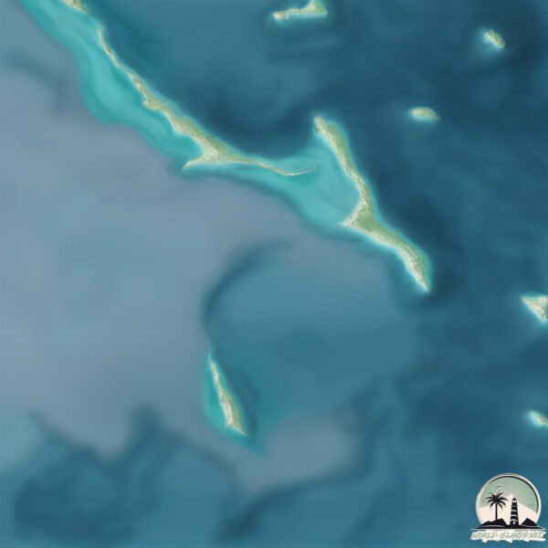
Geography and size of Hog Cay
Size: 3.294 km²
Coastline: 10.3 km
Ocean: Atlantic Ocean
Sea: Caribbean Sea
Continent: North America
Hog Cay is a Small Island spanning 3.3 km² with a coastline of 10.3 km.
Archipel: –
Tectonic Plate: Africa – One of the world’s largest tectonic plates, covering the African continent and parts of the surrounding oceans, known for its stability with some active rift zones.
The geographic heart of the island is pinpointed at these coordinates:
Latitude: 12.36915778 / Longitude: -83.66720406
Climate and weather of Hog Cay
Climate Zone: Tropical
Climate Details: Tropical Rainforest Climate
Temperature: Hot
Climate Characteristics: This climate is typified by heavy rainfall throughout the year, high humidity, and consistently high temperatures, leading to lush rainforests and rich biodiversity. Seasonal temperature variations are minimal.
Topography and nature of Hog Cay
Timezone: UTC-06:00
Timezone places: America/Chicago
Max. Elevation: 5 m
Mean Elevation: 4 m
Vegetation: Evergreen Broadleaf Forest
Tree Coverage: 53%
The mean elevation is 4 m. The highest elevation on the island reaches approximately 5 meters above sea level. The island is characterized by Plains: Flat, low-lying lands characterized by a maximum elevation of up to 200 meters. On islands, plains are typically coastal lowlands or central flat areas.
Dominating Vegetation: Evergreen Broadleaf Forest
Characterized by dense, lush canopies of broadleaf trees that retain their leaves year-round. These forests are typically found in tropical and subtropical regions and are known for their high biodiversity. Hog Cay has a tree cover of 53 %.
Vegetation: 5 vegetation zones – Highly Diverse Island
With five different vegetation zones, these islands offer a rich tapestry of ecosystems. The variety could include dense forests, open meadows, wetlands, coastal zones, and more. This level of diversity supports an intricate web of life, with each zone playing a vital role in the overall ecological health and balance of the island.
Infrastructure and Travelling to Hog Cay
Does the island have a public airport? no.
There is no public and scheduled airport on Hog Cay. The nearest airport is Bluefields Airport, located 42 km away.
Does the island have a major port? no.
There are no major ports on Hog Cay. The closest major port is BLUEFIELDS, approximately 39 km away.
The mean population of Hog Cay is 12 per km². Hog Cay is Gently Populated. The island belongs to Nicaragua.
Continuing your journey, del Venado is the next notable island, situated merely km away.
Landing at Hog Cay, Bahamas (MYEY)
Landing on runway 10 at Hog Cay (also called Torch Cay), Bahamas (MYEY)Landing at Hog Cay, Bahamas (MYEY)
Landing on runway 10 at Hog Cay (also called Torch Cay), Bahamas (MYEY)
Landing on runway 10 at Hog Cay (also called Torch Cay), Bahamas (MYEY)
Hog Cay Ragged Islands
KINDNESSw comes to explore Hog Cay Ragged Islands, Bahamas for ...
KINDNESSw comes to explore Hog Cay Ragged Islands, Bahamas for Christmas. As the sun slipped below the horizon, casting a ...
Hog Cay
Blow hole in ironshore.
Blow hole in ironshore.
Short flight from Exuma International Airport (GGT/MYEF) to Hog Cay Airport (MYEY)
Video of the takeoff from Exuma International Airport (GGT/MYEF) and ...
Video of the takeoff from Exuma International Airport (GGT/MYEF) and the short flight to Hog Cay Airport (MYEY), landing on ...
Hog Cay, Bahamas
My Island's Adventure charter with Captain Tim Hoban and First Mate Ashley.
My Island's Adventure charter with Captain Tim Hoban and First Mate Ashley.
Hog Cay Cut passage - in real time. Completed in 11 minutes
We went north through Hog Cay cut at 12:30 pm on 2/26/23, 90 minutes ...
We went north through Hog Cay cut at 12:30 pm on 2/26/23, 90 minutes after GT high tide, and exactly at Steventon and Nassau ...
HOG CAY, RAGGED ISLANDS IN THE BAHAMAS | IRIE CAT
This video features an aerial view of Hog Cay, Ragged Islands in The ...
This video features an aerial view of Hog Cay, Ragged Islands in The Bahamas. The crew of s/v irie cat has created a series of ...
Two Sides of Paradise: Hog Cay from West to East
The stunning contrast of Hog Cay as we capture its serene Bahamas side ...
The stunning contrast of Hog Cay as we capture its serene Bahamas side and the rugged Atlantic side. Which view captivates you ...
Hog Cay, Jumentos Islands, BS
Paradise.
Paradise.
Finding Corte Magore at Hog Cay Island Virtual Tour
Join us on a Virtual Tour of Finding Corte Magore at Hog Cay in ...
Join us on a Virtual Tour of Finding Corte Magore at Hog Cay in Bluefields Bay, Bluefields, Nicaragua! This 29-acre island rich in ...
Hog Cay in the Raggeds
Quick overhead view of our anchorage at Hog Cay in the Raggeds, Bahamas.
Quick overhead view of our anchorage at Hog Cay in the Raggeds, Bahamas.
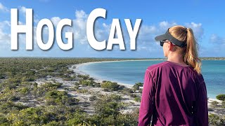
Hog Cay, The Raggeds, The Bahamas: Exploring the trails & beaches
Remote, uninhabited, quiet, serene, and hilly, Hog Cay in the Raggeds ...
Remote, uninhabited, quiet, serene, and hilly, Hog Cay in the Raggeds of the Bahamas is full of wonder -- blue waters, white sand ...
Sailing the Jumentos: Exploring a Hidden Gem
Fellow boaters - I'm thrilled to share my latest project with you: ...
Fellow boaters - I'm thrilled to share my latest project with you: MaintenanceROS! Crafted from my experiences aboard Starry ...
E20: Frazer's Hog Cay, Bahamas Bahamas Express
An overnight sail to Chubb Cay from Bimini leads us to Frazer's Hog ...
An overnight sail to Chubb Cay from Bimini leads us to Frazer's Hog Cay. Beautiful. Serene. Quiet. I FINALLY get to go swimming ...
BV8: Explorkeling Under the Abaco Sea at Hog Cay
Time to go explorkeling!” shouts Scuba Annie! Yes, Phillip loves ...
Time to go explorkeling!” shouts Scuba Annie! Yes, Phillip loves cruising with me. This was our first stop after we wrapped our ...
Reef Snorkel at Hog Cay Bahamas
A very healthy reef just off the beach of Hog Cay Long Island Bahamas. ...
A very healthy reef just off the beach of Hog Cay Long Island Bahamas. I realized after the fact I had the camera zoomed into too ...
Fish, Hog Cay, Ragged Islands, Bahamas
Fish, Hog Cay, Ragged Islands, Bahamas.
Fish, Hog Cay, Ragged Islands, Bahamas.
Dolphin Comes to Say Hello at Hog Cay Long Island Bahamas
The Hog Cay neighbourhood dolphin figured he would have to pay us a ...
The Hog Cay neighbourhood dolphin figured he would have to pay us a visit shortly after we anchored. We had seen one here ...
Hog Cay Cut- How to navigate this popular cut to the Raggeds
Our experience going through Hog Cay Cut in the South Exuma's. A ...
Our experience going through Hog Cay Cut in the South Exuma's. A popular short cut to and from the Ragged Islands. Music from ...
31 - Hog Cay - a place removed from time
Upon arriving at Hog Cay, we disappeared into a place where the days ...
Upon arriving at Hog Cay, we disappeared into a place where the days merged into one another and the outside world ceased to ...
Trail of Treasures: Hiking Hog Cay's Unique Path
Exploring Hog Cay's unique trail, where each step unveils a new view, ...
Exploring Hog Cay's unique trail, where each step unveils a new view, and the path is marked with beach treasures and toys ...
Fun times in Hog Cay Bahamas
Join our sailing family as we explore the breathtaking beauty of Hig ...
Join our sailing family as we explore the breathtaking beauty of Hig Cay, Bahamas! Crystal-clear waters, pristine beaches, and ...
Traveling To Hog Cay, Bahamas 🇧🇸 #bahamas #ocean #turquoisewater #turquoise #water #waves#sailing
Nicaragua is classified as Developing region: Regions characterized by lower income levels, with economies in the process of industrialization and modernization. The level of income is Lower middle income.
News – Latest Updates and Headlines from Hog Cay
Stay informed with the most recent news and important headlines from Hog Cay. Here’s a roundup of the latest developments.
Loading...
Please note: The data used here has been primarily extracted from satellite readings. Deviations from exact values may occur, particularly regarding the height of elevations and population density. Land area and coastline measurements refer to average values at mean high tide.