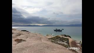
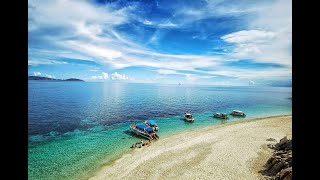
Welcome to Hòn Câu, a Tropical island in the South China Sea, part of the majestic Pacific Ocean. This guide offers a comprehensive overview of what makes Hòn Câu unique – from its geography and climate to its population, infrastructure, and beyond. Dive into the details:
Geography and size of Hòn Câu
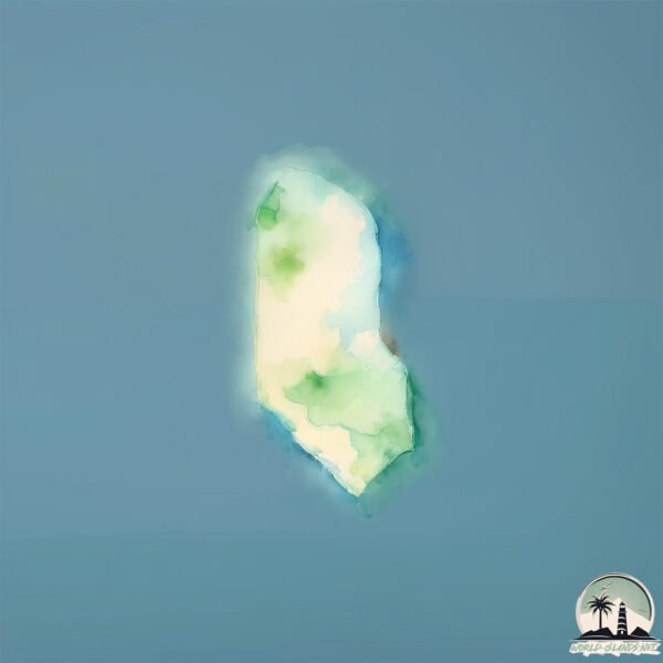
Size: 0.14 km²
Coastline: 1.7 km
Ocean: Pacific Ocean
Sea: South China Sea
Continent: Asia
Hòn Câu is a Tiny Island spanning 0.14 km² with a coastline of 1.7 km.
Archipel: –
Tectonic Plate: Sunda – Extends across Southeast Asia, encompassing parts of the Sunda Shelf, known for its interaction with the Australian Plate, contributing to volcanic activity in Indonesia.
The geographic heart of the island is pinpointed at these coordinates:
Latitude: 12.28279155 / Longitude: 109.36969601
Climate and weather of Hòn Câu
Climate Zone: Tropical
Climate Details: Tropical Savanna, Wet
Temperature: Hot
Climate Characteristics: Defined by distinct wet and dry seasons with high temperatures year-round. Pronounced rainfall occurs during the wet season, while the dry season is marked by drought.
Topography and nature of Hòn Câu
Timezone: UTC+07:00
Timezone places: Asia/Jakarta
Max. Elevation: 3 m
Mean Elevation: 1 m
Vegetation: Agricultural Mosaic
Tree Coverage: 95%
The mean elevation is 1 m. The highest elevation on the island reaches approximately 3 meters above sea level. The island is characterized by Plains: Flat, low-lying lands characterized by a maximum elevation of up to 200 meters. On islands, plains are typically coastal lowlands or central flat areas.
Dominating Vegetation: Agricultural Mosaic
A mix of cropland and natural vegetation, often seen in rural landscapes where agricultural fields are interspersed with patches of natural habitats. Hòn Câu has a tree cover of 95 %.
Vegetation: 1 vegetation zones – Minimal Diversity Island
These islands exhibit the most basic level of ecological diversity, often characterized by a single dominant vegetation type. This could be due to extreme environmental conditions, limited land area, or significant human impact. They represent unique ecosystems where specific species have adapted to thrive in these singular environments.
Infrastructure and Travelling to Hòn Câu
Does the island have a public airport? no.
There is no public and scheduled airport on Hòn Câu. The nearest airport is Cam Ranh International Airport / Cam Ranh Air Base, located 36 km away.
Does the island have a major port? no.
There are no major ports on Hòn Câu. The closest major port is NHA TRANG, approximately 15 km away.
The mean population of Hòn Câu is 1790 per km². Hòn Câu is Densely Populated. The island belongs to Vietnam.
Continuing your journey, Hòn Tre is the next notable island, situated merely km away.
Đảo Cù Lao Câu Bình Thuận – Hướng dẫn du lịch “Hòn Cau” Từ A đến Z
Đảo Cù Lao Câu Bình Thuận – Hướng dẫn du lịch “Hòn Cau” Từ A đến Z #culaocau #daoculaocau #honcau #daohoncau ...Đảo Cù Lao Câu Bình Thuận – Hướng dẫn du lịch “Hòn Cau” Từ A đến Z
Đảo Cù Lao Câu Bình Thuận – Hướng dẫn du lịch “Hòn Cau” Từ A đến Z ...
Đảo Cù Lao Câu Bình Thuận – Hướng dẫn du lịch “Hòn Cau” Từ A đến Z #culaocau #daoculaocau #honcau #daohoncau ...
Hướng dẫn chi tiết cách đi tham quan Đảo Cù Lao Câu - Một ngày làm Robinson trên hòn đảo mới nổi này
Khám phá và cắm trại đảo Cù lao câu hoang sơ .Hành trình một mình tự túc từ đất liền ra đảo
Có một hòn đảo hoang sơ gần bờ , rất dễ để đi và trải nghiệm nằm tại ...
Có một hòn đảo hoang sơ gần bờ , rất dễ để đi và trải nghiệm nằm tại xã Phước thể ,huyện Tuy phong tỉnh Bình thuận .Đó là đảo ......[+] Show More Triump1200 | Vlog Khám Phá Đảo Cù Lao Câu 🇻🇳 | 1 ngày chill ở bãi biển hoang sơ chưa ai biết
Cù Lao Câu – một hòn đảo hoang sơ giữa biển Bình Thuận, nơi tôi dành 1 ...
Cù Lao Câu – một hòn đảo hoang sơ giữa biển Bình Thuận, nơi tôi dành 1 ngày chỉ để chill, nhìn sóng và cảm nhận sự yên tĩnh.
#69 Review đảo Cù Lao Câu - Tour bản địa 1 ngày xuất phát từ Phan Thiết // Mình là Linh
Với mục tiêu đặt chân đến tất cả các đảo ở Việt Nam. Địa điểm kế tiếp ...
Với mục tiêu đặt chân đến tất cả các đảo ở Việt Nam. Địa điểm kế tiếp Linh muốn chia sẻ đến với các bạn chính là Đảo Cù Lao ......[+] Show More Cu Lao Cau – Une île magnifique et préservée du Vietnam
culaocau #travel #explore #explorationvietnam #beach #hellovietnam ⭐ ...
culaocau #travel #explore #explorationvietnam #beach #hellovietnam ⭐ HELLO VIET NAM ⭐ Чтобы следить за последними ...
CÙ LAO CÂU - ĐẢO HOANG CHO NGƯỜI THÍCH KHÁM PHÁ
CÙ LAO CÂU - ĐẢO HOANG CHO NGƯỜI THÍCH KHÁM PHÁ Các bạn cùng mình tham ...
CÙ LAO CÂU - ĐẢO HOANG CHO NGƯỜI THÍCH KHÁM PHÁ Các bạn cùng mình tham quan Cù Lao Câu nhé. About me: ...
Camping Đảo Hòn Câu Rất Đẹp Ai Chưa Đi Nên Thử Trải Nghiệm
kênh youtube Soncamping là kênh khám phá yêu thích thiên nhiên cấm ...
kênh youtube Soncamping là kênh khám phá yêu thích thiên nhiên cấm trại với các chủ đề về CAMPING - TREKKING - TRẢI ...
Hướng dẫn nhanh đi Đảo Hòn Câu Bình Thuận (Hon Cau island VietNam)
Đảo Hòn Câu Travel Video !!!
VIETNAM | 8 Lưu ý khi du lịch đến Cù Lao Câu - Điều 8, quan trọng nhất #travel #vietnam #beach
Hè mà đang tìm kiếm đi du lịch biển ở đâu vừa rẻ, đẹp, lại hoang sơ, ...
Hè mà đang tìm kiếm đi du lịch biển ở đâu vừa rẻ, đẹp, lại hoang sơ, thì Cù Lao Câu ở Bình Thuận, Việt Nam mình, là một nơi ...lý ...[+] Show More 📍Cù Lao Câu - Tuy Phong: Hết tiền nhưng vẫn muốn đi đảo thì mình đi Cù lao câu giá chữa lành chỉ 1tr
muinexpress #phanthiet #travel #tour #dulich #biển #culaocau #island ...
muinexpress #phanthiet #travel #tour #dulich #biển #culaocau #island #beach #beachday #beachlife.
Tham quan đảo Cù Lao Câu (Hòn Câu) thiên đường biển đảo Việt Nam
Cù lao Câu, hay hòn Cau, là một hòn đảo nhỏ thuộc địa phận xã Phước ...
Cù lao Câu, hay hòn Cau, là một hòn đảo nhỏ thuộc địa phận xã Phước Thể, huyện Tuy Phong, tỉnh Bình Thuận, Việt Nam.
Khám phá Cù lao Câu ở Bình Thuận
Cù lao Câu (Hòn Cau) ở Bình Thuận là điểm du lịch hấp dẫn với cảnh ...
Cù lao Câu (Hòn Cau) ở Bình Thuận là điểm du lịch hấp dẫn với cảnh biển đẹp, san hô đa dạng. Thời điểm lý tưởng nhất để du ...
1 vòng quanh đảo Hòn Câu - Mũi Né | Du lịch chỉ với 890k | YoungR
Đảo Cù Lao Câu hoang sơ ở Bình Thuận #travel
Đây là biển Hòn Câu nha các bạn
HƯỚNG DẪN DU LỊCH ĐẢO HÒN SƠN - KIÊN GIANG , Ăn gì chơi gì trên Đảo Hòn Sơn. Du lịch Đảo Nam Du
Facebook : Toro Pan - Review Du Lịch Tiktok : Toro Pan Mail : ...
Facebook : Toro Pan - Review Du Lịch Tiktok : Toro Pan Mail :
Lycongban90@gmail.com 0:00 Giới Thiệu Hòn Sơn 1:16 Hướng ...
Biển cù lao Câu (Hòn Cau), Tuy Phong, Bình Thuận trong vắt và xanh ngắt ngày 18/05/2025
Biển cù lao Câu (Hòn Cau), Tuy Phong, Bình Thuận trong vắt và xanh ...
Biển cù lao Câu (Hòn Cau), Tuy Phong, Bình Thuận trong vắt và xanh ngắt ngày 18/05/2025.
Khu vườn địa đàng đá trên đảo Hòn Cau Cù Lao Câu
Cù Lao Câu là một “thiên đường” mới nổi đang gây sốt mới đây sở hữu đa ...
Cù Lao Câu là một “thiên đường” mới nổi đang gây sốt mới đây sở hữu đa số những người ham mê du lịch. Hoang sơ, bí ẩn, thú ...
Đảo Hòn Câu | Hai Phương TV
Khám Phá Du Lịch Biển – Trải Nghiệm Thiên Nhiên Tuyệt Đẹp! 🏖️ Cùng ...
Khám Phá Du Lịch Biển – Trải Nghiệm Thiên Nhiên Tuyệt Đẹp! 🏖️ Cùng chúng tôi khám phá hành trình du lịch biển đầy thú vị ...
Duyên Đi Dạt | Khám phá Đảo Hòn Cau - Bình Thuận
Chào các bạn! Video này được mình quay cùng chuyến khám phá hòn đảo ...
Chào các bạn! Video này được mình quay cùng chuyến khám phá hòn đảo xinh đẹp - Hòn Cau - Bình Thuận. Chuyến đi trong ...
Cù Lao Câu có nên đi tour không? #travel #dulich #vlog #vietnam
#4 Khám phá Hòn Cau, Côn Đảo || Phượt Côn Đảo với 2 triệu đồng
Khám phá Hòn Cau, Côn Đảo Ngày thứ 2 trên Đảo, 7h sau khi ăn sáng, ...
Khám phá Hòn Cau, Côn Đảo Ngày thứ 2 trên Đảo, 7h sau khi ăn sáng, team mình tập trung tại cầu tàu 94 đi cano ra Hòn Cau ...
Vietnam is classified as Emerging region: G20: Group of Twenty – Major economies comprising both developed and emerging countries, representing the world’s largest economies. The level of income is Lower middle income.
News – Latest Updates and Headlines from Hòn Câu
Stay informed with the most recent news and important headlines from Hòn Câu. Here’s a roundup of the latest developments.
Loading...
Please note: The data used here has been primarily extracted from satellite readings. Deviations from exact values may occur, particularly regarding the height of elevations and population density. Land area and coastline measurements refer to average values at mean high tide.