Horse Isle
Welcome to Horse Isle, a Temperate island in the Inner Seas off the West Coast of Scotland, part of the majestic Atlantic Ocean. This guide offers a comprehensive overview of what makes Horse Isle unique – from its geography and climate to its population, infrastructure, and beyond. Dive into the details:
- Geography and Size: Explore the island’s size and location.
- Climate and Weather: Weather patterns and temperature.
- Topography and Nature: Uncover the natural wonders of the island.
- Infrastructure and Travelling: Insights on reaching, staying, and making the most of your visit.
- News and Headlines: Latest News.
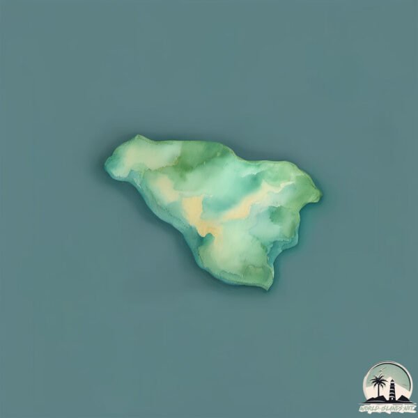
Geography and size of Horse Isle
Size: 0.201 km²
Coastline: 1.9 km
Ocean: Atlantic Ocean
Sea: Inner Seas off the West Coast of Scotland
Continent: Europe
Horse Isle is a Tiny Island spanning 0.201 km² with a coastline of 1.9 km.
Archipel: British Isles – A group of islands off the northwest coast of mainland Europe, including Great Britain, Ireland, and over 6,000 smaller islands, known for their rich history and cultural diversity.
Tectonic Plate: Eurasia – One of the world’s largest tectonic plates, the Eurasian Plate covers a significant portion of Europe and Asia. It’s characterized by diverse geological features, including the Ural Mountains, the European Plain, and the Himalayas formed from its collision with the Indian Plate.
The geographic heart of the island is pinpointed at these coordinates:
Latitude: 55.64553736 / Longitude: -4.84268805
Climate and weather of Horse Isle
Climate Zone: Temperate
Climate Details: Temperate Oceanic Climate
Temperature: Warm Summer
Climate Characteristics: Known for its moderate year-round temperatures with ample rainfall and no dry season. Warm summers are characteristic.
Topography and nature of Horse Isle
Timezone: UTC±00:00
Timezone places: Europe/London
Max. Elevation: -7 m
Mean Elevation: -8 m
Vegetation: Herbaceous Cover
Tree Coverage: 69%
The mean elevation is -8 m. Remarkably, this unique island barely emerges above the sea level, showcasing nature’s fascinating interplay with the ocean. The island is characterized by Plains: Flat, low-lying lands characterized by a maximum elevation of up to 200 meters. On islands, plains are typically coastal lowlands or central flat areas.
Dominating Vegetation: Herbaceous Cover
Comprising mainly of grasses, herbs, and ferns, these areas are common in prairies, meadows, and savannas, and can vary widely in species composition. Horse Isle has a tree cover of 69 %.
Vegetation: 1 vegetation zones – Minimal Diversity Island
These islands exhibit the most basic level of ecological diversity, often characterized by a single dominant vegetation type. This could be due to extreme environmental conditions, limited land area, or significant human impact. They represent unique ecosystems where specific species have adapted to thrive in these singular environments.
Infrastructure and Travelling to Horse Isle
Does the island have a public airport? no.
There is no public and scheduled airport on Horse Isle. The nearest airport is Glasgow Prestwick Airport, located 32 km away.
Does the island have a major port? no.
There are no major ports on Horse Isle. The closest major port is ARDROSSAN, approximately 3 km away.
The mean population of Horse Isle is 9 per km². Horse Isle is Gently Populated. The island belongs to United Kingdom.
Continuing your journey, Great Cumbrae Island is the next notable island, situated merely km away.
United Kingdom is classified as Developed region: G7: Group of Seven – Major advanced economies, including Canada, France, Germany, Italy, Japan, the United Kingdom, and the United States. The level of income is High income: OECD.
News – Latest Updates and Headlines from Horse Isle
Stay informed with the most recent news and important headlines from Horse Isle. Here’s a roundup of the latest developments.
- Zimmermann opens a boutique in Vienna - FashionNetwork Franceby "united-kingdom" - Google News on 26 March 2026
Zimmermann opens a boutique in Vienna FashionNetwork France
- Britain and the Trump corollary - Britain’s Worldby "united-kingdom" - Google News on 26 March 2026
Britain and the Trump corollary Britain’s World
- How New UK National Insurance Rules Will Impact British Expats' State Pensions - deVere Groupby "united-kingdom" - Google News on 26 March 2026
How New UK National Insurance Rules Will Impact British Expats' State Pensions deVere Group
- Bible Society retracts claims from Quiet Revival report after a year of campaigning for accurate data - Humanists UKby "united-kingdom" - Google News on 26 March 2026
Bible Society retracts claims from Quiet Revival report after a year of campaigning for accurate data Humanists UK
- Dodgers and Uniqlo announce historic partnership - FashionNetwork Franceby "united-kingdom" - Google News on 26 March 2026
Dodgers and Uniqlo announce historic partnership FashionNetwork France
- Africa mobilises its resources to transform its cotton industry - FashionNetwork Franceby "united-kingdom" - Google News on 26 March 2026
Africa mobilises its resources to transform its cotton industry FashionNetwork France
- Spirit of America: UK leaders, Lamont reflect on countries’ relationship during Fort Griswold tour - WTNH.comby "united-kingdom" - Google News on 26 March 2026
Spirit of America: UK leaders, Lamont reflect on countries’ relationship during Fort Griswold tour WTNH.com
- Matthew M. Williams Appointed fashion creative director at Oakley - FashionNetwork Franceby "united-kingdom" - Google News on 26 March 2026
Matthew M. Williams Appointed fashion creative director at Oakley FashionNetwork France
- Shein publishes startling study on circular fashion - FashionNetwork Franceby "united-kingdom" - Google News on 26 March 2026
Shein publishes startling study on circular fashion FashionNetwork France
- The United Kingdom’s military-industrial footprint in the Middle East examined - Action on Armed Violence - AOAVby "united-kingdom" - Google News on 26 March 2026
The United Kingdom’s military-industrial footprint in the Middle East examined Action on Armed Violence - AOAV
Please note: The data used here has been primarily extracted from satellite readings. Deviations from exact values may occur, particularly regarding the height of elevations and population density. Land area and coastline measurements refer to average values at mean high tide.