Welcome to Île Beaulieu, a Continental island in the Gulf of St. Lawrence, part of the majestic Atlantic Ocean. This guide offers a comprehensive overview of what makes Île Beaulieu unique – from its geography and climate to its population, infrastructure, and beyond. Dive into the details:
Geography and size of Île Beaulieu
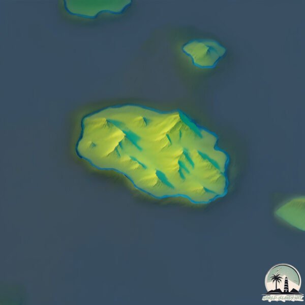
Size: 0.474 km²
Coastline: 2.7 km
Ocean: Atlantic Ocean
Sea: Gulf of St. Lawrence
Continent: North America
Île Beaulieu is a Tiny Island spanning 0.474 km² with a coastline of 2.7 km.
Archipel: –
Tectonic Plate: North America – Covers North America and parts of the Atlantic and Arctic Oceans, characterized by diverse geological features and varying levels of seismic activity.
The geographic heart of the island is pinpointed at these coordinates:
Latitude: 50.66430391 / Longitude: -59.22001025
Climate and weather of Île Beaulieu
Climate Zone: Continental
Climate Details: Subarctic Climate
Temperature: Cold Summer
Climate Characteristics: Characterized by long, extremely cold winters and short, cool summers, often found in northern latitudes of North America and Eurasia.
Topography and nature of Île Beaulieu
Timezone: UTC-04:00
Timezone places: America/La_Paz
Max. Elevation: 8 m
Mean Elevation: 2 m
Vegetation: Open Woodland
Tree Coverage: 97%
The mean elevation is 2 m. The highest elevation on the island reaches approximately 8 meters above sea level. The island is characterized by Plains: Flat, low-lying lands characterized by a maximum elevation of up to 200 meters. On islands, plains are typically coastal lowlands or central flat areas.
Dominating Vegetation: Open Woodland
Characterized by sparsely distributed trees with open canopy allowing sunlight to penetrate, supporting grasses and shrubs underneath. Often found in drier or transitional environments. Île Beaulieu has a tree cover of 97 %.
Vegetation: 1 vegetation zones – Minimal Diversity Island
These islands exhibit the most basic level of ecological diversity, often characterized by a single dominant vegetation type. This could be due to extreme environmental conditions, limited land area, or significant human impact. They represent unique ecosystems where specific species have adapted to thrive in these singular environments.
Infrastructure and Travelling to Île Beaulieu
Does the island have a public airport? no.
There is no public and scheduled airport on Île Beaulieu. The nearest airport is Tête-à-la-Baleine Airport, located 18 km away.
Does the island have a major port? no.
There are no major ports on Île Beaulieu. The closest major port is CORNER BROOK, approximately 236 km away.
The mean population of Île Beaulieu is per km². Île Beaulieu is . The island belongs to Canada.
Continuing your journey, Île du Petit Mécatina is the next notable island, situated merely km away.
Île de Beaulieu (La pointe de la madeleine) Nantes🎥✈️🤘😉
Nouvelle vidéo sur Nantes un lieu que j'avais pas filmer avec mon drone et le lieu étais magnifique ❤️. Mais on a marcher ...Île de Beaulieu (La pointe de la madeleine) Nantes🎥✈️🤘😉
Nouvelle vidéo sur Nantes un lieu que j'avais pas filmer avec mon ...
Nouvelle vidéo sur Nantes un lieu que j'avais pas filmer avec mon drone et le lieu étais magnifique ❤️. Mais on a marcher ...
Tour de l’île Beaulieu, île de Nantes Loire
Petit tour de l'ile Beaulieu à Nantes ...
L'île solitaire - Film complet français - Philippine Leroy-Beaulieu
Trois enfants de la DDASS, profitent d'une sortie en Bretagne pour ...
Trois enfants de la DDASS, profitent d'une sortie en Bretagne pour fuguer. Ils se cachent dans la barque d'Eric, un sculpteur ...
The Uk's Mystery Inland Islands
Beaulieu and Le Cob holiday home rentals
Welcome to the Island of Noirmoutier and to Beaulieu and Le Cob ...
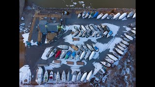
Drone marina ile perrot 2021 févriers
Most Controversial Island in Europe - Faroe Islands 🥶 #europe #island #faroeislands #travel #explore
Most Controversial Island in Europe - Faroe Islands Welcome to ...
Most Controversial Island in Europe - Faroe Islands Welcome to official youtube channel "Global Explorer 69" If there is any ...
Top 10 Places On The French Riviera - Travel Guide
The French Riviera, also known as the Côte d'Azur, is one of the most ...
The French Riviera, also known as the Côte d'Azur, is one of the most incredible regions in Europe. Enjoy this travel guide across ...
Snorkeling in Similan Island National Park Thailand
snorkeling #thailand #similan #underwater #fishes #shorts.
snorkeling #thailand #similan #underwater #fishes #shorts.
I'm Building a Pond on an Island?! Design Part 1
Today we are heading back to Lake Erie Islands Nature & Wildlife ...
Today we are heading back to Lake Erie Islands Nature & Wildlife Center in Put In Bay Ohio! This is our second project at this ...
Aquascape Floating Plant Island for Aquatic Plants
The Aquascape Floating Plant Island is ideal for displaying aquatic ...
The Aquascape Floating Plant Island is ideal for displaying aquatic plants in deeper areas of ponds where no plant shelves are ...
St-Laurent, Île d'Orléans, 4k Drone footage
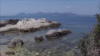
📍Saint Jean Cap-Ferrat, Paloma Beach & Beaulieu-sur-mer 🇫🇷 #shortvideo #travel #shorts #summer
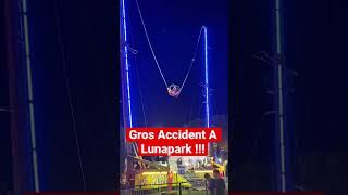
Accident De Manège A Lunapark ! 🥶
Tom Cunliffe approaching the Iles Chausey
Tom Cunliffe's reflections on entering the Iles Chausey of the North ...
Tom Cunliffe's reflections on entering the Iles Chausey of the North French coast. If you're interested in sailing, things maritime ...
Je visite une VILLA DE LUXE à 11,800,000 € sur l’île MAURICE avec une cave sous-marine !
Salut tout le monde, content de vous retrouver pour une nouvelle ...
Salut tout le monde, content de vous retrouver pour une nouvelle visite sur Lacroix Studio. Avant de commencer la visite, venez ...
Opened the door to Ancient Greece on the Cote d'Azur. Do you know where Villa Kerylos is located?
Nexity Yleo Nantes
Nexity Yleo Nantes Réalisation vidéo : L'Art en boîte / Claro Films.
Nexity Yleo Nantes Réalisation vidéo : L'Art en boîte / Claro Films.
Destiny Garden Villas - Ile Maurice
Projet de villas à Grand Baie, Ile Maurice. Pour plus de ...
Projet de villas à Grand Baie, Ile Maurice. Pour plus de renseignements, nous contacter : Tel: +230 5739 7116 Email: ...
mandat-6422 Nantes
Ce programme immobilier neuf de standing propose 39 appartements neufs ...
Ce programme immobilier neuf de standing propose 39 appartements neufs du T2 au T5, avec cellier et raccordés au réseau de ...
Boat trip to the Lerins islands, French Riviera
Île Sainte-Marguerite and Île Saint-Honorat (the Lerin islands) are ...
Île Sainte-Marguerite and Île Saint-Honorat (the Lerin islands) are two islands in the french Riviera facing Cannes. You can take a ...
GROS JONCS CAMPSITE***** (ENG) OLERON ISLAND CHARENTE-MARITIME FRANCE
Places That Don't Feel Real 😨🌍 / #shorts #travel #explore #adventure #destination #visit
Places That Don't Feel Real / nature nature sounds / nature 4k / ...
Places That Don't Feel Real / nature nature sounds / nature 4k / beautiful nature /4k video nature Location : Sørvágsvatn ...
SlideShow (Diaporama) octobre à décembre 2018 à l'aube sur l'ile beaulieu
Le ciel magnifique à l'aurore de mi-octobre à mi-décembre 2018 sur ...
Le ciel magnifique à l'aurore de mi-octobre à mi-décembre 2018 sur l'ile Beaulieu à Nantes 44000 France. L'horizon à l'aurore, ...
Les voies cyclables sur l'île Beaulieu de Nantes #vlog #nantes #cycling #cyclisme #cyclotouriste
Abonnez-vous ☑️ Le petit like Le petit commentaire Actives la petite ...
Abonnez-vous ☑️ Le petit like Le petit commentaire Actives la petite cloche Partager la vidéo #vlog #nantes #cycling ...
Canada is classified as Developed region: G7: Group of Seven – Major advanced economies, including Canada, France, Germany, Italy, Japan, the United Kingdom, and the United States. The level of income is High income: OECD.
News – Latest Updates and Headlines from Île Beaulieu
Stay informed with the most recent news and important headlines from Île Beaulieu. Here’s a roundup of the latest developments.
Loading...
Please note: The data used here has been primarily extracted from satellite readings. Deviations from exact values may occur, particularly regarding the height of elevations and population density. Land area and coastline measurements refer to average values at mean high tide.