Île de Grâce
Welcome to Île de Grâce, a Continental island in the Gulf of St. Lawrence, part of the majestic Atlantic Ocean. This guide offers a comprehensive overview of what makes Île de Grâce unique – from its geography and climate to its population, infrastructure, and beyond. Dive into the details:
- Geography and Size: Explore the island’s size and location.
- Climate and Weather: Weather patterns and temperature.
- Topography and Nature: Uncover the natural wonders of the island.
- Infrastructure and Travelling: Insights on reaching, staying, and making the most of your visit.
- News and Headlines: Latest News.
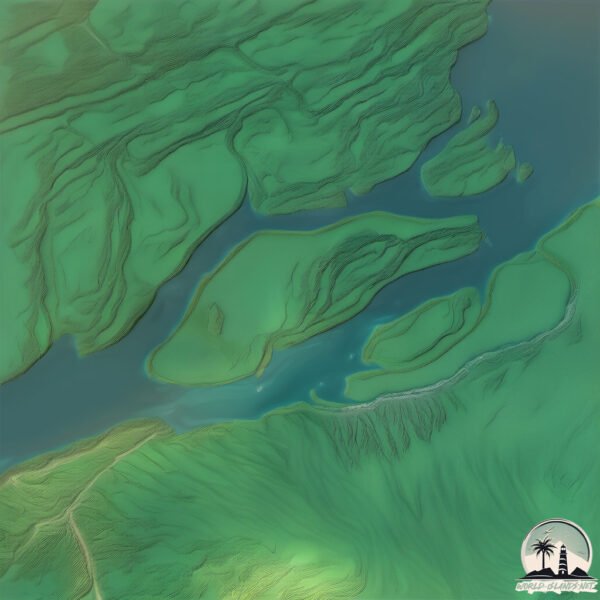
Geography and size of Île de Grâce
Size: 10.9 km²
Coastline: 25.4 km
Ocean: Atlantic Ocean
Sea: Gulf of St. Lawrence
Continent: North America
Île de Grâce is a Medium Island spanning 11 km² with a coastline of 25 km.
Archipel: –
Tectonic Plate: North America – Covers North America and parts of the Atlantic and Arctic Oceans, characterized by diverse geological features and varying levels of seismic activity.
The geographic heart of the island is pinpointed at these coordinates:
Latitude: 46.09022211 / Longitude: -73.03583529
Climate and weather of Île de Grâce
Climate Zone: Continental
Climate Details: Warm-Summer Humid Continental Climate
Temperature: Warm Summer
Climate Characteristics: Features warm summers and cold winters with consistent precipitation, common in higher latitudes.
Topography and nature of Île de Grâce
Timezone: UTC-05:00
Timezone places: America/New_York
Max. Elevation: 8 m
Mean Elevation: 5 m
Vegetation: Open Woodland
Tree Coverage: 57%
The mean elevation is 5 m. The highest elevation on the island reaches approximately 8 meters above sea level. The island is characterized by Plains: Flat, low-lying lands characterized by a maximum elevation of up to 200 meters. On islands, plains are typically coastal lowlands or central flat areas.
Dominating Vegetation: Open Woodland
Characterized by sparsely distributed trees with open canopy allowing sunlight to penetrate, supporting grasses and shrubs underneath. Often found in drier or transitional environments. Île de Grâce has a tree cover of 57 %.
Vegetation: 8 vegetation zones – Very Highly Diverse Island
Islands in this range are ecological powerhouses, showcasing a wide array of vegetation zones. Each zone, from lush rainforests to arid scrublands, coastal mangroves to mountainous regions, contributes to a complex and interdependent ecosystem. These islands are often hotspots of biodiversity, supporting numerous species and intricate ecological processes.
Infrastructure and Travelling to Île de Grâce
Does the island have a public airport? no.
There is no public and scheduled airport on Île de Grâce. The nearest airport is Montréal / Saint-Hubert Airport, located 73 km away.
Does the island have a major port? no.
There are no major ports on Île de Grâce. The closest major port is SOREL, approximately 6 km away.
The mean population of Île de Grâce is 0 per km². Île de Grâce is Uninhabited. The island belongs to Canada.
Continuing your journey, Bouchard is the next notable island, situated merely km away.
Ep. 716, Sulle Spiagge Nascoste di Tablas, Penultima Tappa alle Filippine.


Canada is classified as Developed region: G7: Group of Seven – Major advanced economies, including Canada, France, Germany, Italy, Japan, the United Kingdom, and the United States. The level of income is High income: OECD.
News – Latest Updates and Headlines from Île de Grâce
Stay informed with the most recent news and important headlines from Île de Grâce. Here’s a roundup of the latest developments.
- Chagos : un groupe affirme avoir débarqué à Peros Banhos pour s’y installer durablement - Le Mauricienon 17 February 2026
Chagos : un groupe affirme avoir débarqué à Peros Banhos pour s’y installer durablement Le Mauricien
- Here are the 2025 mayors for Montreal, surrounding regions and across Quebec - CTV Newson 3 November 2025
Here are the 2025 mayors for Montreal, surrounding regions and across Quebec CTV News
- MONTREAL ELECTION: Mayor and councillor results from every borough - CityNews Montrealon 2 November 2025
MONTREAL ELECTION: Mayor and councillor results from every borough CityNews Montreal
- New era in Montreal: Martinez Ferrada elected mayor - Montreal Gazetteon 2 November 2025
New era in Montreal: Martinez Ferrada elected mayor Montreal Gazette
- Greater Montreal mayor and councillor election results - CityNews Montrealon 2 November 2025
Greater Montreal mayor and councillor election results CityNews Montreal
- Easter Island statues may have 'walked' thanks to 'pendulum dynamics' and with as few as 15 people, study finds - Live Scienceon 19 October 2025
Easter Island statues may have 'walked' thanks to 'pendulum dynamics' and with as few as 15 people, study finds Live Science
- Montreal’s scorecard- Key winners and losers of the 2025 federal election - Montreal Gazetteon 29 April 2025
Montreal’s scorecard- Key winners and losers of the 2025 federal election Montreal Gazette
- CANADA VOTES | Live election results across all Montreal ridings - CityNews Montrealon 28 April 2025
CANADA VOTES | Live election results across all Montreal ridings CityNews Montreal
- Election 2025: Ville-Marie—Le Sud-Ouest—Île-des-Sœurs - TheSuburban.comon 23 April 2025
Election 2025: Ville-Marie—Le Sud-Ouest—Île-des-Sœurs TheSuburban.com
- ‘Women in Action’ forum in Montreal celebrates history, focuses on future change - CityNews Montrealon 15 April 2025
‘Women in Action’ forum in Montreal celebrates history, focuses on future change CityNews Montreal
Please note: The data used here has been primarily extracted from satellite readings. Deviations from exact values may occur, particularly regarding the height of elevations and population density. Land area and coastline measurements refer to average values at mean high tide.