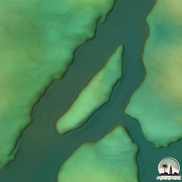
Welcome to Île Du Sablé, a Continental island in the Gulf of St. Lawrence, part of the majestic Atlantic Ocean. This guide offers a comprehensive overview of what makes Île Du Sablé unique – from its geography and climate to its population, infrastructure, and beyond. Dive into the details:
Geography and size of Île Du Sablé
Size: 0.109 km²
Coastline: 2.1 km
Ocean: Atlantic Ocean
Sea: Gulf of St. Lawrence
Continent: North America
Île Du Sablé is a Tiny Island spanning 0.109 km² with a coastline of 2.1 km.
Archipel: –
Tectonic Plate: North America – Covers North America and parts of the Atlantic and Arctic Oceans, characterized by diverse geological features and varying levels of seismic activity.
The geographic heart of the island is pinpointed at these coordinates:
Latitude: 46.06340185 / Longitude: -73.15886881
Climate and weather of Île Du Sablé
Climate Zone: Continental
Climate Details: Warm-Summer Humid Continental Climate
Temperature: Warm Summer
Climate Characteristics: Features warm summers and cold winters with consistent precipitation, common in higher latitudes.
Topography and nature of Île Du Sablé
Timezone: UTC-05:00
Timezone places: America/New_York
Max. Elevation: 4 m
Mean Elevation: 3 m
Vegetation: Cultivated Land
Tree Coverage: 1%
The mean elevation is 3 m. The highest elevation on the island reaches approximately 4 meters above sea level. The island is characterized by Plains: Flat, low-lying lands characterized by a maximum elevation of up to 200 meters. On islands, plains are typically coastal lowlands or central flat areas.
Dominating Vegetation: Cultivated Land
Areas dedicated to agricultural activities, growing crops like grains, vegetables, and fruits. These lands are usually human-modified landscapes. Île Du Sablé has a tree cover of 1 %.
Vegetation: 2 vegetation zones – Low Diversity Island
Islands with two distinct vegetation zones offer slightly more ecological variety. These zones could be due to differences in elevation, moisture, or other environmental factors. While still limited in biodiversity, these islands may offer a contrast between the two zones, such as a coastline with mangroves and an inland area with grassland.
Infrastructure and Travelling to Île Du Sablé
Does the island have a public airport? no.
There is no public and scheduled airport on Île Du Sablé. The nearest airport is Montréal / Saint-Hubert Airport, located 67 km away.
Does the island have a major port? no.
There are no major ports on Île Du Sablé. The closest major port is SOREL, approximately 5 km away.
The mean population of Île Du Sablé is 40 per km². Île Du Sablé is Gently Populated. The island belongs to Canada.
Continuing your journey, Île de Grâce is the next notable island, situated merely km away.
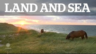
Land & Sea: Sable Island
Sable Island is soon to be one of Canada's newest national parks. But what is the balance between giving more people access to ...Land & Sea: Sable Island
Sable Island is soon to be one of Canada's newest national parks. But ...
Sable Island is soon to be one of Canada's newest national parks. But what is the balance between giving more people access to ...
L’impact des chevaux sauvages de l’île de Sable | La semaine verte
Quelque 600 chevaux sauvages errent en toute liberté sur la ...
Quelque 600 chevaux sauvages errent en toute liberté sur la mystérieuse île de Sable, en Nouvelle-Écosse. Ils pourraient avoir ...
Take a Trip With us to the Famous Sable Island, Where Wild Horses Roam
Wild horses and gray seals mingle on the snow-covered sand dunes of ...
Wild horses and gray seals mingle on the snow-covered sand dunes of this famous National Park Reserve. The Weather ...
Sable Island As you've never seen before
Last Summer I was given the opportunity of a lifetime to travel to one ...
Last Summer I was given the opportunity of a lifetime to travel to one of the most remote wonders of the world. Sable Island, now a ...
Découvrez la Réserve de parc national de l’Île-de-Sable
Au large, dans l'Atlantique Nord, se trouve la réserve de parc ...
Au large, dans l'Atlantique Nord, se trouve la réserve de parc national de l'Île-de-Sable, une île sablonneuse sauvage balayée ...
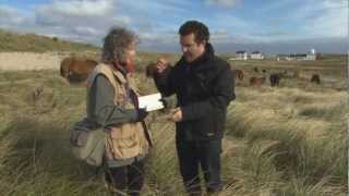
The Secret of Sable Island
Sable Island Stories: Shipwrecks & The Humane Establishment
Learn more about what is perhaps the most intriguing and mysterious ...
Learn more about what is perhaps the most intriguing and mysterious element of Sable Island, its famous shipwreck history.
Facts About Sable Island by Elizabeth Connors
2013 Friends of Sable Island Scholarship Co-Winner Facts About Sable ...
2013 Friends of Sable Island Scholarship Co-Winner Facts About Sable Island- Reflective Statement My video, Facts About Sable ...
L'Ile de sable, une nature unique au monde
Située à 300km au sud-est d'Halifax, l'Ile de Sable est battue par les ...
Située à 300km au sud-est d'Halifax, l'Ile de Sable est battue par les vagues, balayée par les vents et enveloppée jusqu'à deux ...
Canada's Island of Horses? | Canada's Strangest Islands Part 3. | Sable Island
In this video we talk about Sable Island, including its unique ...
In this video we talk about Sable Island, including its unique geography and wildlife on this edition of Canada's Strangest Islands.
WORLD'S Secret Island? The Sable Island
Join us as we uncover the secrets of Sable Island, a mysterious ...
Join us as we uncover the secrets of Sable Island, a mysterious Atlantic gem known for its wild horses and unique ecosystem.
Qu'est-il arrivé aux phoques de l'île de sable ?
En 1993, une chercheuse spécialiste de cette île isolée a repéré ...
En 1993, une chercheuse spécialiste de cette île isolée a repéré plusieurs dizaines de cadavres de phoques qui portaient ...
Walkabout S3E12 Sable Island Part 1
S3E12: In the first of a two part episode we find ourselves 300km ...
S3E12: In the first of a two part episode we find ourselves 300km southeast of Halifax on a sand dune rising above the Atlantic ...
Une journée sur l'île de Sable #shorts | Parcs Canada
Joignez-vous à l'assistante à l'experiénce du visiteur à la Réserve de ...
Joignez-vous à l'assistante à l'experiénce du visiteur à la Réserve de parc national de l'Île-de-Sable alors qu'elle accueille et ...
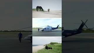
Sable Island Photography #sableisland #helicopter #novascotia #wildhorses
Sable Island Stories: First Settlers of Sable Island
Presenting a complete timeline of Sable Island, back to the earliest ...
Presenting a complete timeline of Sable Island, back to the earliest records of its existence. As much as the island itself has ...
RMR: Rick Visits Sable Island
Rick visits one of Canada's newest national parks off the coast of ...
Rick visits one of Canada's newest national parks off the coast of Nova Scotia.
The Graveyard of the Atlantic; Canada's Isolated Island
The graveyard of the Atlantic Ocean where more than 200 shipwrecks ...
The graveyard of the Atlantic Ocean where more than 200 shipwrecks have occurred is a highly remote island named Sable ...
Shipwrecks and Graves: The Ruins of Cape Sable Island
If you enjoyed this video, please consider joining my Patreon to help ...
If you enjoyed this video, please consider joining my Patreon to help create more videos like this!
150 Sable Island wild horses died last winter, Parks Canada reports
Sable Island ecologist Dan Kehler says the horses are most vulnerable ...
Sable Island ecologist Dan Kehler says the horses are most vulnerable in late winter when their energy reserves are low and ...
Canada’s Wild Horse Island
Sable Island in Canada is home to a unique population of wild horses ...
Sable Island in Canada is home to a unique population of wild horses that roam free across its remote landscape.
Isla "móvil" de arena: cómo Sable pasó de ser una asesina de barcos a un reino de caballos y focas.
Sean bienvenidos a un nuevo episodio de Paradoja. Hoy hablaremos sobre ...
Sean bienvenidos a un nuevo episodio de Paradoja. Hoy hablaremos sobre un lugar misterioso, del que poco se sabe…y esta ...
Les Terribles épreuves des Naufragés de Tromelin, l'île de sable
En 1761, un navire fait naufrage sur une île minuscule au milieu de ...
En 1761, un navire fait naufrage sur une île minuscule au milieu de l'océan Indien. 88 esclaves malgaches y sont abandonnés, ...
Sable Island Horses: Resistance and Survival in a Safe Environment #horses #animals #animal
Sable Island: The Enigmatic Home of Wild Horses Nestled in the ...
Sable Island: The Enigmatic Home of Wild Horses Nestled in the Atlantic Ocean, approximately 300 kilometers southeast of ...
flying over Sable Island NPR
Canada is classified as Developed region: G7: Group of Seven – Major advanced economies, including Canada, France, Germany, Italy, Japan, the United Kingdom, and the United States. The level of income is High income: OECD.
News – Latest Updates and Headlines from Île Du Sablé
Stay informed with the most recent news and important headlines from Île Du Sablé. Here’s a roundup of the latest developments.
Loading...
Please note: The data used here has been primarily extracted from satellite readings. Deviations from exact values may occur, particularly regarding the height of elevations and population density. Land area and coastline measurements refer to average values at mean high tide.