Île Pierre
Welcome to Île Pierre, a Tropical island in the Indian Ocean, part of the majestic Indian Ocean. This guide offers a comprehensive overview of what makes Île Pierre unique – from its geography and climate to its population, infrastructure, and beyond. Dive into the details:
- Geography and Size: Explore the island’s size and location.
- Climate and Weather: Weather patterns and temperature.
- Topography and Nature: Uncover the natural wonders of the island.
- Infrastructure and Travelling: Insights on reaching, staying, and making the most of your visit.
- News and Headlines: Latest News.
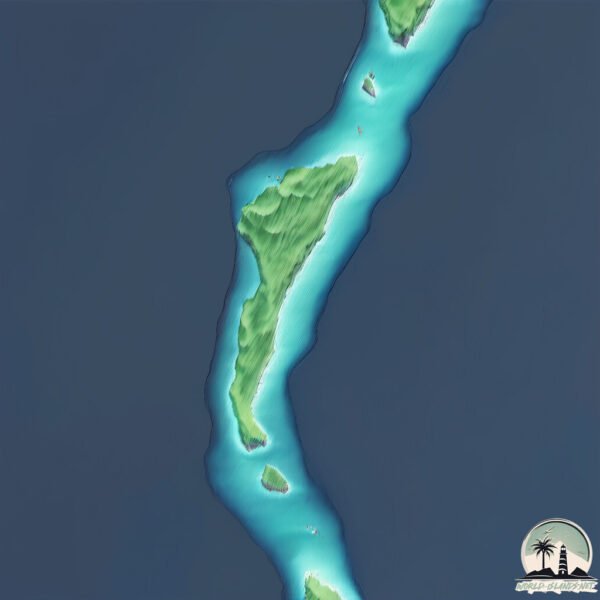
Geography and size of Île Pierre
Size: 1.363 km²
Coastline: 9.2 km
Ocean: Indian Ocean
Sea: Indian Ocean
Continent: Seven seas (open ocean)
Île Pierre is a Small Island spanning 1.4 km² with a coastline of 9.2 km.
Archipel: Chagos Archipelago – A group of atolls in the Indian Ocean, known for the Diego Garcia military base and their rich marine biodiversity.
Tectonic Plate: South Bismarck – Located north of New Guinea and east of the North Bismarck Plate, involved in complex interactions with the Pacific Plate, contributing to the region’s seismicity.
The geographic heart of the island is pinpointed at these coordinates:
Latitude: -5.29314565 / Longitude: 71.73827356
Climate and weather of Île Pierre
Climate Zone: Tropical
Climate Details: Tropical Monsoon Climate
Temperature: Hot
Climate Characteristics: Characterized by heavy rainfall, high humidity, and uniformly high temperatures, but with a distinct short dry season. It features a seasonal reversal of prevailing wind directions.
Topography and nature of Île Pierre
Timezone: UTC+06:00
Timezone places: Indian/Chagos
Max. Elevation: 7 m
Mean Elevation: 6 m
Vegetation: Open Woodland
Tree Coverage: 95%
The mean elevation is 6 m. The highest elevation on the island reaches approximately 7 meters above sea level. The island is characterized by Plains: Flat, low-lying lands characterized by a maximum elevation of up to 200 meters. On islands, plains are typically coastal lowlands or central flat areas.
Dominating Vegetation: Open Woodland
Characterized by sparsely distributed trees with open canopy allowing sunlight to penetrate, supporting grasses and shrubs underneath. Often found in drier or transitional environments. Île Pierre has a tree cover of 95 %.
Vegetation: 3 vegetation zones – Moderately Diverse Island
These islands start to show a broader range of ecological niches. With three vegetation zones, they may offer a mix of ecosystems like coastal areas, inland woods, and perhaps a distinct wetland or dry area. This diversity supports a wider range of flora and fauna, making these islands more ecologically complex than those with minimal diversity.
Infrastructure and Travelling to Île Pierre
Does the island have a public airport? no.
There is no public and scheduled airport on Île Pierre. The nearest airport is Gan International Airport, located 533 km away.
Does the island have a major port? no.
There are no major ports on Île Pierre. The closest major port is DIEGO GARCIA, approximately 241 km away.
The mean population of Île Pierre is per km². Île Pierre is . The island belongs to United Kingdom.
Continuing your journey, Sri Lanka is the next notable island, situated merely km away.
Newfoundland Travel Guide: Saint Pierre and Miquelon Vacation - North America's France


United Kingdom is classified as Developed region: G7: Group of Seven – Major advanced economies, including Canada, France, Germany, Italy, Japan, the United Kingdom, and the United States. The level of income is High income: OECD.
News – Latest Updates and Headlines from Île Pierre
Stay informed with the most recent news and important headlines from Île Pierre. Here’s a roundup of the latest developments.
- Healthguard Distribution powers Sri Lanka’s ‘Port to Pharmacy’ medicine supply chain - Island.lkby "Sri Lanka island" - Google News on 23 March 2026
Healthguard Distribution powers Sri Lanka’s ‘Port to Pharmacy’ medicine supply chain Island.lk
- Policy certainty: The real investment test for Sri Lanka in 2026 - Island.lkby "Sri Lanka island" - Google News on 23 March 2026
Policy certainty: The real investment test for Sri Lanka in 2026 Island.lk
- Samsung Sri Lanka launches Galaxy S26 Series with advanced AI - Island.lkby "Sri Lanka island" - Google News on 23 March 2026
Samsung Sri Lanka launches Galaxy S26 Series with advanced AI Island.lk
- Sri Lanka, ICRC to develop unified national database for missing persons - Island.lkby "Sri Lanka island" - Google News on 23 March 2026
Sri Lanka, ICRC to develop unified national database for missing persons Island.lk
- Sri Lanka’s biodiversity: A living laboratory from backyard to ocean depths - Island.lkby "Sri Lanka island" - Google News on 23 March 2026
Sri Lanka’s biodiversity: A living laboratory from backyard to ocean depths Island.lk
- COPF reviews global crisis impact on Lanka - Island.lkby "Sri Lanka island" - Google News on 23 March 2026
COPF reviews global crisis impact on Lanka Island.lk
- Toward a people-friendly transport system in Sri Lanka - Island.lkby "Sri Lanka island" - Google News on 23 March 2026
Toward a people-friendly transport system in Sri Lanka Island.lk
- The Indian Ocean as a zone of peace - Island.lkby "Sri Lanka island" - Google News on 22 March 2026
The Indian Ocean as a zone of peace Island.lk
- Russia Joins India, UK, China, Germany and Australia as Sri Lanka Sees Explosive Tourist Surge Over 100,000 in Just 18 Days of March 2026 – What You Need to Know - Travel And Tour Worldby "Sri Lanka island" - Google News on 21 March 2026
Russia Joins India, UK, China, Germany and Australia as Sri Lanka Sees Explosive Tourist Surge Over 100,000 in Just 18 Days of March 2026 – What You Need to Know Travel And Tour World
- Sri Lanka says it denied US request to land two aircraft at Mattala airport - Island.lkby "Sri Lanka island" - Google News on 21 March 2026
Sri Lanka says it denied US request to land two aircraft at Mattala airport Island.lk
Please note: The data used here has been primarily extracted from satellite readings. Deviations from exact values may occur, particularly regarding the height of elevations and population density. Land area and coastline measurements refer to average values at mean high tide.