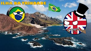
Ilha da Trindade
Welcome to Ilha da Trindade, a Tropical island in the South Atlantic Ocean, part of the majestic Atlantic Ocean. This guide offers a comprehensive overview of what makes Ilha da Trindade unique – from its geography and climate to its population, infrastructure, and beyond. Dive into the details:
- Geography and Size: Explore the island’s size and location.
- Climate and Weather: Weather patterns and temperature.
- Topography and Nature: Uncover the natural wonders of the island.
- Infrastructure and Travelling: Insights on reaching, staying, and making the most of your visit.
- News and Headlines: Latest News.
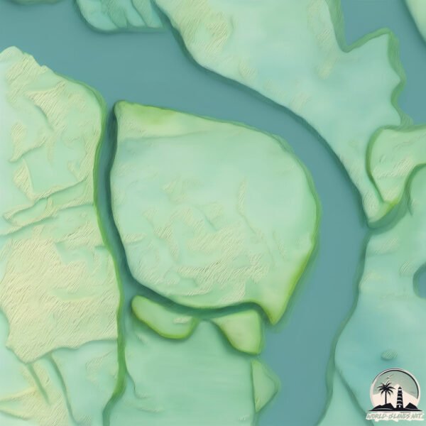
Geography and size of Ilha da Trindade
Size: 9.975 km²
Coastline: 18.4 km
Ocean: Atlantic Ocean
Sea: South Atlantic Ocean
Continent: South America
Ilha da Trindade is a Small Island spanning 10 km² with a coastline of 18.4 km.
Archipel: –
Tectonic Plate: Australia – A major tectonic plate covering Australia, New Zealand, and parts of the Indian and Pacific Oceans, known for its relative stability and occasional seismic activity.
The geographic heart of the island is pinpointed at these coordinates:
Latitude: -20.50937835 / Longitude: -29.32495619
Climate and weather of Ilha da Trindade
Climate Zone: Tropical
Climate Details: Tropical Savanna, Wet
Temperature: Hot
Climate Characteristics: Defined by distinct wet and dry seasons with high temperatures year-round. Pronounced rainfall occurs during the wet season, while the dry season is marked by drought.
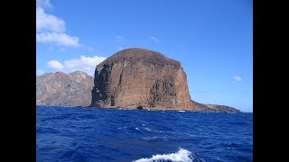
Topography and nature of Ilha da Trindade
Timezone: UTC-02:00
Timezone places: Atlantic/South_Georgia
Max. Elevation: 380 m
Mean Elevation: 178 m
Vegetation: Shrubland
Tree Coverage: 24%
The mean elevation is 178 m. The highest elevation on the island reaches approximately 380 meters above sea level. The island is characterized by Hills: Gently sloping landforms with rounded tops, having a maximum elevation between 200 and 500 meters. Hills contribute to a varied landscape on islands.
Dominating Vegetation: Shrubland
Dominated by shrubs and small bushes, these areas are typical in dry, rocky, or sandy environments, as well as in regions with poor soil fertility. Ilha da Trindade has a tree cover of 24 %.
Vegetation: 10 vegetation zones – Very Highly Diverse Island
Islands in this range are ecological powerhouses, showcasing a wide array of vegetation zones. Each zone, from lush rainforests to arid scrublands, coastal mangroves to mountainous regions, contributes to a complex and interdependent ecosystem. These islands are often hotspots of biodiversity, supporting numerous species and intricate ecological processes.
Infrastructure and Travelling to Ilha da Trindade
Does the island have a public airport? no.
There is no public and scheduled airport on Ilha da Trindade. The nearest airport is Porto Seguro Airport, located 1172 km away.
Does the island have a major port? no.
There are no major ports on Ilha da Trindade. The closest major port is PORTOCEL, approximately 1192 km away.
The mean population of Ilha da Trindade is 0 per km². Ilha da Trindade is Uninhabited. The island belongs to Brazil.
Continuing your journey, Ilha de Bolpeba is the next notable island, situated merely km away.
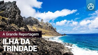
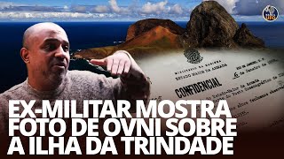
Ilha da Trindade - A Grande Reportagem


Brazil is classified as Emerging region: BRIC: Brazil, Russia, India, and China – Economies noted for their rapid growth and increasing influence on global affairs. The level of income is Upper middle income.
News – Latest Updates and Headlines from Ilha da Trindade
Stay informed with the most recent news and important headlines from Ilha da Trindade. Here’s a roundup of the latest developments.
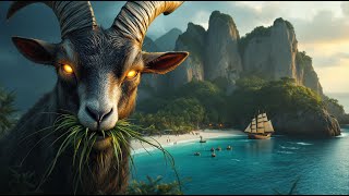
- Brazil has an island so mysterious that only navies and scientists enter: 1.200 km off the coast, Trindade brings together legends of pirate treasure, UFO sightings, and a forest that regenerated after an invasion of goats. - CPG Click Petróleo e Gásby "Ilha da Trindade island" - Google News on 4 March 2026
Brazil has an island so mysterious that only navies and scientists enter: 1.200 km off the coast, Trindade brings together legends of pirate treasure, UFO sightings, and a forest that regenerated after an invasion of goats. CPG Click Petróleo e […]
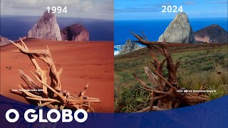
- About 300 years ago, a Briton released goats on a Brazilian island; they multiplied, devastated the vegetation, were eventually eliminated by the Navy, and today the area is experiencing a historic environmental recovery, with a 1.468% increase in forest area. - CPG Click Petróleo e Gásby "Ilha da Trindade island" - Google News on 16 January 2026
About 300 years ago, a Briton released goats on a Brazilian island; they multiplied, devastated the vegetation, were eventually eliminated by the Navy, and today the area is experiencing a historic environmental recovery, with a 1.468% increase in […]
- Ilha oceânica mais misteriosa do Brasil recupera parte da floresta após eliminar cabras - O Globoby "Ilha da Trindade island" - Google News on 15 January 2026
Ilha oceânica mais misteriosa do Brasil recupera parte da floresta após eliminar cabras O Globo
- Green turtle nests are burying plastic rocks on a remote island; scientists warn that the trash becomes part of the soil, can remain buried for millions of years, and threatens eggs, hatchlings, and the future survival of the species on the planet today - CPG Click Petróleo e Gásby "Ilha da Trindade island" - Google News on 14 January 2026
Green turtle nests are burying plastic rocks on a remote island; scientists warn that the trash becomes part of the soil, can remain buried for millions of years, and threatens eggs, hatchlings, and the future survival of the species on the planet […]
- How Brazil made the British Empire retreat without firing a shot by defeating the world's largest navy in the Trinidad and Tobago Crisis. - CPG Click Petróleo e Gásby "Ilha da Trindade island" - Google News on 8 January 2026
How Brazil made the British Empire retreat without firing a shot by defeating the world's largest navy in the Trinidad and Tobago Crisis. CPG Click Petróleo e Gás
- Scientists discover a unique fish species on an isolated island in Brazil; it is colorful, rare, and full of curious adaptations - CPG Click Petróleo e Gásby "Ilha da Trindade island" - Google News on 3 January 2026
Scientists discover a unique fish species on an isolated island in Brazil; it is colorful, rare, and full of curious adaptations CPG Click Petróleo e Gás
- The Cape2Rio Yacht Race Will Be Setting Sail This December - 2oceansvibe Newsby "Ilha da Trindade island" - Google News on 18 December 2025
The Cape2Rio Yacht Race Will Be Setting Sail This December 2oceansvibe News
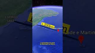
- Brazil's easternmost point is a volcanic archipelago 1.200 km off the coast, home to the country's youngest rocks and with access restricted to military personnel and scientists authorized by the Navy. - CPG Click Petróleo e Gásby "Ilha da Trindade island" - Google News on 9 October 2025
Brazil's easternmost point is a volcanic archipelago 1.200 km off the coast, home to the country's youngest rocks and with access restricted to military personnel and scientists authorized by the Navy. CPG Click Petróleo e Gás
- A Brazilian magnetic island that makes compasses go crazy and planes veer off course? - CPG Click Petróleo e Gásby "Ilha da Trindade island" - Google News on 10 May 2025
A Brazilian magnetic island that makes compasses go crazy and planes veer off course? CPG Click Petróleo e Gás
- Rio de Janeiro, Brazil, Earthquakes: Latest Quakes - Volcano Discoveryby "Ilha da Trindade island" - Google News on 23 March 2024
Rio de Janeiro, Brazil, Earthquakes: Latest Quakes Volcano Discovery
Please note: The data used here has been primarily extracted from satellite readings. Deviations from exact values may occur, particularly regarding the height of elevations and population density. Land area and coastline measurements refer to average values at mean high tide.