Welcome to Ilha da Trindade, a Tropical island in the South Atlantic Ocean, part of the majestic Atlantic Ocean. This guide offers a comprehensive overview of what makes Ilha da Trindade unique – from its geography and climate to its population, infrastructure, and beyond. Dive into the details:
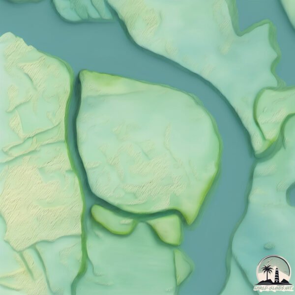
Geography and size of Ilha da Trindade
Size: 2.952 km²
Coastline: 6.8 km
Ocean: Atlantic Ocean
Sea: South Atlantic Ocean
Continent: South America
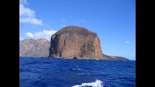
Ilha da Trindade is a Small Island spanning 3 km² with a coastline of 6.8 km.
Archipel: –
Tectonic Plate: South America – A major plate covering the South American continent and part of the Atlantic Ocean, known for the Andes mountain range and significant seismic and volcanic activity.
The geographic heart of the island is pinpointed at these coordinates:
Latitude: -2.93167577 / Longitude: -40.81520473
Climate and weather of Ilha da Trindade
Climate Zone: Tropical
Climate Details: Tropical Savanna, Wet
Temperature: Hot
Climate Characteristics: Defined by distinct wet and dry seasons with high temperatures year-round. Pronounced rainfall occurs during the wet season, while the dry season is marked by drought.
Topography and nature of Ilha da Trindade
Timezone: UTC-03:00
Timezone places: America/Sao_Paulo
Max. Elevation: 2 m
Mean Elevation: 2 m
Vegetation: Wetland
Tree Coverage: 45%
The mean elevation is 2 m. The highest elevation on the island reaches approximately 2 meters above sea level. The island is characterized by Plains: Flat, low-lying lands characterized by a maximum elevation of up to 200 meters. On islands, plains are typically coastal lowlands or central flat areas.
Dominating Vegetation: Wetland
These areas are saturated with water, either permanently or seasonally, and support aquatic plants. Wetlands are important for biodiversity and water filtration. Ilha da Trindade has a tree cover of 45 %.
Vegetation: 1 vegetation zones – Minimal Diversity Island
These islands exhibit the most basic level of ecological diversity, often characterized by a single dominant vegetation type. This could be due to extreme environmental conditions, limited land area, or significant human impact. They represent unique ecosystems where specific species have adapted to thrive in these singular environments.
Infrastructure and Travelling to Ilha da Trindade
Does the island have a public airport? no.
There is no public and scheduled airport on Ilha da Trindade. The nearest airport is Jericoacoara – Comandante Ariston Pessoa Regional Airport, located 50 km away.
Does the island have a major port? no.
There are no major ports on Ilha da Trindade. The closest major port is CAMOCIM, approximately 3 km away.
The mean population of Ilha da Trindade is 58 per km². Ilha da Trindade is Gently Populated. The island belongs to Brazil.
Continuing your journey, Ilha do Caju is the next notable island, situated merely km away.
Ilha da Trindade - A Grande Reportagem
Entre a costa brasileira e o continente africano se destaca um santuário da vida selvagem, isolado no meio do Atlântico. Um lugar ...Ilha da Trindade - A Grande Reportagem
Entre a costa brasileira e o continente africano se destaca um ...
Entre a costa brasileira e o continente africano se destaca um santuário da vida selvagem, isolado no meio do Atlântico. Um lugar ...
Ilha da Trindade Mistério no Meio do Oceano #carcara #ilhadatrindade #misterio #curiosidades
Ajudar o próximo é um gesto de gratidão. Faça uma doação! ...
Ajudar o próximo é um gesto de gratidão. Faça uma doação!
https://livepix.gg/falatuh Assista + videos Sergio Sacani fala quais ...
Lugares Surreais | Ilha da Trindade
Paraíso brasileiro A Ilha da Trindade, localizada a cerca de 1.140 km ...
Paraíso brasileiro A Ilha da Trindade, localizada a cerca de 1.140 km da costa do Espírito Santo, é um dos lugares mais remotos ...
Ilhas oceânicas do Brasil: Trindade e Martim Vaz #geografia #ilhasoceanicas #trindade #martimvaz
Posto Oceânico da Ilha da Trindade (POIT) Onde começa o Brasil!
O Posto Oceânico da Ilha da Trindade (POIT) é um destacamento isolado ...
O Posto Oceânico da Ilha da Trindade (POIT) é um destacamento isolado do 1° DN, sob a responsabilidade do Estado-Maior.
A Ilha da Trindade! #curiosidades #bizarro #fatos #historias #historia
Assista este vídeo em 4k no conforto da sua casa! ...
👽Caso do OVNI na Ilha da Trindade👽Assista ao episódio completo no link da Bio!#ovnis
Conheça o Programa de Pesquisas Científicas na Ilha da Trindade (PROTRINDADE)
Saiba mais sobre o Programa de Pesquisas Científicas na Ilha da ...
Saiba mais sobre o Programa de Pesquisas Científicas na Ilha da Trindade (#PROTRINDADE) que foi lançado em 2007 e tem ...
ILHA DA TRINDADE - LUGAR INCRÍVEL!
Olá gente, tudo bem? Esperamos que sim 🙂 Conheçam agora a ilha mais ...
Olá gente, tudo bem? Esperamos que sim 🙂 Conheçam agora a ilha mais linda do mundo!! Vocês vão amar!! ❤ Link deste vídeo: ...
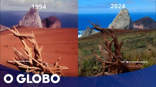
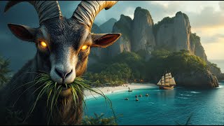
Ilha oceânica mais misteriosa do Brasil recupera parte da floresta após eliminar cabras
A 1180 km da costa, Trindade conseguiu ampliar em 1.468% cobertura ...
A 1180 km da costa, Trindade conseguiu ampliar em 1.468% cobertura verde depois de ser devastada por animais deixados por ...
A HISTÓRIA JAMAIS CONTADA DA ILHA DA TRINDADE: O LEGADO DAS CABRAS DEVASTADORAS!!
Você sabia que cabras introduzidas no século XVIII causaram um enorme ...
Você sabia que cabras introduzidas no século XVIII causaram um enorme impacto na vegetação da Ilha da Trindade, no Atlântico ...
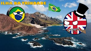
A ILHA QUE TENTARAM ROUBAR DO BRASIL - A ocupação Britânica de Trindade
Olá! No vídeo vamos abordar um fato envolvendo o Brasil e o Império ...
Olá! No vídeo vamos abordar um fato envolvendo o Brasil e o Império Britânica, na mais grave ameaça a integridade nacional ...
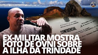
O Caso Ilha da Trindade 1996: Ex-Militar Quebra o Silêncio e Mostra Evidências - Brazil UFO, Relatos
Neste vídeo, trazemos o relato impressionante do Cabo da reserva ...
Neste vídeo, trazemos o relato impressionante do Cabo da reserva Márcio Giazo sobre um avistamento ufológico ocorrido na ...
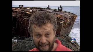
Globo Repórter Ilha de Trindade 1983
Meu pai participou desse Globo Repórter em 1983.
Meu pai participou desse Globo Repórter em 1983.
EVIDÊNCIAS CHOCANTES: ILHA SECRETA NO ATLÂNTICO MUDA TUDO SOBRE A DESCOBERTA DO BRASIL!
Prepare-se: a história da "descoberta" do Brasil pode não ser como ...
Prepare-se: a história da "descoberta" do Brasil pode não ser como você aprendeu na escola! Novas interpretações de mapas ...
As mortais ondas camelos da Ilha da Trindade
Em um mar aparentemente calmo, as ondas surgem em dupla e arrastam a ...
Em um mar aparentemente calmo, as ondas surgem em dupla e arrastam a vítima para o mar. O fenômeno, comum em ilhas ...
O Território Brasileiro Mais Distante do Continente: Arquipélago de Trindade e Martim Vaz
O Brasil Começa Aqui A Ilha da Trindade Revela Seus Segredos
Você sabia que o Brasil começa em uma ilha isolada no meio do ...
Você sabia que o Brasil começa em uma ilha isolada no meio do Atlântico? Neste episódio especial do Capixaba da Gema, ...
Contatos Extraterrestres. - Caso da Ilha da Trindade / Brasil.
No dia 16 de janeiro de 1958, o navio-escola Almirante Saldanha, da ...
No dia 16 de janeiro de 1958, o navio-escola Almirante Saldanha, da Marinha de Guerra do Brasil, se encontrava fundeado na ...
Imagens da Ilha da Trindade, Vitória ES
Imagens da Ilha da Trindade, Vitória ES Registro feito por Marcelo ...
Imagens da Ilha da Trindade, Vitória ES Registro feito por Marcelo Cabral Lamy de Miranda Rede Social Youtube ➥ Se Inscreva: ...
Ilha da Trindade coleciona histórias incríveis e pode ter tesouro inestimável no Brasil
A Ilha da Trindade, uma das ilhas brasileiras mais distantes do ...
A Ilha da Trindade, uma das ilhas brasileiras mais distantes do continente, em alto mar, é envolta em mistérios e curiosidades ...
A ilha brasileira mais próxima da África que vai desaparecer
O Arquipélago de São Pedro e São Paulo é um dos lugares mais Inóspitos ...
O Arquipélago de São Pedro e São Paulo é um dos lugares mais Inóspitos do Brasil, chacoalhado frequentemente por tremores ...
Ilha da Trindade (1/4) - Caminhos da Reportagem
O Caminhos da Reportagem de 17/02/2011 visitou o ponto mais distante ...
O Caminhos da Reportagem de 17/02/2011 visitou o ponto mais distante do Brasil no continente: a Ilha da Trindade. O programa ...
"ILHA da TRINDADE: 12 Homens SUMIRAM… e Tudo Foi Encontrado INTACTO”.
AVISO IMPORTANTE Este vídeo é uma obra de ficção narrativa, criada ...
AVISO IMPORTANTE Este vídeo é uma obra de ficção narrativa, criada exclusivamente para entretenimento. A história é ...
ILHA DA TRINDADE - MISTÉRIO 👽 #ilhas #trindade #misterio #despertar
Brazil is classified as Emerging region: BRIC: Brazil, Russia, India, and China – Economies noted for their rapid growth and increasing influence on global affairs. The level of income is Upper middle income.
News – Latest Updates and Headlines from Ilha da Trindade
Stay informed with the most recent news and important headlines from Ilha da Trindade. Here’s a roundup of the latest developments.
Loading...
Please note: The data used here has been primarily extracted from satellite readings. Deviations from exact values may occur, particularly regarding the height of elevations and population density. Land area and coastline measurements refer to average values at mean high tide.