Ilha do Pinheiro
Welcome to Ilha do Pinheiro, a Tropical island in the South Atlantic Ocean, part of the majestic Atlantic Ocean. This guide offers a comprehensive overview of what makes Ilha do Pinheiro unique – from its geography and climate to its population, infrastructure, and beyond. Dive into the details:
- Geography and Size: Explore the island’s size and location.
- Climate and Weather: Weather patterns and temperature.
- Topography and Nature: Uncover the natural wonders of the island.
- Infrastructure and Travelling: Insights on reaching, staying, and making the most of your visit.
- News and Headlines: Latest News.
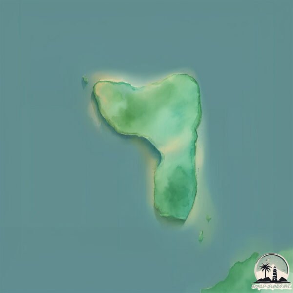
Geography and size of Ilha do Pinheiro
Size: 0.116 km²
Coastline: 1.8 km
Ocean: Atlantic Ocean
Sea: South Atlantic Ocean
Continent: South America
Ilha do Pinheiro is a Tiny Island spanning 0.116 km² with a coastline of 1.8 km.
Archipel: –
Tectonic Plate: South America – A major plate covering the South American continent and part of the Atlantic Ocean, known for the Andes mountain range and significant seismic and volcanic activity.
The geographic heart of the island is pinpointed at these coordinates:
Latitude: -25.35501888 / Longitude: -48.23260872
Climate and weather of Ilha do Pinheiro
Climate Zone: Tropical
Climate Details: Tropical Rainforest Climate
Temperature: Hot
Climate Characteristics: This climate is typified by heavy rainfall throughout the year, high humidity, and consistently high temperatures, leading to lush rainforests and rich biodiversity. Seasonal temperature variations are minimal.
Topography and nature of Ilha do Pinheiro
Timezone: UTC-03:00
Timezone places: America/Sao_Paulo
Max. Elevation: -3 m
Mean Elevation: -4 m
Vegetation: Evergreen Broadleaf Forest
Tree Coverage: 91%
The mean elevation is -4 m. Remarkably, this unique island barely emerges above the sea level, showcasing nature’s fascinating interplay with the ocean. The island is characterized by Plains: Flat, low-lying lands characterized by a maximum elevation of up to 200 meters. On islands, plains are typically coastal lowlands or central flat areas.
Dominating Vegetation: Evergreen Broadleaf Forest
Characterized by dense, lush canopies of broadleaf trees that retain their leaves year-round. These forests are typically found in tropical and subtropical regions and are known for their high biodiversity. Ilha do Pinheiro has a tree cover of 91 %.
Vegetation: 1 vegetation zones – Minimal Diversity Island
These islands exhibit the most basic level of ecological diversity, often characterized by a single dominant vegetation type. This could be due to extreme environmental conditions, limited land area, or significant human impact. They represent unique ecosystems where specific species have adapted to thrive in these singular environments.
Infrastructure and Travelling to Ilha do Pinheiro
Does the island have a public airport? no.
There is no public and scheduled airport on Ilha do Pinheiro. The nearest airport is Afonso Pena Airport, located 106 km away.
Does the island have a major port? no.
There are no major ports on Ilha do Pinheiro. The closest major port is PARANAGUA, approximately 35 km away.
The mean population of Ilha do Pinheiro is 5 per km². Ilha do Pinheiro is Gently Populated. The island belongs to Brazil.
Continuing your journey, Ilha das Peças is the next notable island, situated merely km away.
Ele INVADIU a ILHA de Jeffrey Epstein


Brazil is classified as Emerging region: BRIC: Brazil, Russia, India, and China – Economies noted for their rapid growth and increasing influence on global affairs. The level of income is Upper middle income.
News – Latest Updates and Headlines from Ilha do Pinheiro
Stay informed with the most recent news and important headlines from Ilha do Pinheiro. Here’s a roundup of the latest developments.
- Neymar Heavily Criticized in Brazil After Comments in the Santos Match - beinsports.comby "brazil" - Google News on 3 April 2026
Neymar Heavily Criticized in Brazil After Comments in the Santos Match beinsports.com
- ‘If they pollute our rivers, what will become of us?’: the town divided between hope and fear in Brazil’s Amazon oil rush - The Guardianby "brazil" - Google News on 3 April 2026
‘If they pollute our rivers, what will become of us?’: the town divided between hope and fear in Brazil’s Amazon oil rush The Guardian
- ‘It’s not just Flávio’: is surname-dropping son downplaying Bolsonaro connection? - The Guardianby "brazil" - Google News on 3 April 2026
‘It’s not just Flávio’: is surname-dropping son downplaying Bolsonaro connection? The Guardian
- Amazon fires in Brazil rise 13.2% in March - Plataforma Mediaby "brazil" - Google News on 3 April 2026
Amazon fires in Brazil rise 13.2% in March Plataforma Media
- Brazil Establishes Offshore Wind Guidelines, Prepares Next Steps - offshoreWIND.bizby "brazil" - Google News on 3 April 2026
Brazil Establishes Offshore Wind Guidelines, Prepares Next Steps offshoreWIND.biz
- Brazil’s president vows to shield economy from West Asia conflict fallout - National Heraldby "brazil" - Google News on 3 April 2026
Brazil’s president vows to shield economy from West Asia conflict fallout National Herald
- Aneel okays first BESS linked to solar plant in Brazil - Renewables Nowby "brazil" - Google News on 3 April 2026
Aneel okays first BESS linked to solar plant in Brazil Renewables Now
- Ronaldo Nazário believes that Ancelotti will "fine-tune the small missing details" for Brazil to win World Cup - Gamereactor UKby "brazil" - Google News on 3 April 2026
Ronaldo Nazário believes that Ancelotti will "fine-tune the small missing details" for Brazil to win World Cup Gamereactor UK
- Portugal and Brazil secure opening day victories in San Salvador - Beach Soccer Worldwideby "brazil" - Google News on 3 April 2026
Portugal and Brazil secure opening day victories in San Salvador Beach Soccer Worldwide
- Brazil puts 350-MW solar complex into full operation - Renewables Nowby "brazil" - Google News on 3 April 2026
Brazil puts 350-MW solar complex into full operation Renewables Now
Please note: The data used here has been primarily extracted from satellite readings. Deviations from exact values may occur, particularly regarding the height of elevations and population density. Land area and coastline measurements refer to average values at mean high tide.