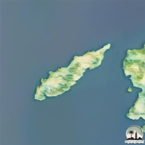
Illa Dragonera
Welcome to Illa Dragonera, a Dry island in the Balearic (Iberian Sea), part of the majestic Atlantic Ocean. This guide offers a comprehensive overview of what makes Illa Dragonera unique – from its geography and climate to its population, infrastructure, and beyond. Dive into the details:
- Geography and Size: Explore the island’s size and location.
- Climate and Weather: Weather patterns and temperature.
- Topography and Nature: Uncover the natural wonders of the island.
- Infrastructure and Travelling: Insights on reaching, staying, and making the most of your visit.
- News and Headlines: Latest News.
Geography and size of Illa Dragonera
Size: 2.822 km²
Coastline: 10.4 km
Ocean: Atlantic Ocean
Sea: Balearic (Iberian Sea)
Continent: Europe
Illa Dragonera is a Small Island spanning 2.8 km² with a coastline of 10.4 km.
Archipel: Balearic Islands – An archipelago off eastern Spain in the Mediterranean Sea, known for their vibrant culture, beautiful beaches, and popular tourist destinations like Mallorca and Ibiza.
Tectonic Plate: Anatolia – A tectonic microplate covering most of Turkey, it’s squeezed between the Eurasian Plate to the north and the African Plate to the south, known for significant seismic activity.
The geographic heart of the island is pinpointed at these coordinates:
Latitude: 39.58448735 / Longitude: 2.3197889
Climate and weather of Illa Dragonera
Climate Zone: Dry
Climate Details: Cold Semi-Arid (Steppe) Climate
Temperature: Cold
Climate Characteristics: Characterized by hot summers and cold winters, this climate is typically found on the edges of continental zones. It receives sufficient precipitation to avoid desert conditions.
Topography and nature of Illa Dragonera
Timezone: UTC+01:00
Timezone places: Europe/Paris
Max. Elevation: 149 m
Mean Elevation: 126 m
Vegetation: Open Woodland
Tree Coverage: 73%
The mean elevation is 126 m. The highest elevation on the island reaches approximately 149 meters above sea level. The island is characterized by Plains: Flat, low-lying lands characterized by a maximum elevation of up to 200 meters. On islands, plains are typically coastal lowlands or central flat areas.
Dominating Vegetation: Open Woodland
Characterized by sparsely distributed trees with open canopy allowing sunlight to penetrate, supporting grasses and shrubs underneath. Often found in drier or transitional environments. Illa Dragonera has a tree cover of 73 %.
Vegetation: 5 vegetation zones – Highly Diverse Island
With five different vegetation zones, these islands offer a rich tapestry of ecosystems. The variety could include dense forests, open meadows, wetlands, coastal zones, and more. This level of diversity supports an intricate web of life, with each zone playing a vital role in the overall ecological health and balance of the island.
Infrastructure and Travelling to Illa Dragonera
Does the island have a public airport? no.
There is no public and scheduled airport on Illa Dragonera. The nearest airport is Palma de Mallorca Airport, located 45 km away.
Does the island have a major port? no.
There are no major ports on Illa Dragonera. The closest major port is PALMA DE MALLORCA, approximately 33 km away.
The mean population of Illa Dragonera is 172 per km². Illa Dragonera is Moderately Inhabited. The island belongs to Spain.
Continuing your journey, Majorca is the next notable island, situated merely km away.
Spain is classified as Developed region: nonG7: Developed economies outside of the Group of Seven, characterized by high income and advanced economic structures. The level of income is High income: OECD.
News – Latest Updates and Headlines from Illa Dragonera
Stay informed with the most recent news and important headlines from Illa Dragonera. Here’s a roundup of the latest developments.
Please note: The data used here has been primarily extracted from satellite readings. Deviations from exact values may occur, particularly regarding the height of elevations and population density. Land area and coastline measurements refer to average values at mean high tide.