Isla Arturo
Welcome to Isla Arturo, a Polar island in the South Pacific Ocean, part of the majestic Pacific Ocean. This guide offers a comprehensive overview of what makes Isla Arturo unique – from its geography and climate to its population, infrastructure, and beyond. Dive into the details:
- Geography and Size: Explore the island’s size and location.
- Climate and Weather: Weather patterns and temperature.
- Topography and Nature: Uncover the natural wonders of the island.
- Infrastructure and Travelling: Insights on reaching, staying, and making the most of your visit.
- News and Headlines: Latest News.
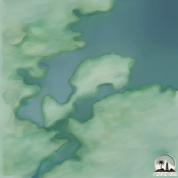
Geography and size of Isla Arturo
Size: 1.413 km²
Coastline: 8.5 km
Ocean: Pacific Ocean
Sea: South Pacific Ocean
Continent: South America
Isla Arturo is a Small Island spanning 1.4 km² with a coastline of 8.5 km.
Archipel: Andes fueguinos – A subregion of Tierra del Fuego in the southernmost tip of South America, known for its rugged mountain landscapes and remote beauty.
Tectonic Plate: Scotia – Situated in the Southern Ocean, surrounding the Scotia Sea, between South America and Antarctica, known for the Scotia Arc and active seismicity.
The geographic heart of the island is pinpointed at these coordinates:
Latitude: -53.49075974 / Longitude: -72.90508439
Climate and weather of Isla Arturo
Climate Zone: Polar
Climate Details: Tundra
Temperature: Cold
Climate Characteristics: The tundra climate features long, extremely cold winters and short, cool summers. Vegetation is limited to mosses, lichens, and small shrubs due to the low temperatures and short growing seasons. Biodiversity is low, but some specialized species thrive.
Topography and nature of Isla Arturo
Timezone: UTC-04:00
Timezone places: America/La_Paz
Max. Elevation: 67 m
Mean Elevation: 52 m
Vegetation: Shrubland
Tree Coverage: 85%
The mean elevation is 52 m. The highest elevation on the island reaches approximately 67 meters above sea level. The island is characterized by Plains: Flat, low-lying lands characterized by a maximum elevation of up to 200 meters. On islands, plains are typically coastal lowlands or central flat areas.
Dominating Vegetation: Shrubland
Dominated by shrubs and small bushes, these areas are typical in dry, rocky, or sandy environments, as well as in regions with poor soil fertility. Isla Arturo has a tree cover of 85 %.
Vegetation: 4 vegetation zones – Diverse Island
Four distinct vegetation zones mark these islands as ecologically diverse. They might feature varied landscapes such as forests, beaches, grasslands, and rocky areas. Such diversity reflects the island’s complex ecological interactions and varied habitats, which can support a rich array of wildlife and plant species.
Infrastructure and Travelling to Isla Arturo
Does the island have a public airport? no.
There is no public and scheduled airport on Isla Arturo. The nearest airport is Lieutenant Julio Gallardo Airport, located 205 km away.
Does the island have a major port? no.
There are no major ports on Isla Arturo. The closest major port is CALETA MINA ELENA, approximately 142 km away.
The mean population of Isla Arturo is 7 per km². Isla Arturo is Gently Populated. The island belongs to Chile.
Continuing your journey, Santa Ines is the next notable island, situated merely km away.
Women divers of the Atauro Island I SLICE

![Most Biodiverse Reef on Earth: Atauro Island [4K] | Timor-Leste from Below (S01E03) | SZtv](https://i.ytimg.com/vi/yEZcqx3euiw/mqdefault.jpg)

Chile is classified as Emerging region: G20: Group of Twenty – Major economies comprising both developed and emerging countries, representing the world’s largest economies. The level of income is Upper middle income.
News – Latest Updates and Headlines from Isla Arturo
Stay informed with the most recent news and important headlines from Isla Arturo. Here’s a roundup of the latest developments.
Please note: The data used here has been primarily extracted from satellite readings. Deviations from exact values may occur, particularly regarding the height of elevations and population density. Land area and coastline measurements refer to average values at mean high tide.