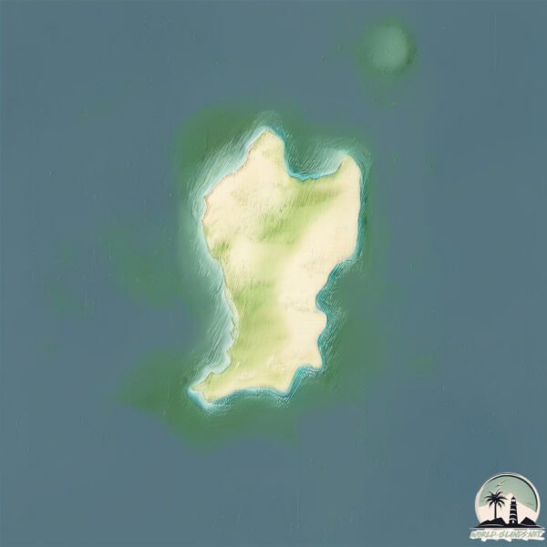
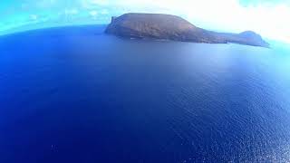
Isla de Montaña Clara
Welcome to Isla de Montaña Clara, a Dry island in the North Atlantic Ocean, part of the majestic Atlantic Ocean. This guide offers a comprehensive overview of what makes Isla de Montaña Clara unique – from its geography and climate to its population, infrastructure, and beyond. Dive into the details:
- Geography and Size: Explore the island’s size and location.
- Climate and Weather: Weather patterns and temperature.
- Topography and Nature: Uncover the natural wonders of the island.
- Infrastructure and Travelling: Insights on reaching, staying, and making the most of your visit.
- News and Headlines: Latest News.
Geography and size of Isla de Montaña Clara
Size: 1.363 km²
Coastline: 6.9 km
Ocean: Atlantic Ocean
Sea: North Atlantic Ocean
Continent: Africa
Isla de Montaña Clara is a Small Island spanning 1.4 km² with a coastline of 6.9 km.
Archipel: Canary Islands – A Spanish archipelago off the coast of northwestern Africa, known for their volcanic landscapes, unique ecosystems, and vibrant cultures.
Tectonic Plate: North America – Covers North America and parts of the Atlantic and Arctic Oceans, characterized by diverse geological features and varying levels of seismic activity.
The geographic heart of the island is pinpointed at these coordinates:
Latitude: 29.29728682 / Longitude: -13.53456343
Climate and weather of Isla de Montaña Clara
Climate Zone: Dry
Climate Details: Hot Deserts Climate
Temperature: Hot
Climate Characteristics: Dominated by extremely hot temperatures, this climate is marked by minimal rainfall and barren landscapes. Nights often experience drastic temperature drops.
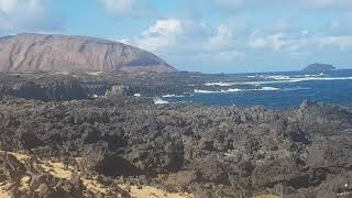
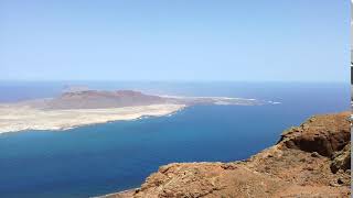
Topography and nature of Isla de Montaña Clara
Timezone: UTC±00:00
Timezone places: Europe/Lisbon
Max. Elevation: 72 m
Mean Elevation: 35 m
Vegetation: Sparse Vegetation
Tree Coverage: 14%
The mean elevation is 35 m. The highest elevation on the island reaches approximately 72 meters above sea level. The island is characterized by Plains: Flat, low-lying lands characterized by a maximum elevation of up to 200 meters. On islands, plains are typically coastal lowlands or central flat areas.
Dominating Vegetation: Sparse Vegetation
These regions have limited plant growth, typically due to extreme conditions like aridity or poor soils. Vegetation is scattered and consists of hardy plant species. Isla de Montaña Clara has a tree cover of 14 %.
Vegetation: 3 vegetation zones – Moderately Diverse Island
These islands start to show a broader range of ecological niches. With three vegetation zones, they may offer a mix of ecosystems like coastal areas, inland woods, and perhaps a distinct wetland or dry area. This diversity supports a wider range of flora and fauna, making these islands more ecologically complex than those with minimal diversity.
Infrastructure and Travelling to Isla de Montaña Clara
Does the island have a public airport? no.
There is no public and scheduled airport on Isla de Montaña Clara. The nearest airport is César Manrique-Lanzarote Airport, located 39 km away.
Does the island have a major port? no.
There are no major ports on Isla de Montaña Clara. The closest major port is ARRECIFE, approximately 38 km away.
The mean population of Isla de Montaña Clara is 90 per km². Isla de Montaña Clara is Gently Populated. The island belongs to Spain.
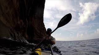
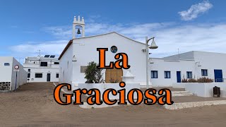
Continuing your journey, Graciosa Island is the next notable island, situated merely km away.
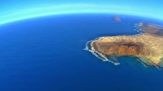
La Graciosa: Lanzarote: A flight to the island Montana Clara


Spain is classified as Developed region: nonG7: Developed economies outside of the Group of Seven, characterized by high income and advanced economic structures. The level of income is High income: OECD.
News – Latest Updates and Headlines from Isla de Montaña Clara
Stay informed with the most recent news and important headlines from Isla de Montaña Clara. Here’s a roundup of the latest developments.
Please note: The data used here has been primarily extracted from satellite readings. Deviations from exact values may occur, particularly regarding the height of elevations and population density. Land area and coastline measurements refer to average values at mean high tide.