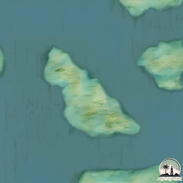
Welcome to Isla Dos Canales, a Temperate island in the South Pacific Ocean, part of the majestic Pacific Ocean. This guide offers a comprehensive overview of what makes Isla Dos Canales unique – from its geography and climate to its population, infrastructure, and beyond. Dive into the details:
Geography and size of Isla Dos Canales
Size: 3.515 km²
Coastline: 12.6 km
Ocean: Pacific Ocean
Sea: South Pacific Ocean
Continent: South America
Isla Dos Canales is a Small Island spanning 3.5 km² with a coastline of 12.6 km.
Archipel: –
Tectonic Plate: South America – A major plate covering the South American continent and part of the Atlantic Ocean, known for the Andes mountain range and significant seismic and volcanic activity.
The geographic heart of the island is pinpointed at these coordinates:
Latitude: -50.88189947 / Longitude: -74.33743337
Climate and weather of Isla Dos Canales
Climate Zone: Temperate
Climate Details: Subpolar Oceanic Climate
Temperature: Cold Summer
Climate Characteristics: Predominantly cold with cool summers and no dry season. Often found in coastal areas at higher latitudes or on islands.
Topography and nature of Isla Dos Canales
Timezone: UTC-04:00
Timezone places: America/La_Paz
Max. Elevation: 66 m
Mean Elevation: 55 m
Vegetation: Evergreen Broadleaf Forest
Tree Coverage: 70%
The mean elevation is 55 m. The highest elevation on the island reaches approximately 66 meters above sea level. The island is characterized by Plains: Flat, low-lying lands characterized by a maximum elevation of up to 200 meters. On islands, plains are typically coastal lowlands or central flat areas.
Dominating Vegetation: Evergreen Broadleaf Forest
Characterized by dense, lush canopies of broadleaf trees that retain their leaves year-round. These forests are typically found in tropical and subtropical regions and are known for their high biodiversity. Isla Dos Canales has a tree cover of 70 %.
Vegetation: 6 vegetation zones – Very Highly Diverse Island
Islands in this range are ecological powerhouses, showcasing a wide array of vegetation zones. Each zone, from lush rainforests to arid scrublands, coastal mangroves to mountainous regions, contributes to a complex and interdependent ecosystem. These islands are often hotspots of biodiversity, supporting numerous species and intricate ecological processes.
Infrastructure and Travelling to Isla Dos Canales
Does the island have a public airport? no.
There is no public and scheduled airport on Isla Dos Canales. The nearest airport is Lieutenant Julio Gallardo Airport, located 217 km away.
Does the island have a major port? no.
There are no major ports on Isla Dos Canales. The closest major port is PUERTO NATALES, approximately 215 km away.
The mean population of Isla Dos Canales is 1 per km². Isla Dos Canales is Uninhabited. The island belongs to Chile.
Continuing your journey, Esperanza is the next notable island, situated merely km away.
ISLANDIA | Los Paisajes Más Impresionantes
Conviértete en miembro de este canal para disfrutar de ventajas exclusivas: ...ISLANDIA | Los Paisajes Más Impresionantes
Conviértete en miembro de este canal para disfrutar de ventajas ...
Conviértete en miembro de este canal para disfrutar de ventajas exclusivas: ...
Todas las ISLAS de Jurassic Park 😱 #mrrelevante #cine #dinosaurios #estrenos #jurassicworld #edits
Los dinosaurios están de regreso… pero esta vez no solo acechan, ...
Los dinosaurios están de regreso… pero esta vez no solo acechan, evolucionan. La nueva entrega de Jurassic World promete ...
SABES CUALES SON LOS LIMITES DE REPÚBLICA DOMINICANA......? #limites #oceano #cordillera
¡Este YouTuber fue a la isla real de El Juego del Calamar! 🏝😱 (Squid Game - VicInTheGame)
Este YouTuber se infiltró en la verdadera isla de El Juego del Calamar ...
Este YouTuber se infiltró en la verdadera isla de El Juego del Calamar y lo grabó TODO! Seguramente ya has oído hablar de la ...
Montoya estalla al ver unas imágenes de Anita con Manuel en la habitación 💥🔥| #mediaset
LaIslaDeLasTentaciones los lunes a las 22:00 horas en #Telecinco ...
LaIslaDeLasTentaciones los lunes a las 22:00 horas en #Telecinco #shorts #Mediaset ⬇️ Síguenos en nuestras redes sociales ...
La isla Sentinel del Norte.
sentinel #sentineldelnorte #tribu #aislada #curiosidades ...
sentinel #sentineldelnorte #tribu #aislada #curiosidades #datoscuriosos #datosinteresantes #reels #shorts.
Este Error le Quitó el Invicto a Islam Makhachev! 💀 #ufc
ufc #mma #fitness #educacion #iliatopuria #islammakhachev NOTA LEGAL ...
ufc #mma #fitness #educacion #iliatopuria #islammakhachev NOTA LEGAL ⚠️: El contenido visual y de audio de este video no ...
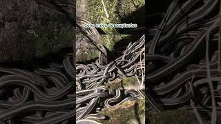
Isla de las serpientes
la sorprendente pero temida isla de las serpientes, esta total mente ...
la sorprendente pero temida isla de las serpientes, esta total mente prohibido ingresar.
¿Qué es el Islam? Descubre Su Verdadero Significado
En este video exploramos la esencia del Islam, enseñado por los ...
En este video exploramos la esencia del Islam, enseñado por los profetas desde Adam hasta Muhammad. Aprende cómo la ...
En una ISLA VIRGEN con mis hermanas 🇻🇪😍 #viajes #travel #caribe #playas
La CENSURA de ISLA DEL DRAMA!
Holaaaa!! Hoy hablaremos de una de las series mas CENSURADAS de la ...
Holaaaa!! Hoy hablaremos de una de las series mas CENSURADAS de la HISTORIA de CARTOON NETWORK!! La PRIMERA ...
¡YouTuber se cuela en la isla abandonada de MrBeast! 🏝😱 (Dara Tah)
Este YouTuber se coló en la isla abandonada de MrBeast... ¡y lo grabó ...
Este YouTuber se coló en la isla abandonada de MrBeast... ¡y lo grabó TODO! Hace aproximadamente un año, MrBeast subió un ...
Chandler side eye 😒 #mrbeast #shorts #chandler
JACKNJELLIFY EN ESPAÑOL Y SU CENSURA #shorts #bfdi #bpie #bfb #tpot #osc
Este video lo hice con el único objetivo de entretener, no estoy ...
Este video lo hice con el único objetivo de entretener, no estoy mandando hate ni nada hacia el canal de Jacknjellify en Español, ...
6 Meses de Constante ejercicio dan como Resultado una Transformación Total
Te muestro como en 6 meses de ejercicio, comer bien y Orar me dan como ...
Te muestro como en 6 meses de ejercicio, comer bien y Orar me dan como resultado una impresionante transformación física.
Mr. Beast acaba de demostrar que es dueño de YouTube #shorts #opentracks
7 Amazing Places You Must See in Gran Canaria
Add these 7 Amazing Places You Must See in Gran Canaria🏝️⛵️ 🗺️ In this ...
Add these 7 Amazing Places You Must See in Gran Canaria🏝️⛵️ 🗺️ In this guide, you'll discover: Iconic natural ...
🎬TOP 5 DRAMAS más populares de NETFLIX🍿😍 #kdrama #seriescoreanas #netflixoriginal #dorama #drama
Atención amantes de los dramas coreanos! Esta semana en Corea del Sur, ...
Atención amantes de los dramas coreanos! Esta semana en Corea del Sur, los 5 dramas más populares en Netflix te están ...
Los Próximos 10 Animes de Mappa | Jigokuraku Temporada 2 #hellsparadise #mappa
Este Tipo ENCONTRÓ UN CANÍBAL en el Bosque
viral #shorts #trending #youtubeshorts.
viral #shorts #trending #youtubeshorts.
La isla NEGRA de GOOGLE MAPS #shorts #miedo
La isla más peligrosa 😱 Isla Sentinel del Norte 🏝️
Misterio y peligro de la Isla Sentinel del Norte, la masa terrestre ...
Misterio y peligro de la Isla Sentinel del Norte, la masa terrestre más traicionera del planeta. ☠️ Esta remota isla, del tamaño de ...
El Último en Dejar esta Isla de $800,000 se la Queda
Hola a todos! A partir de ahora, voy a dejar de subir videos a este ...
Hola a todos! A partir de ahora, voy a dejar de subir videos a este canal y voy a publicar todos los videos nuevos en mi canal ...
Poveglia la isla de los muertos
Poveglia la isla de los muertos #shorts #poveglia CONTRIBUCIONES AL ...
Poveglia la isla de los muertos #shorts #poveglia CONTRIBUCIONES AL CANAL Si quieres ayudarme a mejorar el canal ...
Chile is classified as Emerging region: G20: Group of Twenty – Major economies comprising both developed and emerging countries, representing the world’s largest economies. The level of income is Upper middle income.
News – Latest Updates and Headlines from Isla Dos Canales
Stay informed with the most recent news and important headlines from Isla Dos Canales. Here’s a roundup of the latest developments.
Loading...
Please note: The data used here has been primarily extracted from satellite readings. Deviations from exact values may occur, particularly regarding the height of elevations and population density. Land area and coastline measurements refer to average values at mean high tide.