Welcome to Isla Hieron, a Polar island in the South Pacific Ocean, part of the majestic Pacific Ocean. This guide offers a comprehensive overview of what makes Isla Hieron unique – from its geography and climate to its population, infrastructure, and beyond. Dive into the details:
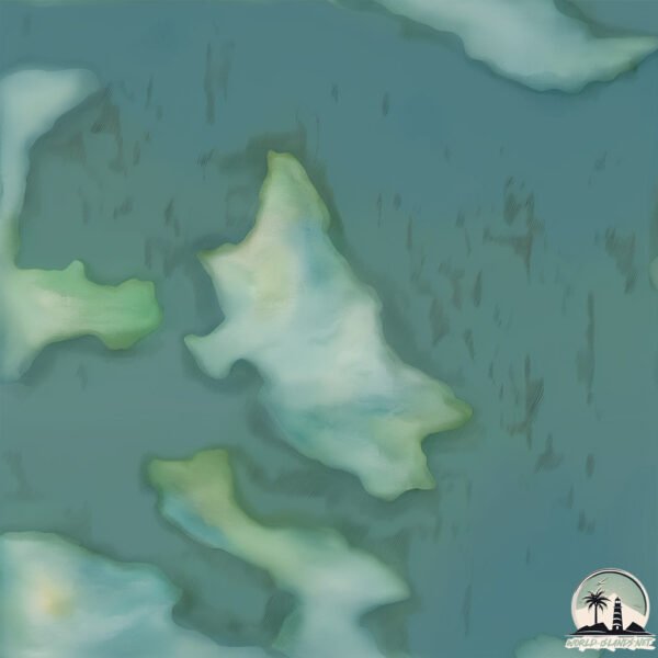
Geography and size of Isla Hieron
Size: 1.345 km²
Coastline: 9.4 km
Ocean: Pacific Ocean
Sea: South Pacific Ocean
Continent: South America
Isla Hieron is a Small Island spanning 1.3 km² with a coastline of 9.4 km.
Archipel: Cordillera Patagónica Insular – A series of islands in the Patagonian region, known for their dramatic landscapes and part of the Andean mountain range.
Tectonic Plate: South America – A major plate covering the South American continent and part of the Atlantic Ocean, known for the Andes mountain range and significant seismic and volcanic activity.
The geographic heart of the island is pinpointed at these coordinates:
Latitude: -52.2074984 / Longitude: -74.78449057
Climate and weather of Isla Hieron
Climate Zone: Polar
Climate Details: Tundra
Temperature: Cold
Climate Characteristics: The tundra climate features long, extremely cold winters and short, cool summers. Vegetation is limited to mosses, lichens, and small shrubs due to the low temperatures and short growing seasons. Biodiversity is low, but some specialized species thrive.
Topography and nature of Isla Hieron
Timezone: UTC-04:00
Timezone places: America/La_Paz
Max. Elevation: 72 m
Mean Elevation: 44 m
Vegetation: Evergreen Broadleaf Forest
Tree Coverage: 77%
The mean elevation is 44 m. The highest elevation on the island reaches approximately 72 meters above sea level. The island is characterized by Plains: Flat, low-lying lands characterized by a maximum elevation of up to 200 meters. On islands, plains are typically coastal lowlands or central flat areas.
Dominating Vegetation: Evergreen Broadleaf Forest
Characterized by dense, lush canopies of broadleaf trees that retain their leaves year-round. These forests are typically found in tropical and subtropical regions and are known for their high biodiversity. Isla Hieron has a tree cover of 77 %.
Vegetation: 5 vegetation zones – Highly Diverse Island
With five different vegetation zones, these islands offer a rich tapestry of ecosystems. The variety could include dense forests, open meadows, wetlands, coastal zones, and more. This level of diversity supports an intricate web of life, with each zone playing a vital role in the overall ecological health and balance of the island.
Infrastructure and Travelling to Isla Hieron
Does the island have a public airport? no.
There is no public and scheduled airport on Isla Hieron. The nearest airport is Lieutenant Julio Gallardo Airport, located 257 km away.
Does the island have a major port? no.
There are no major ports on Isla Hieron. The closest major port is PUERTO NATALES, approximately 251 km away.
The mean population of Isla Hieron is 1 per km². Isla Hieron is Uninhabited. The island belongs to Chile.
Continuing your journey, Pacheco is the next notable island, situated merely km away.
OVNI saliendo del mar 🛸 en playa de Miami 🏖️. Emerge a una velocidad impresionante #OVNI #UFO #OSNI
OVNI saliendo del mar 🛸 en playa de Miami 🏖️. Emerge a una velocidad impresionante #OVNI #UFO #OSNI
History of the city of Syracuse - Part 1
Sicily has been a melting pot of civilisations for pretty much all of ...
Sicily has been a melting pot of civilisations for pretty much all of its histories, due to its strategic spot in the centre of the ...
Ancient Greek Marble Pyramid Found on an Aegean Island
Ancient Greek Marble Pyramid Found on an Aegean Island.
Ancient Greek Marble Pyramid Found on an Aegean Island.
The path to Fengari (Samothrace island )
I was wrong! All the trade went via Africa, not Arabia!
One of our viewers, lyth Mashni, had a comment which caught me by ...
One of our viewers, lyth Mashni, had a comment which caught me by surprise. He wrote “you are just saying whats on the ...
Invention of Coins | Metallic Coins of Lydian Kingdom #shorts #coins #inventions #drbinocsshow
shorts According to western history, the first coins found were in ...
shorts According to western history, the first coins found were in modern-day Turkey. This was known in ancient times as the ...
Gorgeous Siracusa, Sicily Through the Ages - Dionysius to Monica Bellucci
Gorgeous Siracusa, Sicily Through the Ages - Dionysius to Monica ...
Gorgeous Siracusa, Sicily Through the Ages - Dionysius to Monica Bellucci Explore the rich and layered history of Syracuse, the ...
Discovering the Ancient Wonders of Lindos Acropolis#LindosAcropolis#AncientGreece#VisitRhodes
Explore the breathtaking Lindos Acropolis, an ancient archaeological ...
Explore the breathtaking Lindos Acropolis, an ancient archaeological treasure on the stunning island of Rhodes! This 10-minute ...
Syracuse | How a City-State Defeated Athens
Founded in 734 or 733 BC by Greek settlers from Corinth and Tenea, the ...
Founded in 734 or 733 BC by Greek settlers from Corinth and Tenea, the city-state of Syracuse would eventually become a major ...
MECCA: Did Diodorus refer to Mecca in the 1st century BC?
Muslims, desperate to find any reference for Mecca before the 7th ...
Muslims, desperate to find any reference for Mecca before the 7th century have looked to ancient texts, and have found what they ...
Venecia explicada
Explora conmigo los canales y las plazas de Venecia para entender su ...
Explora conmigo los canales y las plazas de Venecia para entender su arquitectura y su fascinante diseño urbano. Watch in ...
2,000 Years of Drama in Sicily
The Ancient Theatre of Taormina in Sicily was first built by the ...
The Ancient Theatre of Taormina in Sicily was first built by the Greeks in the 3rd century BC during the reign of King Hieron II of ...
💫Mañana Productiva En Casa/ Limpieza, Cocina Casera y Organización
Hoy os invito a pasar una mañana conmigo en casa. Aprovecho para ...
Hoy os invito a pasar una mañana conmigo en casa. Aprovecho para adelantar algunas tareas, limpiar un poco y preparar la ...
Silvestre Dangond E Israel Romero - El Higueron + No Te Quiero Perder [EN VIVO] (Fiesta Privada)
The Ancient Greek COLONIZATION Of Sicily Part 1/11
The Ancient Greek COLONIZATION Of Sicily Part 1/11 Uncover the ...
The Ancient Greek COLONIZATION Of Sicily Part 1/11 Uncover the fascinating history of Greek Sicily, where ancient settlers ...
Samothrace
Island Samothrace at north-east Greece *Scenes from the video of ...
Island Samothrace at north-east Greece *Scenes from the video of Prefecture of Evros for the promotion campaign of Evros.
Mecca = Yet another "HOLE in the Classical Narrative"?
Muslims, desperate to find any evidence for Mecca in the 7th century ...
Muslims, desperate to find any evidence for Mecca in the 7th century have come up with a number of "proofs" that it existed long ...
Ancient coins - An amazing tetradrachm from Troas, Tenedos - Second known in the private market
Today I have the priviliege to show you an amazing coin, a tetradrachm ...
Today I have the priviliege to show you an amazing coin, a tetradrachm from Tenedos, a Island outside the cost of Troas. The coin ...
Robert Whittaker Is A TERRIBLE Match Up For Khamzat Chimaev..
Robert Whittaker Is A TERRIBLE Match Up For Khamzat Chimaev.. Welcome ...
Robert Whittaker Is A TERRIBLE Match Up For Khamzat Chimaev.. Welcome back to Strive Sports, today on the channel we're ...
Itzia da a luz en los baños de la secundaria | La rosa de Guadalupe | RESUMEN | El pacto
Mira el capítulo ➡️
https://bit.ly/2Ej9D9C Itzia le confiesa a sus amigas que está embarazada, pero no le dirá nada a su familia ...
Confesiones entre hermanos con Vadhir y José Eduardo Derbez | T6 Ep #6 La Magia del Caos
Vadhir, será papá soltero?, cómo va Jose Eduardo con la paternidad, ...
Vadhir, será papá soltero?, cómo va Jose Eduardo con la paternidad, porqué Vadhir y yo no triunfamos tanto en el amor, qué ...
Cory 'Poppins' McKenna | UFC Star Exclusive | UFC Results | MMA News | Danny Batten Fight Show #97
New Live Danny Batten #FightShow featuring an exclusive interview with ...
New Live Danny Batten #FightShow featuring an exclusive interview with another top guest from the world of combat sports plus ...
JURASSIC PARK III 2001 film CAST; THEN AND NOW; Laura Dern Instagram @lauradern;
JURASSIC PARK III (2001 film)_CAST; THEN AND NOW; Laura ...
JURASSIC PARK III (2001 film)_CAST; THEN AND NOW; Laura Dern_Instagram_@lauradern; ...
Stormshot: Diamond Payment Guide
In this video, we would like to take this opportunity to explain the ...
In this video, we would like to take this opportunity to explain the various aspects of the new Diamond payments in detail so that ...
Sicily 16: Siracusa: self guided walking tour: Teatro Greco, crying Mary prosthetics, market SD 480p
CLICK “Show More” BELOW for more info and Key Moments (timestamps)⟱⬇︎ ...
CLICK “Show More” BELOW for more info and Key Moments (timestamps)⟱⬇︎ 00:00 INTRO: Syracuse (Siracusa) 00:45 ...
Chile is classified as Emerging region: G20: Group of Twenty – Major economies comprising both developed and emerging countries, representing the world’s largest economies. The level of income is Upper middle income.
News – Latest Updates and Headlines from Isla Hieron
Stay informed with the most recent news and important headlines from Isla Hieron. Here’s a roundup of the latest developments.
Loading...
Please note: The data used here has been primarily extracted from satellite readings. Deviations from exact values may occur, particularly regarding the height of elevations and population density. Land area and coastline measurements refer to average values at mean high tide.


![Silvestre Dangond E Israel Romero - El Higueron + No Te Quiero Perder [EN VIVO] (Fiesta Privada)](https://i.ytimg.com/vi/fs2B9ktiOC4/mqdefault.jpg)