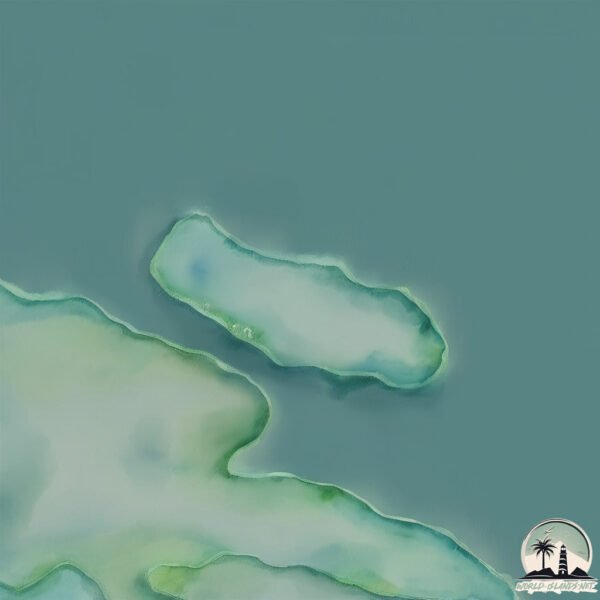
Welcome to Isla Patranca, a Polar island in the South Pacific Ocean, part of the majestic Pacific Ocean. This guide offers a comprehensive overview of what makes Isla Patranca unique – from its geography and climate to its population, infrastructure, and beyond. Dive into the details:
Geography and size of Isla Patranca
Size: 0.116 km²
Coastline: 1.9 km
Ocean: Pacific Ocean
Sea: South Pacific Ocean
Continent: South America
Isla Patranca is a Tiny Island spanning 0.116 km² with a coastline of 1.9 km.
Archipel: –
Tectonic Plate: Scotia – Situated in the Southern Ocean, surrounding the Scotia Sea, between South America and Antarctica, known for the Scotia Arc and active seismicity.
The geographic heart of the island is pinpointed at these coordinates:
Latitude: -52.96913437 / Longitude: -74.04349119
Climate and weather of Isla Patranca
Climate Zone: Polar
Climate Details: Tundra
Temperature: Cold
Climate Characteristics: The tundra climate features long, extremely cold winters and short, cool summers. Vegetation is limited to mosses, lichens, and small shrubs due to the low temperatures and short growing seasons. Biodiversity is low, but some specialized species thrive.
Topography and nature of Isla Patranca
Timezone: UTC-04:00
Timezone places: America/La_Paz
Max. Elevation: -3 m
Mean Elevation: -27 m
Vegetation: Herbaceous Cover
Tree Coverage: 40%
The mean elevation is -27 m. Remarkably, this unique island barely emerges above the sea level, showcasing nature’s fascinating interplay with the ocean. The island is characterized by Plains: Flat, low-lying lands characterized by a maximum elevation of up to 200 meters. On islands, plains are typically coastal lowlands or central flat areas.
Dominating Vegetation: Herbaceous Cover
Comprising mainly of grasses, herbs, and ferns, these areas are common in prairies, meadows, and savannas, and can vary widely in species composition. Isla Patranca has a tree cover of 40 %.
Vegetation: 1 vegetation zones – Minimal Diversity Island
These islands exhibit the most basic level of ecological diversity, often characterized by a single dominant vegetation type. This could be due to extreme environmental conditions, limited land area, or significant human impact. They represent unique ecosystems where specific species have adapted to thrive in these singular environments.
Infrastructure and Travelling to Isla Patranca
Does the island have a public airport? no.
There is no public and scheduled airport on Isla Patranca. The nearest airport is Lieutenant Julio Gallardo Airport, located 221 km away.
Does the island have a major port? no.
There are no major ports on Isla Patranca. The closest major port is PUERTO NATALES, approximately 215 km away.
The mean population of Isla Patranca is 7 per km². Isla Patranca is Gently Populated. The island belongs to Chile.
Continuing your journey, Desolacion is the next notable island, situated merely km away.
Islas Ballesta - Pisco
Las islas Ballestas poseen atractivos turísticos únicos, en ella podemos encontrar extraordinarios monumentos esculpido en ...Islas Ballesta - Pisco
Las islas Ballestas poseen atractivos turísticos únicos, en ella ...
Las islas Ballestas poseen atractivos turísticos únicos, en ella podemos encontrar extraordinarios monumentos esculpido en ...
Humboldt penguin Spheniscus humboldti Peruvian penguin Humboldt-Pinguin Patranca
Islas de Ancon: Humboldt-Pinguine Penguin Spheniscus humboldti - Peru ...
Islas de Ancon: Humboldt-Pinguine Penguin Spheniscus humboldti - Peru The Humboldt Penguin (Spheniscus humboldti) (also ...
Magellanic penguins displaying on a beach, Gypsy Cove, Stanley, Falkland Islands.
Magellanic penguins (Spheniscus magellanicus) displaying on a beach, ...
Magellanic penguins (Spheniscus magellanicus) displaying on a beach, Gypsy Cove, Stanley, Falkland Islands.
Peruvian Penguins
The Ballestas Islands are the Peruvian equivalent of the Galapagos ...
The Ballestas Islands are the Peruvian equivalent of the Galapagos with an enormous diversity of birds including penguins (in ...
Ballestas Islands, Peru - Penguins & Birds
Warm water penguins?? You betcha! Here are some Peruvian Penguins and ...
Warm water penguins?? You betcha! Here are some Peruvian Penguins and other various birds at Ballesta Islands, fondly ...
Choros Island, Humboldt Penguin National Reserve, Coquimbo Region, Chile, South America
Humboldt Penguin National Reserve is a nature reserve located a short ...
Humboldt Penguin National Reserve is a nature reserve located a short distance off the coast of mainland Chile. It Consists of ...
Islas Encantadas - Galápagos
Julio del 2008.
Julio del 2008.
P1170990 Humbolt Penguins at Ballestas Island, Peru
Penguins jumping on rocks.
Penguins jumping on rocks.
Pinguinos de Humboldt.wmv
Grupo de Pinguinos de Humboldt en la isla de Pachacamac - Peru.
Grupo de Pinguinos de Humboldt en la isla de Pachacamac - Peru.
Humboldt penguins walks in a rock piongu02
Do you want to use this video in your project? Get a license to use ...
Do you want to use this video in your project? Get a license to use the video for $20 USD!!! Or become my Patreon and get a ...
Fauna de las islas Ballesta
Un paseo en lancha alrededor de los islotes y sus habitantes. ...
islas ballestas maracas.3gp
Islas Ballestas de Paracas Las Islas Ballestas son unas islas que ...
Islas Ballestas de Paracas Las Islas Ballestas son unas islas que están en el Océano Pacífico, próximas a la costa del Perú.
Pelícanos
Isla Santa Cruz / Islas Galápagos / Ecuador / Sudamérica.
Isla Santa Cruz / Islas Galápagos / Ecuador / Sudamérica.
Humbolt Penguin in Peru
While visiting Islas Ballestas we saw peguins !!! yeah.
While visiting Islas Ballestas we saw peguins !!! yeah.
Our visit to the Magdalena Penguin Reserve 2012
The Penguins National Nature Reserve: Magdalena Island, Punta Arenas, ...
The Penguins National Nature Reserve: Magdalena Island, Punta Arenas, Chile One of Chile's largest and most important ...
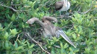
Tijerilla o Rabijunco (Fregata magnificens) - Magnificen Frigate Bird
Es la más grande de las aves que zurcan los cielos de PR. Su ...
Es la más grande de las aves que zurcan los cielos de PR. Su embergadura puede alcanzar unos 8 pies. Es un ave común en las ...
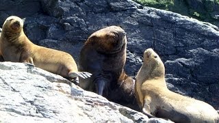
Lobos marinos en las Islas Ballestas
Lobos marinos en las Islas Ballestas en nuestro viaje a Perú ...
Humboldt Penguin seen at Ballestas Islands
Here is a penguins from Peru.
Here is a penguins from Peru. Here are a group of penguins who're ...
Here is a penguins from Peru. Here are a group of penguins who're waiting for their food!
Humbolt Penguin Video.MPG
Humboldt Penguin National Reserve is two hours away from La Serena. ...
Humboldt Penguin National Reserve is two hours away from La Serena. They are very cute and walk just like you imagine.
Galápagos-Pinguine (Galápagos Floreana)
Galápagos-Pinguine bei der Insel Floreana / Santa María (Islas ...
Galápagos-Pinguine bei der Insel Floreana / Santa María (Islas Galápagos). Der Galápagos-Pinguin kommt weltweit nur auf den ...
Attacked by a Galapagos pinguin
Birdwatching in Peru: Humboldt Penguin
Pingüinos de Humboldt / Humboldt Penguin (Spheniscus humbolti) Habitan ...
Pingüinos de Humboldt / Humboldt Penguin (Spheniscus humbolti) Habitan en la costa del Perú y Chile. Su nombre se debe a la ...
Pingüinera Ushuaia
Isla Martillo, donde habita una colonia de pingüinos magallánicos, los ...
Isla Martillo, donde habita una colonia de pingüinos magallánicos, los propios de la zona, y unos cuantos papúas, de la antártida, ...
Galapagos Islands Frigate Birds Chasing Our Boat for Free Fish
I think these are frigate birds chasing our boat at Galapagos Islands, ...
I think these are frigate birds chasing our boat at Galapagos Islands, Ecuador. March 2008.
Chile is classified as Emerging region: G20: Group of Twenty – Major economies comprising both developed and emerging countries, representing the world’s largest economies. The level of income is Upper middle income.
News – Latest Updates and Headlines from Isla Patranca
Stay informed with the most recent news and important headlines from Isla Patranca. Here’s a roundup of the latest developments.
Loading...
Please note: The data used here has been primarily extracted from satellite readings. Deviations from exact values may occur, particularly regarding the height of elevations and population density. Land area and coastline measurements refer to average values at mean high tide.