Welcome to Isla Sáez, a Polar island in the South Pacific Ocean, part of the majestic Pacific Ocean. This guide offers a comprehensive overview of what makes Isla Sáez unique – from its geography and climate to its population, infrastructure, and beyond. Dive into the details:
Geography and size of Isla Sáez
Size: 0.594 km²
Coastline: 4.6 km
Ocean: Pacific Ocean
Sea: South Pacific Ocean
Continent: South America
Isla Sáez is a Tiny Island spanning 0.594 km² with a coastline of 4.6 km.
Archipel: –
Tectonic Plate: South America – A major plate covering the South American continent and part of the Atlantic Ocean, known for the Andes mountain range and significant seismic and volcanic activity.
The geographic heart of the island is pinpointed at these coordinates:
Latitude: -51.58728555 / Longitude: -74.60235338
Climate and weather of Isla Sáez
Climate Zone: Polar
Climate Details: Tundra
Temperature: Cold
Climate Characteristics: The tundra climate features long, extremely cold winters and short, cool summers. Vegetation is limited to mosses, lichens, and small shrubs due to the low temperatures and short growing seasons. Biodiversity is low, but some specialized species thrive.
Topography and nature of Isla Sáez
Timezone: UTC-04:00
Timezone places: America/La_Paz
Max. Elevation: -29 m
Mean Elevation: -68 m
Vegetation: Evergreen Broadleaf Forest
Tree Coverage: 71%
The mean elevation is -68 m. Remarkably, this unique island barely emerges above the sea level, showcasing nature’s fascinating interplay with the ocean. The island is characterized by Plains: Flat, low-lying lands characterized by a maximum elevation of up to 200 meters. On islands, plains are typically coastal lowlands or central flat areas.
Dominating Vegetation: Evergreen Broadleaf Forest
Characterized by dense, lush canopies of broadleaf trees that retain their leaves year-round. These forests are typically found in tropical and subtropical regions and are known for their high biodiversity. Isla Sáez has a tree cover of 71 %.
Vegetation: 3 vegetation zones – Moderately Diverse Island
These islands start to show a broader range of ecological niches. With three vegetation zones, they may offer a mix of ecosystems like coastal areas, inland woods, and perhaps a distinct wetland or dry area. This diversity supports a wider range of flora and fauna, making these islands more ecologically complex than those with minimal diversity.
Infrastructure and Travelling to Isla Sáez
Does the island have a public airport? no.
There is no public and scheduled airport on Isla Sáez. The nearest airport is Lieutenant Julio Gallardo Airport, located 229 km away.
Does the island have a major port? no.
There are no major ports on Isla Sáez. The closest major port is PUERTO NATALES, approximately 225 km away.
The mean population of Isla Sáez is 1 per km². Isla Sáez is Uninhabited. The island belongs to Chile.
Continuing your journey, Torres is the next notable island, situated merely km away.
#ConquistandoElMundo - Hacienda del Mar | By Sheldry sáez
En Panamá tenemos muchos lugares espectaculares que a veces ni siquiera hemos contemplado como opción por no saber de ...#ConquistandoElMundo - Hacienda del Mar | By Sheldry sáez
En Panamá tenemos muchos lugares espectaculares que a veces ni ...
En Panamá tenemos muchos lugares espectaculares que a veces ni siquiera hemos contemplado como opción por no saber de ...
Chiloé - Island route (Alvaro Saez) | Travel Video
Route island of Chiloé (Chile): - Castro - Dalcahue - Mechuque - Tenaún.
Route island of Chiloé (Chile): - Castro - Dalcahue - Mechuque - Tenaún.
SAN BLAS ISLAS PANAMA 2019 🇵🇦 - RAFA SÁEZ ⚡️TRIP BEST BEACH
Hemos visitado las islas más hermosas de Panamá SAN BLAS, En nuestro ...
Hemos visitado las islas más hermosas de Panamá SAN BLAS, En nuestro recorrido visitamos 4 islas, (isla Diablo, Isla perro ...
Isla Perro chico, Isla Fragata y Piscina Natural - Guna Yala (San Blas) - Panamá
Bienvenidos al Caribe! Isla Perro Chico, Isla Fragata y la Piscina ...
Bienvenidos al Caribe! Isla Perro Chico, Isla Fragata y la Piscina Natural son 3 de los puntos más famosos de Guna Yala (San ...
How to Install a Kitchen Island (DIY)
Isla de Pico, Azores.
Dos estudiantes de erasmus (de España y Estonia) en Terceira suben al ...
Dos estudiantes de erasmus (de España y Estonia) en Terceira suben al Pico mas alto de Portugal, situado en el archipielago de ...
Easter Island 2017 | Mike Sáez
LA ISLA DEL ENCANTO 🏝 #shorts #puertorico #antonniosaez
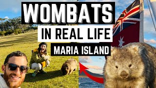
Visitamos MARIA ISLAND la Isla de los Wombats en TASMANIA🇦🇺
Hoy viajamos a Maria Island, Tasmania: vida salvaje, paisajes ...
Hoy viajamos a Maria Island, Tasmania: vida salvaje, paisajes impresionantes y una historia aterradora. ¡No te lo pierdas!
❤ isla diablo san blas has been very nice indeed !! ❤
isla diablo san blas ...has been very nice indeed !!
isla diablo san blas ...has been very nice indeed !!
Viajando a Isla Santa María ,de Lota . Barcaza.video de Sebastián Sáez
♊ ISLA DIABLO SAN BLAS - MORE ..PERFECT DAYS AT THE PLAYA - MOLAS ♊
ISLA DIABLO SAN BLAS - MORE ..PERFECT DAYS AT THE PLAYA - MOLAS.
ISLA DIABLO SAN BLAS - MORE ..PERFECT DAYS AT THE PLAYA - MOLAS.
Infinix smart 8 pro Magic Ring new model #shortvideo
CHILOE ISLAND: CHILE'S HIDDEN GEM! 🌈🏡🐧 #culture #curiosity #placestovisit #education #travel
places #culture #education #curiosity #placestovisit #travel ...
places #culture #education #curiosity #placestovisit #travel #didyouknow #shortvideo #entertainment #traveling ...
EL IMPACTANTE VIDEO DE MISS UNIVERSO SIN MAQUILLAJE!!! #shorts #missuniverso #certamen
EL IMPACTANTE VIDEO DE MISS UNIVERSO SIN MAQUILLAJE!!! #shorts ...
EL IMPACTANTE VIDEO DE MISS UNIVERSO SIN MAQUILLAJE!!! #shorts #missuniverso #certamen.
Salar de Uyuni - Mirror of the world (Alvaro Saez) | Travel Video
The world's largest mirror in Salar de Uyuni (Bolivia) - Laguna Verde ...
The world's largest mirror in Salar de Uyuni (Bolivia) - Laguna Verde - Termas Laguna Blanca - Geysers Sol de Mañana - Laguna ...
✠♟ ☸ ISLA DIABLO SAN BLAS - MORE PERFECT DAYS AT THE PLAYA ✠♟ ☸
ISLA DIABLO SAN BLAS - MORE PERFECT DAYS AT THE PLAYA.
ISLA DIABLO SAN BLAS - MORE PERFECT DAYS AT THE PLAYA.
012 La Isla
Las islas pueden tener diversos orígenes (como la erosión y la ...
Las islas pueden tener diversos orígenes (como la erosión y la sedimentación), en especial las que están ubicadas en mares y ...
Isla de Oleron
Isla de Oleron, fortificaciones Vauban, playas y ostras.
Isla de Oleron, fortificaciones Vauban, playas y ostras.
Drone footage of Isla Pelicano, San Blas, Panama
Isla Pelicano, one of the beautiful San Blas islands. Footage shot by ...
Isla Pelicano, one of the beautiful San Blas islands. Footage shot by a DJI Mavic Pro. Isla Pelicano is part of a cruise from ...
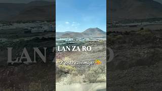
Recuerdos de cuando visité Lanzarote, una Isla different a todo lo demás💫 #artista #cuadernodeviaje
Isla masargandub Gunayala -San Blas Panama, 2020
Isla Masaragandub , una de la isla más grande del golfo de Carti. ...
Isla Masaragandub , una de la isla más grande del golfo de Carti. Saliendo de un punto usted llega en 45 a 1 hora al punto ...
Isla Masargandub - San Blas Panamá
La Isla Masargandub es una de las mas espectaculares de Cartí en Guna ...
La Isla Masargandub es una de las mas espectaculares de Cartí en Guna Yala Panamá, antes conocido como San Blas Panamá ...
2025 02 18 Pitcairn island (Reino Unido). Vuelta al mundo 2025. MSC Magnifica
ISLA PITCAIRN (Reino Unido). 18 de febrero de 2025, martes, Muy ...
ISLA PITCAIRN (Reino Unido). 18 de febrero de 2025, martes, Muy nuboso. Algún chaparrón. Temperatura 24 ºC. Marejada.
Isla de RE
Isla de RE.
Isla de RE.
Chile is classified as Emerging region: G20: Group of Twenty – Major economies comprising both developed and emerging countries, representing the world’s largest economies. The level of income is Upper middle income.
News – Latest Updates and Headlines from Isla Sáez
Stay informed with the most recent news and important headlines from Isla Sáez. Here’s a roundup of the latest developments.
Loading...
Please note: The data used here has been primarily extracted from satellite readings. Deviations from exact values may occur, particularly regarding the height of elevations and population density. Land area and coastline measurements refer to average values at mean high tide.