Welcome to Isola Barrettini, a Temperate island in the Tyrrhenian Sea, part of the majestic Atlantic Ocean. This guide offers a comprehensive overview of what makes Isola Barrettini unique – from its geography and climate to its population, infrastructure, and beyond. Dive into the details:
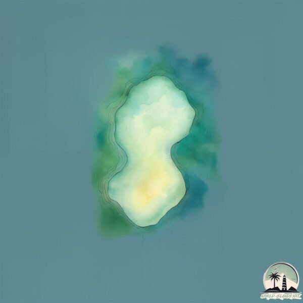
Geography and size of Isola Barrettini
Size: 0.126 km²
Coastline: 1.6 km
Ocean: Atlantic Ocean
Sea: Tyrrhenian Sea
Continent: Europe
Isola Barrettini is a Tiny Island spanning 0.126 km² with a coastline of 1.6 km.
Archipel: –
Tectonic Plate: Eurasia – One of the world’s largest tectonic plates, the Eurasian Plate covers a significant portion of Europe and Asia. It’s characterized by diverse geological features, including the Ural Mountains, the European Plain, and the Himalayas formed from its collision with the Indian Plate.
The geographic heart of the island is pinpointed at these coordinates:
Latitude: 41.28337181 / Longitude: 9.40148211
Climate and weather of Isola Barrettini
Climate Zone: Temperate
Climate Details: Hot-Summer Mediterranean Climate
Temperature: Hot Summer
Climate Characteristics: Characterized by hot, dry summers and mild, wet winters, typical of coastal areas with abundant sunshine.
Topography and nature of Isola Barrettini
Timezone: UTC+01:00
Timezone places: Europe/Paris
Max. Elevation: -31 m
Mean Elevation: -31 m
Vegetation: Open Woodland
Tree Coverage: 66%
The mean elevation is -31 m. Remarkably, this unique island barely emerges above the sea level, showcasing nature’s fascinating interplay with the ocean. The island is characterized by Plains: Flat, low-lying lands characterized by a maximum elevation of up to 200 meters. On islands, plains are typically coastal lowlands or central flat areas.
Dominating Vegetation: Open Woodland
Characterized by sparsely distributed trees with open canopy allowing sunlight to penetrate, supporting grasses and shrubs underneath. Often found in drier or transitional environments. Isola Barrettini has a tree cover of 66 %.
Vegetation: 1 vegetation zones – Minimal Diversity Island
These islands exhibit the most basic level of ecological diversity, often characterized by a single dominant vegetation type. This could be due to extreme environmental conditions, limited land area, or significant human impact. They represent unique ecosystems where specific species have adapted to thrive in these singular environments.
Infrastructure and Travelling to Isola Barrettini
Does the island have a public airport? no.
There is no public and scheduled airport on Isola Barrettini. The nearest airport is Figari Sud-Corse Airport, located 41 km away.
Does the island have a major port? no.
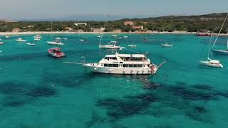
There are no major ports on Isola Barrettini. The closest major port is LA MADDALENA, approximately 9 km away.
The mean population of Isola Barrettini is 0 per km². Isola Barrettini is Uninhabited. The island belongs to Italy.
Continuing your journey, Isola Maddalena is the next notable island, situated merely km away.
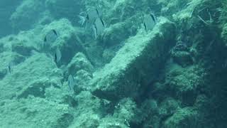
Snorkeling Barrettini Island- La Maddalena Archipelago
Immersione all'interno del Parco Nazionale Arcipelago di La Maddalena.
Immersione all'interno del Parco Nazionale Arcipelago di La Maddalena.
Sardaigne, Barrettini drone 🏖
Drone de l'île Barrettini, une petite île de l'archipel de la Sardaigne.
Drone de l'île Barrettini, une petite île de l'archipel de la Sardaigne.
Il Banco N-est Barrettini island
La Maddalena Explore - Summer Memories
La Maddalena (Gallurese: Madalena or La Madalena, Sardinian: Sa ...
La Maddalena (Gallurese: Madalena or La Madalena, Sardinian: Sa Madalena) is a comune located on the islands of the ...
Isola della Maddalena in Sup
Alla scoperta dell'isola dell Maddalena a bordo dei nostri "Twinsup"!
Alla scoperta dell'isola dell Maddalena a bordo dei nostri "Twinsup"!
barrettini di fuori lighthouse - Sardinia 360 italy
Exploring and snorkeling archipelago of La Maddalena
With our tour, we bring you to discover the most hidden and beatiful ...
With our tour, we bring you to discover the most hidden and beatiful corners of the archipelago of La Maddalena. Join us!
Sardegna, 12 Luglio 2024, escursione all'Arcipelago di La Maddalena. (video 2 di 3, Isola di Spargi)
Dopo l'escursione all'isola di Tavolara, sempre durante le vacanze a ...
Dopo l'escursione all'isola di Tavolara, sempre durante le vacanze a San Teodoro (SS), in Sardegna (dal 7 al 15 Luglio 2024), ...
Sardegna, 12 Luglio 2024, escursione all'Arcipelago di La Maddalena. (video 1 di 3, La Maddalena).
Dopo l'escursione all'isola di Tavolara, sempre durante le vacanze a ...
Dopo l'escursione all'isola di Tavolara, sempre durante le vacanze a San Teodoro (SS), in Sardegna (dal 7 al 15 Luglio 2024), ...
Isola di Corcelli Parco Nazionale Arcipelago di La Maddalena (OT)
L'isola di Corcelli è poco frequentata per la difficoltà di accesso la ...
L'isola di Corcelli è poco frequentata per la difficoltà di accesso la sostanziale integrità favorisce l'insediamento di importanti ...
Sardegna, 12 Luglio 24, escursione Arcipelago La Maddalena (video 3 di 3, Budelli, S.Maria,Caprera)
Dopo l'escursione all'isola di Tavolara, sempre durante le vacanze a ...
Dopo l'escursione all'isola di Tavolara, sempre durante le vacanze a San Teodoro (SS), in Sardegna (dal 7 al 15 Luglio 2024), ...
Snorkeling in La Maddalena national park (Part 1)
Snorkeling in La Maddalena National Park (Sardinia, Italy). August, 2021.
Snorkeling in La Maddalena National Park (Sardinia, Italy). August, 2021.
🛣️ PANORAMA sul paese di LA MADDALENA dal "curvone" #shorts #sardegna
Vista dal punto panoramico "curvone" rotonda via Barrettini - via Suor ...
Vista dal punto panoramico "curvone" rotonda via Barrettini - via Suor Gotteland #maddalena #isoladellamaddalena #sardegna.
Film Spot Maggior Leggero Tour, Arcipelago di La Maddalena.
Breve film spot emozionale realizzato per Maggior Leggero Tour, ...
Breve film spot emozionale realizzato per Maggior Leggero Tour, agenzia adibita al traffico passeggeri autorizzata dall'Ente ...
Escursione in SUP all'isola Su Cardolinu (Chia)
Escursione in SUP Pinus Village - Isola Su Cardolinu organizzata da: ...
Escursione in SUP Pinus Village - Isola Su Cardolinu organizzata da: Wooden Waves SUP Club di Marco Loi ...
Andiamo all'Isola Piana...Cala della Barca...(Alghero)
L'isola Piana si trova a Cala della Barca ed è accessibile dalle ...
L'isola Piana si trova a Cala della Barca ed è accessibile dalle Prigionette l'ingresso si trova vicino al Hotel Baia di Conte.
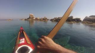
Sardegna in kayak , Arcipelago della Maddalena.
Isola di Barrettini.
Isola di Barrettini.
Une plongée avec les poissons, La Maddalena
Retrouvez l'article complet sur le blog : ...
Snorkeling in La Maddalena national park (Part 3)
Snorkeling in La Maddalena National Park (Sardinia, Italy). August, 2021.
Snorkeling in La Maddalena National Park (Sardinia, Italy). August, 2021.
La Maddalena boat trip and snorkeling - Sardinia 2021
La Maddalena is visited best by booking a full day on a small ...
La Maddalena is visited best by booking a full day on a small yacht/boat with a skipper, with food and wine/prosecco and enough ...
Tranquille en plongée, La Maddalena
Retrouvez l'article complet sur le blog : ...
Excursion en bateau à La Maddalena | Olbia #2
La Maddalena est une commune de la province de Sassari en Sardaigne en ...
La Maddalena est une commune de la province de Sassari en Sardaigne en Italie. Le territoire de la commune comprend la ...
La Maddalena Diving ASD#Sardinia 2k20#corso open water
Corso OWD.
Corso OWD.
La Maddalena Diving 2k19
This video is about La Maddalena Diving 2k19 #dji#osmo#pocket#La ...
This video is about La Maddalena Diving 2k19 #dji#osmo#pocket#La Maddalena#diving#Center#
Italy is classified as Developed region: G7: Group of Seven – Major advanced economies, including Canada, France, Germany, Italy, Japan, the United Kingdom, and the United States. The level of income is High income: OECD.
News – Latest Updates and Headlines from Isola Barrettini
Stay informed with the most recent news and important headlines from Isola Barrettini. Here’s a roundup of the latest developments.
Loading...
Please note: The data used here has been primarily extracted from satellite readings. Deviations from exact values may occur, particularly regarding the height of elevations and population density. Land area and coastline measurements refer to average values at mean high tide.