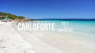
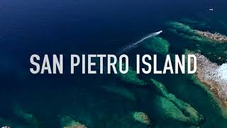
Ìsola di San Pietro
Welcome to Ìsola di San Pietro, a Temperate island in the Mediterranean Sea – Western Basin, part of the majestic Atlantic Ocean. This guide offers a comprehensive overview of what makes Ìsola di San Pietro unique – from its geography and climate to its population, infrastructure, and beyond. Dive into the details:
- Geography and Size: Explore the island’s size and location.
- Climate and Weather: Weather patterns and temperature.
- Topography and Nature: Uncover the natural wonders of the island.
- Infrastructure and Travelling: Insights on reaching, staying, and making the most of your visit.
- News and Headlines: Latest News.
Geography and size of Ìsola di San Pietro
Size: 51.4 km²
Coastline: 42.3 km
Ocean: Atlantic Ocean
Sea: Mediterranean Sea – Western Basin
Continent: Europe
Ìsola di San Pietro is a Medium Island spanning 51 km² with a coastline of 42 km.
Archipel: –
Tectonic Plate: Anatolia – A tectonic microplate covering most of Turkey, it’s squeezed between the Eurasian Plate to the north and the African Plate to the south, known for significant seismic activity.
The geographic heart of the island is pinpointed at these coordinates:
Latitude: 39.14097193 / Longitude: 8.2751481
Climate and weather of Ìsola di San Pietro
Climate Zone: Temperate
Climate Details: Hot-Summer Mediterranean Climate
Temperature: Hot Summer
Climate Characteristics: Characterized by hot, dry summers and mild, wet winters, typical of coastal areas with abundant sunshine.
Topography and nature of Ìsola di San Pietro
Timezone: UTC+01:00
Timezone places: Europe/Paris
Max. Elevation: 169 m
Mean Elevation: 71 m
Vegetation: Open Woodland
Tree Coverage: 35%
The mean elevation is 71 m. The highest elevation on the island reaches approximately 169 meters above sea level. The island is characterized by Plains: Flat, low-lying lands characterized by a maximum elevation of up to 200 meters. On islands, plains are typically coastal lowlands or central flat areas.
Dominating Vegetation: Open Woodland
Characterized by sparsely distributed trees with open canopy allowing sunlight to penetrate, supporting grasses and shrubs underneath. Often found in drier or transitional environments. Ìsola di San Pietro has a tree cover of 35 %.
Vegetation: 11 vegetation zones – Exceptionally Diverse Island
Islands with more than ten vegetation zones are among the most ecologically rich and varied in the world. These islands are akin to miniature continents, boasting an incredible array of ecosystems. The sheer range of habitats, from high peaks to deep valleys, rainforests to deserts, creates a mosaic of life that is unparalleled. They are crucial for conservation and ecological studies.
Infrastructure and Travelling to Ìsola di San Pietro
Does the island have a public airport? no.
There is no public and scheduled airport on Ìsola di San Pietro. The nearest airport is Cagliari Elmas Airport, located 83 km away.
Does the island have a major port? no.
There are no major ports on Ìsola di San Pietro. The closest major port is CARLOFORTE, approximately 1 km away.
The mean population of Ìsola di San Pietro is 134 per km². Ìsola di San Pietro is Moderately Inhabited. The island belongs to Italy.
Continuing your journey, Sant’Antioco is the next notable island, situated merely km away.
Un Weekend a Carloforte, spiagge e centro storico | Isola di San Pietro | Sardegna, Italy

Italy is classified as Developed region: G7: Group of Seven – Major advanced economies, including Canada, France, Germany, Italy, Japan, the United Kingdom, and the United States. The level of income is High income: OECD.
News – Latest Updates and Headlines from Ìsola di San Pietro
Stay informed with the most recent news and important headlines from Ìsola di San Pietro. Here’s a roundup of the latest developments.
Please note: The data used here has been primarily extracted from satellite readings. Deviations from exact values may occur, particularly regarding the height of elevations and population density. Land area and coastline measurements refer to average values at mean high tide.